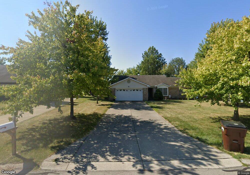
1264 Robbins Run Ct Dayton, OH 45458
Estimated Value: $330,360 - $442,000
3
Beds
4
Baths
2,790
Sq Ft
$139/Sq Ft
Est. Value
About This Home
This home is located at 1264 Robbins Run Ct, Dayton, OH 45458 and is currently estimated at $389,090, approximately $139 per square foot. 1264 Robbins Run Ct is a home located in Montgomery County with nearby schools including Primary Village South, Normandy Elementary School, and Hadley E Watts Middle School.
Ownership History
Date
Name
Owned For
Owner Type
Purchase Details
Closed on
Sep 18, 2002
Sold by
Shortt Carl H
Bought by
Shortt Carl H and Carl H Shortt Trust
Current Estimated Value
Home Financials for this Owner
Home Financials are based on the most recent Mortgage that was taken out on this home.
Original Mortgage
$100,000
Interest Rate
6.13%
Purchase Details
Closed on
Jan 2, 2001
Sold by
Shortt Carl H
Bought by
Shortt Carl H and The Carl H Shortt Trust
Purchase Details
Closed on
May 20, 1997
Sold by
American Planning & Development Inc
Bought by
Shortt Carl H
Create a Home Valuation Report for This Property
The Home Valuation Report is an in-depth analysis detailing your home's value as well as a comparison with similar homes in the area
Home Values in the Area
Average Home Value in this Area
Purchase History
| Date | Buyer | Sale Price | Title Company |
|---|---|---|---|
| Shortt Carl H | -- | -- | |
| Shortt Carl H | -- | -- | |
| Shortt Carl H | -- | -- | |
| Shortt Carl H | $39,900 | -- |
Source: Public Records
Mortgage History
| Date | Status | Borrower | Loan Amount |
|---|---|---|---|
| Closed | Shortt Carl H | $100,000 |
Source: Public Records
Tax History Compared to Growth
Tax History
| Year | Tax Paid | Tax Assessment Tax Assessment Total Assessment is a certain percentage of the fair market value that is determined by local assessors to be the total taxable value of land and additions on the property. | Land | Improvement |
|---|---|---|---|---|
| 2024 | $5,711 | $90,330 | $7,140 | $83,190 |
| 2023 | $5,711 | $90,330 | $7,140 | $83,190 |
| 2022 | $3,503 | $53,080 | $4,200 | $48,880 |
| 2021 | $3,513 | $53,080 | $4,200 | $48,880 |
| 2020 | $3,448 | $53,080 | $4,200 | $48,880 |
| 2019 | $4,910 | $64,950 | $4,200 | $60,750 |
| 2018 | $4,386 | $64,950 | $4,200 | $60,750 |
| 2017 | $4,318 | $64,950 | $4,200 | $60,750 |
| 2016 | $4,125 | $58,680 | $4,200 | $54,480 |
| 2015 | $4,004 | $58,680 | $4,200 | $54,480 |
| 2014 | $4,004 | $58,680 | $4,200 | $54,480 |
| 2012 | -- | $58,650 | $10,500 | $48,150 |
Source: Public Records
Map
Nearby Homes
- 8477 Woodgrove Ct Unit 8
- 1070 Foxshire Place
- 1241 Autumn Wind Ct
- 8436 Mcewen Rd
- 8454 Mcewen Rd
- 1444 Yankee Vineyards
- 1157 Timbertrail Ct Unit 12
- 8472 Mcewen Rd
- 1200 Captains Bridge
- 1124 Evergreen Park Ct Unit 221124
- 8517 Garnet Dr
- 1909 Washington Dr N
- 1051 Millstone Rd
- 8030 Paragon Rd
- 7853 Betsy Ross Cir Unit 11
- 9211 Bottega - South Dr Unit 67
- 1943 Washington South Dr Unit 1943
- 1901 Washington Dr N
- 1739 Waterstone Blvd Unit 208
- 8370 Paragon Rd
- 1260 Robbins Run Ct
- 1254 Robbins Run Ct
- 1256 Robbins Run Ct
- 1276 Robbins Run Ct
- 1274 Robbins Run Ct
- 1280 Robbins Run Ct
- 8368 Wahington Village Dr
- 8368 Washington Village Dr
- 1246 Robbins Run Ct
- 1244 Robbins Run Ct
- 8374 Washington Village Dr Unit 8368-8374
- 8373 Hawks Nest Ct
- 8377 Hawks Nest Ct
- 8371 Hawks Nest Ct
- 8379 Hawks Nest Ct
- 1275 Robbins Run Ct
- 1245 Robbins Run Ct Unit 1
- 8369 Hawks Nest Ct
- 8381 Hawks Nest Ct
- 8367 Hawks Nest Ct
