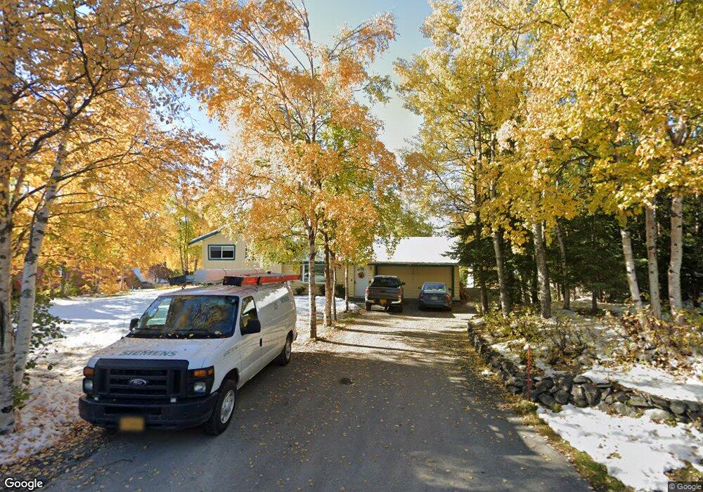
12640 Saunders Rd Anchorage, AK 99516
Mid-Hillside NeighborhoodEstimated Value: $396,000 - $566,038
3
Beds
2
Baths
1,392
Sq Ft
$365/Sq Ft
Est. Value
About This Home
This home is located at 12640 Saunders Rd, Anchorage, AK 99516 and is currently estimated at $508,013, approximately $364 per square foot. 12640 Saunders Rd is a home located in Anchorage Municipality with nearby schools including Bear Valley Elementary School, Goldenview Middle School, and South Anchorage High School.
Ownership History
Date
Name
Owned For
Owner Type
Purchase Details
Closed on
Dec 16, 1996
Sold by
Dixon Dennis J and Galbreath Holly N
Bought by
Ford John D and Ford Sandra L
Current Estimated Value
Home Financials for this Owner
Home Financials are based on the most recent Mortgage that was taken out on this home.
Original Mortgage
$127,200
Outstanding Balance
$10,499
Interest Rate
7.76%
Mortgage Type
New Conventional
Estimated Equity
$497,514
Purchase Details
Closed on
Jun 29, 1992
Sold by
Congdon Robert E and Congdon Frank Prewitt
Bought by
Dixon Dennis J and Galbreath Holly N
Home Financials for this Owner
Home Financials are based on the most recent Mortgage that was taken out on this home.
Original Mortgage
$129,542
Interest Rate
8.67%
Mortgage Type
FHA
Purchase Details
Closed on
Jul 22, 1991
Sold by
Secretary/Housing & Urban Dev
Bought by
Congdon Robert E and Congdon Frank Prewitt
Create a Home Valuation Report for This Property
The Home Valuation Report is an in-depth analysis detailing your home's value as well as a comparison with similar homes in the area
Home Values in the Area
Average Home Value in this Area
Purchase History
| Date | Buyer | Sale Price | Title Company |
|---|---|---|---|
| Ford John D | -- | -- | |
| Dixon Dennis J | -- | -- | |
| Congdon Robert E | -- | -- |
Source: Public Records
Mortgage History
| Date | Status | Borrower | Loan Amount |
|---|---|---|---|
| Open | Ford John D | $127,200 | |
| Previous Owner | Dixon Dennis J | $129,542 |
Source: Public Records
Tax History
| Year | Tax Paid | Tax Assessment Tax Assessment Total Assessment is a certain percentage of the fair market value that is determined by local assessors to be the total taxable value of land and additions on the property. | Land | Improvement |
|---|---|---|---|---|
| 2025 | $5,723 | $506,500 | $112,400 | $394,100 |
| 2024 | $5,723 | $467,400 | $107,100 | $360,300 |
| 2023 | $6,328 | $417,700 | $103,000 | $314,700 |
| 2022 | $5,445 | $405,900 | $103,000 | $302,900 |
| 2021 | $6,441 | $391,100 | $103,000 | $288,100 |
| 2020 | $5,126 | $393,600 | $103,000 | $290,600 |
| 2019 | $4,397 | $348,100 | $75,200 | $272,900 |
| 2018 | $4,376 | $346,900 | $85,800 | $261,100 |
| 2017 | $4,712 | $346,300 | $85,800 | $260,500 |
| 2016 | $4,101 | $349,900 | $85,800 | $264,100 |
| 2015 | $4,101 | $354,500 | $85,800 | $268,700 |
| 2014 | $4,101 | $351,500 | $72,900 | $278,600 |
Source: Public Records
Map
Nearby Homes
- 12801 Midori Dr
- 13492 de Palatis Cir
- 000 de Palatis Cir
- 6820 Gunnison Dr
- 12855 Ginami St
- 8835 Tower Estates Cir
- L1 B1 E Klatt Rd
- 14351 Equestrian Cir
- 11440 Doggie Ave
- 6815 Double Tree Ct
- 12700 Reata Dr
- 14474 Rockingham Cir
- 6770 Round Tree Dr
- L2 Totem Rd
- L7 Canyon Rd
- 13764 Canyon Rd
- 0 Rd
- 10640 Stroganof Dr
- L2A Snow Flake Dr
- 12610 Glen Alps Rd
- 12620 Saunders Rd
- 12700 Saunders Rd
- 12641 Foster Rd
- 12720 Saunders Rd
- 12621 Foster Rd
- 12701 Foster Rd
- 12701 Saunders Rd
- 7200 North Park Dr
- 7200 N Park Dr
- 7261 South Park Dr
- 12621 Saunders Rd
- 7301 South Park Dr
- 7301 S Park Dr
- 12800 Saunders Rd
- 7200 South Park Dr
- 7200 S Park Dr
- 12640 Foster Rd
- 12450 Hillside Dr
- 12550 Hillside Dr
- 12620 Foster Rd
Your Personal Tour Guide
Ask me questions while you tour the home.