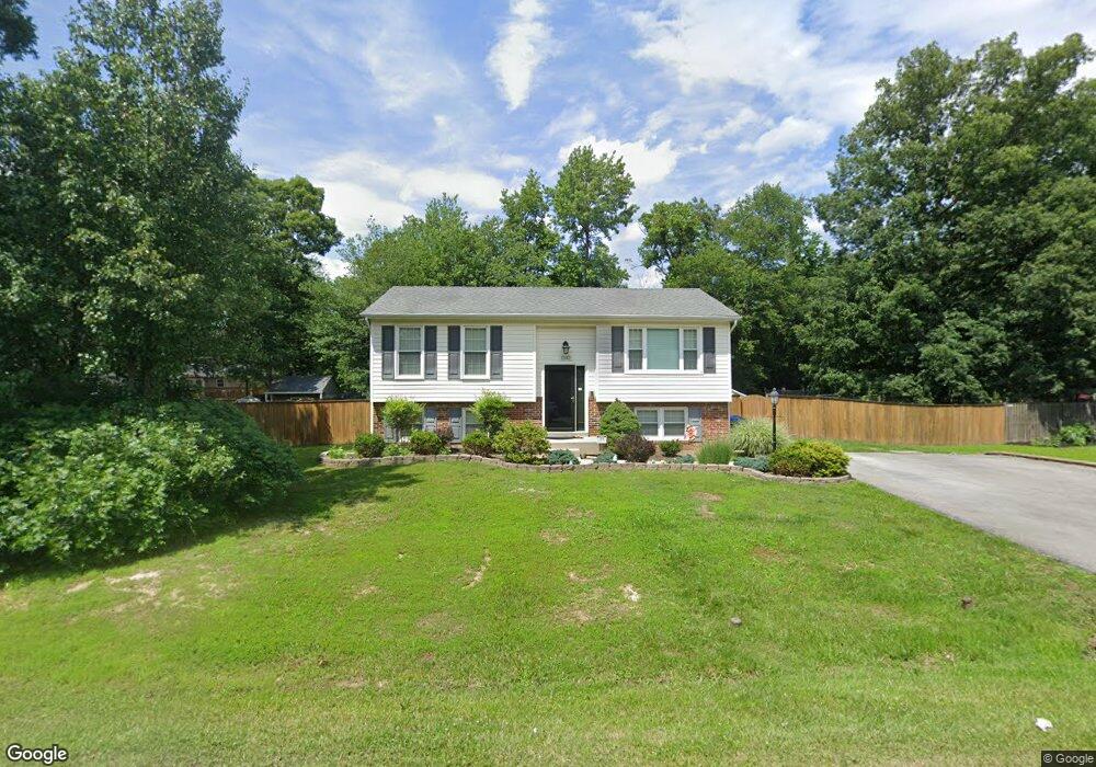
12642 Council Oak Dr Waldorf, MD 20601
Estimated Value: $327,682 - $403,000
--
Bed
2
Baths
894
Sq Ft
$409/Sq Ft
Est. Value
About This Home
This home is located at 12642 Council Oak Dr, Waldorf, MD 20601 and is currently estimated at $365,671, approximately $409 per square foot. 12642 Council Oak Dr is a home located in Charles County with nearby schools including J.P. Ryon Elementary School, John Hanson Middle School, and Thomas Stone High School.
Ownership History
Date
Name
Owned For
Owner Type
Purchase Details
Closed on
Oct 20, 2020
Sold by
Conroe Stephen J and Conroe Stephen
Bought by
Conroe Stephen J and Conroe Kajada N
Current Estimated Value
Home Financials for this Owner
Home Financials are based on the most recent Mortgage that was taken out on this home.
Original Mortgage
$186,000
Outstanding Balance
$165,437
Interest Rate
2.9%
Mortgage Type
New Conventional
Estimated Equity
$200,234
Purchase Details
Closed on
Aug 12, 2004
Sold by
Smith Troy S and Smith Stacy L
Bought by
Conroe Stephen
Purchase Details
Closed on
Sep 22, 1994
Sold by
Patterson We
Bought by
Smith Troy S
Home Financials for this Owner
Home Financials are based on the most recent Mortgage that was taken out on this home.
Original Mortgage
$132,498
Interest Rate
8.56%
Create a Home Valuation Report for This Property
The Home Valuation Report is an in-depth analysis detailing your home's value as well as a comparison with similar homes in the area
Home Values in the Area
Average Home Value in this Area
Purchase History
| Date | Buyer | Sale Price | Title Company |
|---|---|---|---|
| Conroe Stephen J | -- | Gpn Title Inc | |
| Conroe Stephen | $174,000 | -- | |
| Smith Troy S | $129,900 | -- |
Source: Public Records
Mortgage History
| Date | Status | Borrower | Loan Amount |
|---|---|---|---|
| Open | Conroe Stephen J | $186,000 | |
| Previous Owner | Smith Troy S | $132,498 | |
| Closed | Conroe Stephen | -- |
Source: Public Records
Tax History Compared to Growth
Tax History
| Year | Tax Paid | Tax Assessment Tax Assessment Total Assessment is a certain percentage of the fair market value that is determined by local assessors to be the total taxable value of land and additions on the property. | Land | Improvement |
|---|---|---|---|---|
| 2025 | $9,205 | $295,567 | -- | -- |
| 2024 | $4,029 | $281,500 | $125,300 | $156,200 |
| 2023 | $3,662 | $256,267 | $0 | $0 |
| 2022 | $3,310 | $231,033 | $0 | $0 |
| 2021 | $2,857 | $205,800 | $95,300 | $110,500 |
| 2020 | $2,857 | $200,100 | $0 | $0 |
| 2019 | $2,766 | $194,400 | $0 | $0 |
| 2018 | $2,651 | $188,700 | $90,300 | $98,400 |
| 2017 | $2,579 | $183,767 | $0 | $0 |
| 2016 | -- | $178,833 | $0 | $0 |
| 2015 | $2,614 | $173,900 | $0 | $0 |
| 2014 | $2,614 | $173,900 | $0 | $0 |
Source: Public Records
Map
Nearby Homes
- 12720 Bar Oak Dr
- 12820 Twin Oak Dr
- 1525 Pin Oak Dr
- 2549 Mattawoman Beantown Rd
- 2552 Fernwood Ct
- 1610 Pin Oak Dr
- 12606 Sub Station Rd
- 2002 English Oak Ct
- 2204 Holly Oak Ct
- 2650 Pinewood Dr
- 4208 Sandwich Cir
- 2290 Mattawoman Beantown Rd
- 3502 Lisa Ln
- 2914 Sandwich Dr
- 3907 Brewster Ct
- 4302 Sandwich Ct
- 2217 Pinefield Way
- 919 Truro Ln
- 5026 Nicholas Rd
- 12113 Farrar Place
- 12644 Council Oak Dr
- 12640 Council Oak Dr
- 1698 Pin Oak Dr
- 12641 Council Oak Dr
- 12639 Council Oak Dr
- 12646 Council Oak Dr
- 12643 Council Oak Dr
- 12637 Council Oak Dr
- 12634 Council Oak Dr
- 12576 Mirkwood Ln
- 12648 Council Oak Dr
- 12568 Mirkwood Ln
- 12566 Mirkwood Ln
- 12574 Mirkwood Ln
- 12564 Mirkwood Ln
- 12562 Mirkwood Ln
- 12560 Mirkwood Ln
- 12572 Mirkwood Ln
- 12635 Council Oak Dr
- 12558 Mirkwood Ln