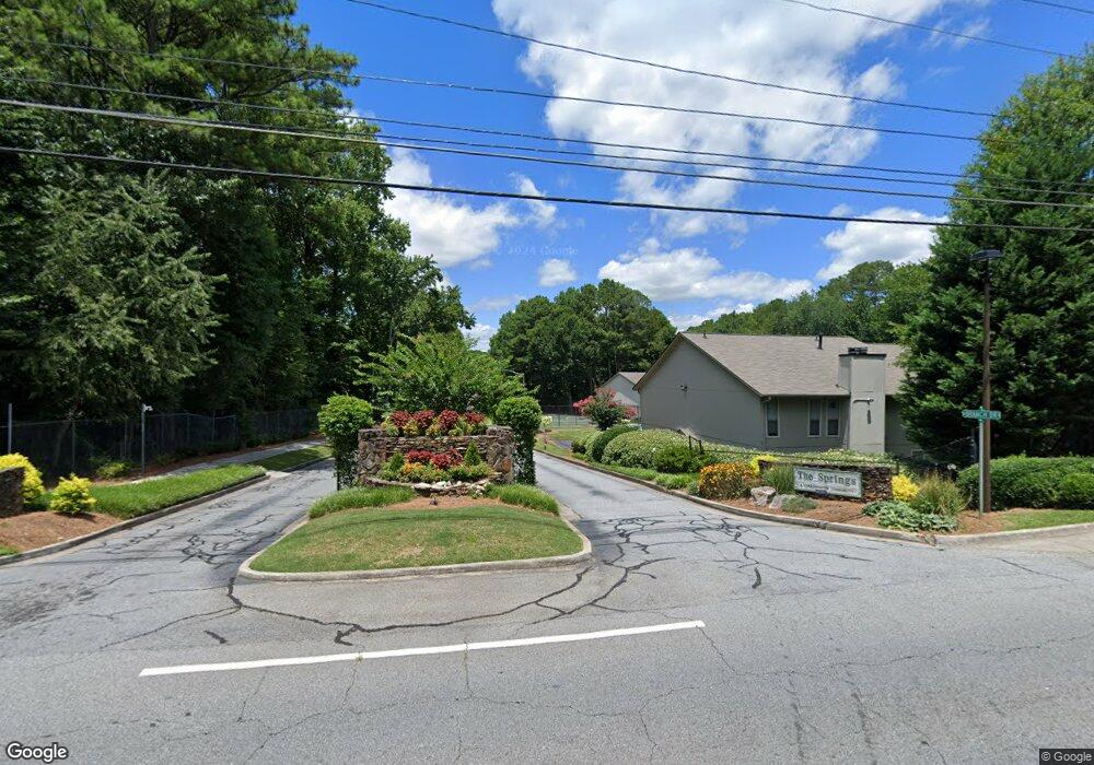
1265 Branch Dr Unit 1265 Tucker, GA 30084
Pittsburg NeighborhoodEstimated Value: $153,000 - $205,000
2
Beds
2
Baths
1,170
Sq Ft
$157/Sq Ft
Est. Value
About This Home
This home is located at 1265 Branch Dr Unit 1265, Tucker, GA 30084 and is currently estimated at $183,593, approximately $156 per square foot. 1265 Branch Dr Unit 1265 is a home located in Gwinnett County with nearby schools including Nesbit Elementary School, Lilburn Middle School, and Meadowcreek High School.
Ownership History
Date
Name
Owned For
Owner Type
Purchase Details
Closed on
Dec 12, 2016
Sold by
Romero A
Bought by
Fisher Joan A and Fisher Brian B
Current Estimated Value
Home Financials for this Owner
Home Financials are based on the most recent Mortgage that was taken out on this home.
Original Mortgage
$52,800
Outstanding Balance
$42,701
Interest Rate
3.57%
Mortgage Type
New Conventional
Estimated Equity
$140,892
Purchase Details
Closed on
Dec 30, 1996
Sold by
Frangi Ronald A Evelyn
Bought by
Frangi Romero A
Create a Home Valuation Report for This Property
The Home Valuation Report is an in-depth analysis detailing your home's value as well as a comparison with similar homes in the area
Home Values in the Area
Average Home Value in this Area
Purchase History
| Date | Buyer | Sale Price | Title Company |
|---|---|---|---|
| Fisher Joan A | $66,000 | -- | |
| Frangi Romero A | $42,800 | -- |
Source: Public Records
Mortgage History
| Date | Status | Borrower | Loan Amount |
|---|---|---|---|
| Open | Fisher Joan A | $52,800 | |
| Closed | Frangi Romero A | $0 |
Source: Public Records
Tax History Compared to Growth
Tax History
| Year | Tax Paid | Tax Assessment Tax Assessment Total Assessment is a certain percentage of the fair market value that is determined by local assessors to be the total taxable value of land and additions on the property. | Land | Improvement |
|---|---|---|---|---|
| 2024 | $2,727 | $76,280 | $14,000 | $62,280 |
| 2023 | $2,727 | $69,160 | $15,200 | $53,960 |
| 2022 | $1,927 | $53,440 | $8,000 | $45,440 |
| 2021 | $1,462 | $39,520 | $5,200 | $34,320 |
| 2020 | $1,472 | $39,520 | $5,200 | $34,320 |
| 2019 | $1,312 | $36,520 | $5,200 | $31,320 |
| 2018 | $964 | $26,440 | $5,200 | $21,240 |
| 2016 | $691 | $18,680 | $4,000 | $14,680 |
| 2015 | $673 | $17,920 | $4,000 | $13,920 |
| 2014 | -- | $17,920 | $4,000 | $13,920 |
Source: Public Records
Map
Nearby Homes
- 1302 Branch Dr
- 1312 Branch Dr
- 1382 Branch Dr
- 6734 Graves Mill Dr
- 6001 Kingsbridge Rd Unit 3
- 3321 S Norcross Tucker Rd
- 1111 Pin Oak Dr
- 1164 Red Oak Cove
- 3274 Enfield Ct
- 4125 Spring Valley Cir Unit 7
- 434 Bentley Place
- 6445 Wedgewood Trace Unit B
- 6622 Wellington Square
- 533 Bentley Place
- 6606 Wellington Square
- 328 Bentley Place
- 1066 Wedgewood Ln
- 1265 Branch Dr
- 1261 Branch Dr Unit 1261
- 1263 Branch Dr Unit 1263
- 1257 Branch Dr
- 1259 Branch Dr
- 1253 Branch Dr Unit 1253
- 1275 Branch Dr
- 1281 Branch Dr
- 1272 Branch Dr
- 1276 Branch Dr
- 1279 Branch Dr
- 1279 Branch Dr
- 1270 Branch Dr
- 1278 Branch Dr
- 1285 Branch Dr Unit 1285
- 1285 Branch Dr
- 1271 Branch Dr
- 1284 Branch Dr
- 1283 Branch Dr Unit 1283
- 1280 Branch Dr
