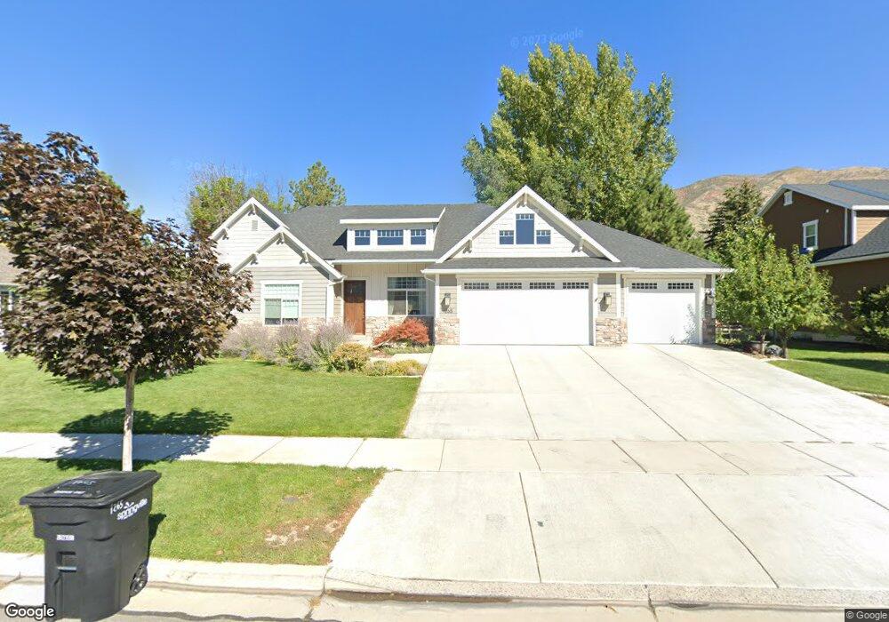
1265 E 1150 S Unit 16 Springville, UT 84663
East Hobble Creek NeighborhoodEstimated Value: $755,000 - $1,030,000
3
Beds
4
Baths
1,968
Sq Ft
$446/Sq Ft
Est. Value
About This Home
This home is located at 1265 E 1150 S Unit 16, Springville, UT 84663 and is currently estimated at $878,554, approximately $446 per square foot. 1265 E 1150 S Unit 16 is a home located in Utah County with nearby schools including Sage Creek Elementary, Springville High School, and Springville Junior High School.
Ownership History
Date
Name
Owned For
Owner Type
Purchase Details
Closed on
May 22, 2014
Sold by
Sparks Noah
Bought by
Sparks Noah and Sparks Stephanie
Current Estimated Value
Home Financials for this Owner
Home Financials are based on the most recent Mortgage that was taken out on this home.
Original Mortgage
$355,400
Outstanding Balance
$270,654
Interest Rate
4.31%
Mortgage Type
New Conventional
Estimated Equity
$607,900
Purchase Details
Closed on
Nov 27, 2013
Sold by
Rlp Enterprises Llc
Bought by
Sweetwater Homes Llc
Home Financials for this Owner
Home Financials are based on the most recent Mortgage that was taken out on this home.
Original Mortgage
$311,874
Interest Rate
4.23%
Mortgage Type
Construction
Create a Home Valuation Report for This Property
The Home Valuation Report is an in-depth analysis detailing your home's value as well as a comparison with similar homes in the area
Home Values in the Area
Average Home Value in this Area
Purchase History
We collect this data history from publicly available records. To have your information removed, we recommend requesting removal directly through your county’s website.
| Date | Buyer | Sale Price | Title Company |
|---|---|---|---|
| Sparks Noah | -- | Utah First Title Ins Ag | |
| Sparks Noah | -- | Utah First Title Ins Ag | |
| Sweetwater Homes Llc | -- | United West Title |
Source: Public Records
Mortgage History
We collect this data history from publicly available records. To have your information removed, we recommend requesting removal directly through your county’s website.
| Date | Status | Borrower | Loan Amount |
|---|---|---|---|
| Open | Sparks Noah | $355,400 | |
| Previous Owner | Sweetwater Homes Llc | $311,874 |
Source: Public Records
Tax History
| Year | Tax Paid | Tax Assessment Tax Assessment Total Assessment is a certain percentage of the fair market value that is determined by local assessors to be the total taxable value of land and additions on the property. | Land | Improvement |
|---|---|---|---|---|
| 2025 | $4,292 | $472,505 | -- | -- |
| 2024 | $4,292 | $439,670 | $0 | $0 |
| 2023 | $4,284 | $439,340 | $0 | $0 |
| 2022 | $4,580 | $461,285 | $0 | $0 |
| 2021 | $3,676 | $576,300 | $175,100 | $401,200 |
| 2020 | $3,497 | $531,500 | $152,300 | $379,200 |
| 2019 | $3,389 | $524,300 | $145,100 | $379,200 |
| 2018 | $3,146 | $464,400 | $130,600 | $333,800 |
| 2017 | $3,039 | $238,315 | $0 | $0 |
| 2016 | $2,752 | $211,530 | $0 | $0 |
| 2015 | $2,620 | $205,920 | $0 | $0 |
| 2014 | $1,365 | $106,600 | $0 | $0 |
Source: Public Records
Map
Nearby Homes
- 1264 E 1150 S
- 949 S 1060 E
- 1697 N 500 W
- 598 W 1600 N
- 899 E 800 S
- 145 W Carnesecca Ct
- 894 E 700 S
- 1816 River Bottom Rd
- 557 S 1470 E
- 1332 N 1500 W Unit 7
- 1378 N 1500 W Unit 8
- 1375 N 1500 W Unit 5
- 1279 W 1500 N
- 677 E 800 South St
- 630 E 800 St S
- 1361 E 400 S
- 405 W 1200 N Unit 4
- 487 W 1200 N Unit 1
- 1492 W 1400 N Unit 3
- 1524 W 1400 N Unit 2
- 1265 E 1150 S
- 1281 E 1150 S Unit 15
- 1239 E 1150 S Unit 11
- 1239 E 1150 S
- 1239 E 1150 S Unit 17
- 1260 Hobble Creek Dr
- 1260 Hobble Creek Dr Unit 23
- 1280 Hobble Creek Dr
- 1208 Hobble Creek Dr
- 1264 E 1150 S Unit 20
- 1278 E 1150 S Unit 19
- 1278 E 1150 S
- 1319 E 1150 S Unit 14
- 1300 Hobble Creek Dr
- 1232 E 1150 S Unit 21
- 1232 E 1150 S
- 1207 E 1150 S Unit 12
- 1207 E 1150 S
- 1207 E 1150 S Unit 18
- 1222 Hobble Creek Dr
Your Personal Tour Guide
Ask me questions while you tour the home.