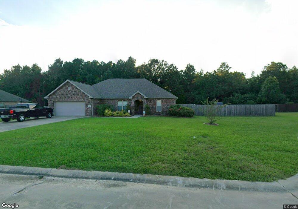
1265 Harmony Ln Deridder, LA 70634
Estimated Value: $270,000 - $296,000
3
Beds
2
Baths
2,615
Sq Ft
$108/Sq Ft
Est. Value
About This Home
This home is located at 1265 Harmony Ln, Deridder, LA 70634 and is currently estimated at $282,909, approximately $108 per square foot. 1265 Harmony Ln is a home located in Beauregard Parish with nearby schools including K.R. Hanchey Elementary School, Pine Wood Elementary School, and DeRidder Junior High School.
Ownership History
Date
Name
Owned For
Owner Type
Purchase Details
Closed on
Mar 29, 2018
Sold by
Howard James Mcarthur and Howard Dana Chevon
Bought by
Coronel Alvais Daniel and Curtis Shelby Anai
Current Estimated Value
Home Financials for this Owner
Home Financials are based on the most recent Mortgage that was taken out on this home.
Original Mortgage
$211,945
Outstanding Balance
$180,649
Interest Rate
4.43%
Mortgage Type
New Conventional
Estimated Equity
$102,260
Create a Home Valuation Report for This Property
The Home Valuation Report is an in-depth analysis detailing your home's value as well as a comparison with similar homes in the area
Purchase History
| Date | Buyer | Sale Price | Title Company |
|---|---|---|---|
| Coronel Alvais Daniel | $218,500 | None Available |
Source: Public Records
Mortgage History
| Date | Status | Borrower | Loan Amount |
|---|---|---|---|
| Open | Coronel Alvais Daniel | $211,945 |
Source: Public Records
Tax History
| Year | Tax Paid | Tax Assessment Tax Assessment Total Assessment is a certain percentage of the fair market value that is determined by local assessors to be the total taxable value of land and additions on the property. | Land | Improvement |
|---|---|---|---|---|
| 2025 | $2,195 | $21,240 | $1,800 | $19,440 |
| 2024 | $2,180 | $21,240 | $1,800 | $19,440 |
| 2023 | $2,058 | $19,596 | $1,500 | $18,096 |
| 2022 | $2,058 | $19,596 | $1,500 | $18,096 |
| 2021 | $2,058 | $19,596 | $1,500 | $18,096 |
| 2020 | $2,057 | $19,596 | $1,500 | $18,096 |
| 2019 | $2,060 | $19,596 | $1,500 | $18,096 |
| 2018 | $2,060 | $19,596 | $1,500 | $18,096 |
| 2017 | $2,060 | $19,596 | $1,500 | $18,096 |
| 2016 | $2,060 | $19,596 | $1,500 | $18,096 |
Source: Public Records
Map
Nearby Homes
- 0 Gladys St
- 1515 Rose St
- 423 Logan St
- 629 Parish Line Rd
- 810 Greenbriar St
- 903 Greenbriar St
- 1844 Woodlawn St
- 605 Barbara St
- 0 Johnnie B Hall Memorial Hwy
- 507 E North St
- 1016 Meadowbrook St
- 506 Hillcrest Rd
- 1007 Nichols St
- 0 N Texas St
- 2107 Peach St
- 2108 Pear St
- 406 Cain Ave
- 905 N Texas St
- 737 Roberts St Unit A and B
- 501 Magnolia St
- 1271 Harmony Ln
- 1264 Harmony Ln
- 1258 Harmony Ln
- 1258 Harmony Ln Unit Ln
- 1270 Harmony Ln
- 1253 Harmony Ln
- 227 N Ridge Dr
- 227 N Ridge Dr Unit Drive
- 1252 Harmony Ln
- 251 N Ridge Dr
- 211 N Ridge Dr
- 1247 Harmony Ln
- 1246 Harmony Ln
- 265 N Ridge Dr
- 195 N Ridge Dr
- 222 N Ridge Dr
- 244 N Ridge Dr
- 1241 Harmony Ln
- 208 N Ridge Dr
- 208 N Ridge Dr Unit Drive
Your Personal Tour Guide
Ask me questions while you tour the home.