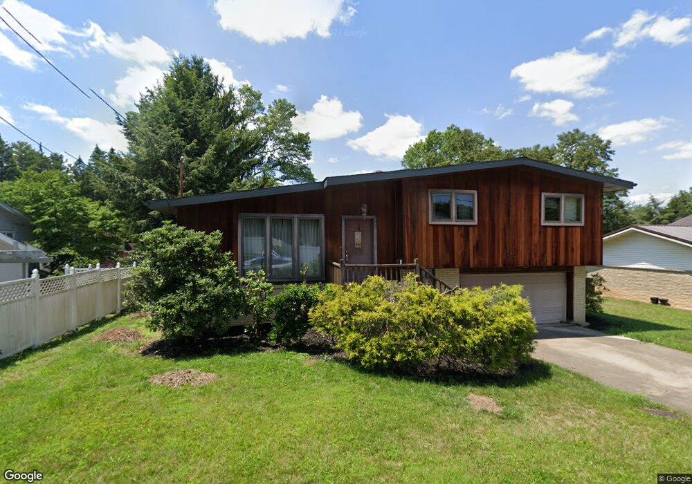
1265 Longdon St Morgantown, WV 26505
Suncrest NeighborhoodEstimated Value: $310,000 - $355,000
3
Beds
2
Baths
1,672
Sq Ft
$195/Sq Ft
Est. Value
About This Home
This home is located at 1265 Longdon St, Morgantown, WV 26505 and is currently estimated at $326,499, approximately $195 per square foot. 1265 Longdon St is a home located in Monongalia County with nearby schools including Suncrest Elementary School, Suncrest Middle School, and Morgantown High School.
Ownership History
Date
Name
Owned For
Owner Type
Purchase Details
Closed on
Sep 9, 2022
Sold by
Photiadis Alese N
Bought by
Allen Peter and Allen Andrea
Current Estimated Value
Home Financials for this Owner
Home Financials are based on the most recent Mortgage that was taken out on this home.
Original Mortgage
$112,375
Outstanding Balance
$107,133
Interest Rate
4.99%
Mortgage Type
New Conventional
Estimated Equity
$219,366
Purchase Details
Closed on
Jun 25, 2009
Sold by
Photiadis James
Bought by
Photiadis Evelyn and Photiadis Lynn
Create a Home Valuation Report for This Property
The Home Valuation Report is an in-depth analysis detailing your home's value as well as a comparison with similar homes in the area
Home Values in the Area
Average Home Value in this Area
Purchase History
| Date | Buyer | Sale Price | Title Company |
|---|---|---|---|
| Allen Peter | $250,000 | -- | |
| Photiadis Evelyn | $116,000 | None Available |
Source: Public Records
Mortgage History
| Date | Status | Borrower | Loan Amount |
|---|---|---|---|
| Open | Allen Peter | $112,375 | |
| Closed | Allen Peter | $112,375 |
Source: Public Records
Tax History Compared to Growth
Tax History
| Year | Tax Paid | Tax Assessment Tax Assessment Total Assessment is a certain percentage of the fair market value that is determined by local assessors to be the total taxable value of land and additions on the property. | Land | Improvement |
|---|---|---|---|---|
| 2024 | $1,710 | $129,720 | $51,420 | $78,300 |
| 2023 | $1,707 | $122,160 | $51,420 | $70,740 |
| 2022 | $1,540 | $120,840 | $51,420 | $69,420 |
| 2021 | $1,547 | $120,840 | $51,420 | $69,420 |
| 2020 | $1,552 | $120,840 | $51,420 | $69,420 |
| 2019 | $1,561 | $120,840 | $51,420 | $69,420 |
| 2018 | $1,565 | $120,840 | $51,420 | $69,420 |
| 2017 | $1,533 | $117,900 | $48,480 | $69,420 |
| 2016 | $1,511 | $115,560 | $46,140 | $69,420 |
| 2015 | $1,407 | $111,600 | $42,180 | $69,420 |
| 2014 | $1,313 | $108,120 | $40,500 | $67,620 |
Source: Public Records
Map
Nearby Homes
- 34 Salthouse Ln
- 563 Killarney Dr
- 678 Bellaire Dr
- 1287 Broadview Dr
- 675 Colonial Dr
- 1301 Heritage Place
- TBA van Voorhis Rd
- 604 Schubert Place
- 3356 Collins Ferry Rd
- 478 Legion St
- 1230 van Voorhis Rd
- 663 Kenwood Place
- 1081 Koontz Ave
- 102 Forest Dr
- 101 Forest Dr
- 104 Forest Dr
- 1236 van Voorhis Rd
- 481 Meridan St
- 1232 Lions Ave
- 2002 White Oak Dr
- 1269 Longdon St
- 1276 Dogwood Ave
- 636 Bellaire Dr
- 1260 Longdon St
- 1277 Longdon St
- 1272 Longdon St
- 644 Bellaire Dr
- 1278 Dogwood Ave
- 628 Killarney Dr
- 630 Killarney Dr
- 636 Killarney Dr
- 643 Killarney Dr
- 1257 Dogwood Ave
- 1281 Longdon St
- 643 Bellaire Dr
- 1280 Longdon St
- 1265 Dogwood Ave
- 652 Bellaire Dr
- 574 Killarney Dr
- 651 Killarney Dr