Estimated Value: $324,000 - $363,000
3
Beds
3
Baths
3,447
Sq Ft
$101/Sq Ft
Est. Value
About This Home
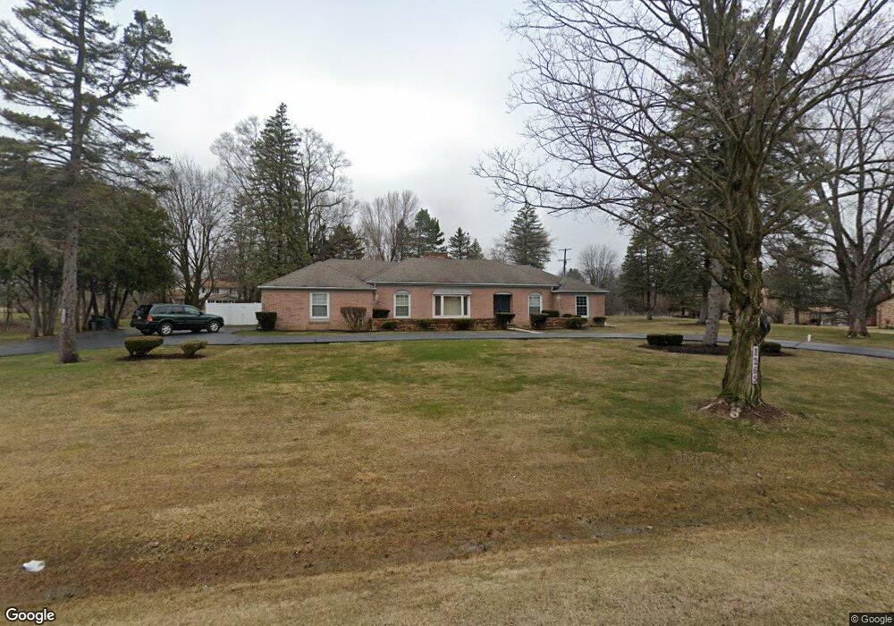
This home is located at 1265 Maplekrest Dr, Flint, MI 48532 and is currently estimated at $348,966, approximately $101 per square foot. 1265 Maplekrest Dr is a home located in Genesee County with nearby schools including Carman-Ainsworth High School, Genesee STEM Academy, and Linden Charter Academy.
Ownership History
Date
Name
Owned For
Owner Type
Purchase Details
Closed on
Sep 23, 2013
Sold by
Hawkins Courtney T and Hawkins Candace
Bought by
Hawkins Courtney T and Hawkins Hall Rene D
Current Estimated Value
Home Financials for this Owner
Home Financials are based on the most recent Mortgage that was taken out on this home.
Original Mortgage
$139,000
Interest Rate
4.33%
Mortgage Type
New Conventional
Purchase Details
Closed on
Mar 1, 2004
Sold by
Hawkins Courtney T
Bought by
Hawkins Courtney T and Hawkins Rene D
Create a Home Valuation Report for This Property
The Home Valuation Report is an in-depth analysis detailing your home's value as well as a comparison with similar homes in the area
Home Values in the Area
Average Home Value in this Area
Purchase History
| Date | Buyer | Sale Price | Title Company |
|---|---|---|---|
| Hawkins Courtney T | -- | Vantage Point | |
| Hawkins Courtney T | -- | Lawyers Title |
Source: Public Records
Mortgage History
| Date | Status | Borrower | Loan Amount |
|---|---|---|---|
| Closed | Hawkins Courtney T | $139,000 |
Source: Public Records
Tax History
| Year | Tax Paid | Tax Assessment Tax Assessment Total Assessment is a certain percentage of the fair market value that is determined by local assessors to be the total taxable value of land and additions on the property. | Land | Improvement |
|---|---|---|---|---|
| 2025 | $4,807 | $199,700 | $0 | $0 |
| 2024 | $2,632 | $184,500 | $0 | $0 |
| 2023 | $2,511 | $174,900 | $0 | $0 |
| 2022 | $1,966 | $133,900 | $0 | $0 |
| 2021 | $4,249 | $128,600 | $0 | $0 |
| 2020 | $2,256 | $128,600 | $0 | $0 |
| 2019 | $2,224 | $127,100 | $0 | $0 |
| 2018 | $3,963 | $117,300 | $0 | $0 |
| 2017 | $3,811 | $117,300 | $0 | $0 |
| 2016 | $3,917 | $113,900 | $0 | $0 |
| 2015 | $3,735 | $97,800 | $0 | $0 |
| 2014 | $2,216 | $93,700 | $0 | $0 |
| 2012 | -- | $94,600 | $94,600 | $0 |
Source: Public Records
Map
Nearby Homes
- 1246 Dyemeadow Ln
- 5551 Sugar Bush Ln
- 5477 Fernwood Dr
- 1504 Sun Terrace Dr
- 5411 River Meadow Blvd
- 5021 Forest Side Dr
- 5396 Oaktree Dr
- 5442 Meadow Creek Ct
- 2008 Beekman Ct
- 5325 N Dyewood Dr
- Covered Wagons Trail Covered Wagons Trail
- 1090 Cabot Dr
- 6142 Noel Dr
- 1161 S Dye Rd
- 6123 E River Rd
- 1321 Highland Meadows
- Integrity 1880 Plan at Country Ridge of Flint
- oo Walnut Creek Dr
- 1192 Citation Dr
- 1184 Citation Dr
- 1281 Maplekrest Dr
- 1327 Woodkrest Dr
- 1282 Dye Krest Cir
- 1266 Maplekrest Dr
- 1346 Dye Krest Cir
- 1314 Dye Krest Cir
- 1234 Maplekrest Dr
- 1286 Maplekrest Dr
- 1322 Woodkrest Dr
- 1267 Woodkrest Dr
- 1267 Woodkrest Dr
- 1267 Woodkrest Dr
- 1295 Dye Krest Cir
- 1214 Maplekrest Dr
- 1310 Maplekrest Dr
- 1339 Dye Krest Cir
- 1327 Dye Krest Cir
- 1375 Dye Krest Cir
- 1209 Maplekrest Dr
- 1357 Dye Krest Cir