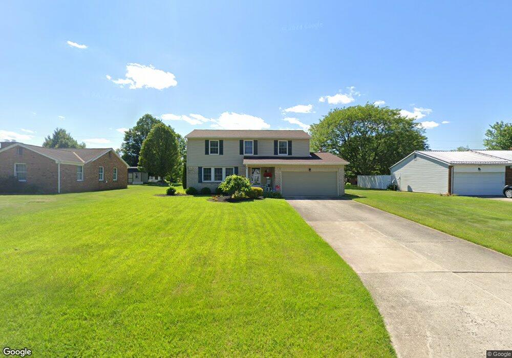
1265 Southland Dr Bucyrus, OH 44820
Estimated Value: $197,000 - $228,587
4
Beds
3
Baths
955
Sq Ft
$223/Sq Ft
Est. Value
About This Home
This home is located at 1265 Southland Dr, Bucyrus, OH 44820 and is currently estimated at $212,897, approximately $222 per square foot. 1265 Southland Dr is a home located in Crawford County with nearby schools including Bucyrus Elementary School, Bucyrus Secondary School, and Wayside Christian School.
Ownership History
Date
Name
Owned For
Owner Type
Purchase Details
Closed on
Sep 5, 2025
Sold by
Bucyrus United Methodist Church
Bought by
Fannin Tad J E and Fannin Haley E
Current Estimated Value
Home Financials for this Owner
Home Financials are based on the most recent Mortgage that was taken out on this home.
Original Mortgage
$210,000
Outstanding Balance
$210,000
Interest Rate
6.74%
Mortgage Type
New Conventional
Estimated Equity
$2,897
Create a Home Valuation Report for This Property
The Home Valuation Report is an in-depth analysis detailing your home's value as well as a comparison with similar homes in the area
Home Values in the Area
Average Home Value in this Area
Purchase History
| Date | Buyer | Sale Price | Title Company |
|---|---|---|---|
| Fannin Tad J E | $210,000 | None Listed On Document |
Source: Public Records
Mortgage History
| Date | Status | Borrower | Loan Amount |
|---|---|---|---|
| Open | Fannin Tad J E | $210,000 |
Source: Public Records
Tax History Compared to Growth
Tax History
| Year | Tax Paid | Tax Assessment Tax Assessment Total Assessment is a certain percentage of the fair market value that is determined by local assessors to be the total taxable value of land and additions on the property. | Land | Improvement |
|---|---|---|---|---|
| 2024 | $2,977 | $65,990 | $7,160 | $58,830 |
| 2023 | $2,977 | $49,710 | $5,510 | $44,200 |
| 2022 | $2,652 | $49,710 | $5,510 | $44,200 |
| 2021 | $2,646 | $49,710 | $5,510 | $44,200 |
| 2020 | $2,217 | $39,480 | $5,510 | $33,970 |
| 2019 | $2,267 | $39,480 | $5,510 | $33,970 |
| 2018 | $2,256 | $39,480 | $5,510 | $33,970 |
| 2017 | $2,157 | $36,420 | $5,510 | $30,910 |
| 2016 | $2,091 | $36,420 | $5,510 | $30,910 |
| 2015 | $2,061 | $36,420 | $5,510 | $30,910 |
| 2014 | $2,054 | $36,420 | $5,510 | $30,910 |
| 2013 | $2,054 | $36,420 | $5,510 | $30,910 |
Source: Public Records
Map
Nearby Homes
- 1315 Lynne Ave
- 0 Lynne Ave
- 1149 Farmview Dr
- 1145 Lynne Ave
- 1123 Hillcrest Dr
- 1112 Hillcrest Dr
- 1555 Rosedale Ave
- 2440 Wyandot Rd
- 452 Pleasant Ln
- 130 Brentwood St
- 275 Brentwood St
- 1211 S Sandusky Ave
- 900 S Spring St
- 1021 S Sandusky Ave
- 325 W Liberty St
- 708 S Sandusky Ave
- 318 Charlotte St
- 317 S Spring St
- 316 W Warren St
- 550 S Walnut St
- 1285 Southland Dr
- 1245 Southland Dr
- 1274 Farmview Dr
- 1254 Farmview Dr
- 1225 Southland Dr
- 1126 Wade Dr
- 1260 Southland Dr
- 1240 Southland Ave
- 1240 Southland Dr
- 1282 Southland Dr
- 1234 Farmview Dr
- 1115 Wade Dr
- 1220 Southland Dr
- 1115 Laura Ave
- 1127 Wade Dr
- 1117 Laura Ave
- 1302 Southland Dr
- 1025 Laura Ave
- 1265 Lynne Ave
- 1235 Lynne Ave