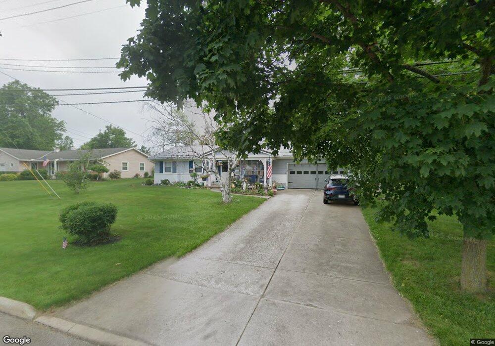
1265 Spruce Tree Ln Amherst, OH 44001
Estimated Value: $261,793 - $272,000
4
Beds
2
Baths
1,856
Sq Ft
$144/Sq Ft
Est. Value
About This Home
This home is located at 1265 Spruce Tree Ln, Amherst, OH 44001 and is currently estimated at $266,698, approximately $143 per square foot. 1265 Spruce Tree Ln is a home located in Lorain County with nearby schools including Powers Elementary School, Walter G. Nord Middle School, and Amherst Junior High School.
Ownership History
Date
Name
Owned For
Owner Type
Purchase Details
Closed on
Mar 2, 2013
Sold by
Trackson Catherine and Bloor Catherine
Bought by
Bloor Catherine
Current Estimated Value
Purchase Details
Closed on
Feb 13, 2001
Sold by
Tarcson Michael M
Bought by
Tarcson Catherine M
Purchase Details
Closed on
Oct 20, 1995
Sold by
Foley John G
Bought by
Tarcson Michael M and Tarcson Catherine M
Home Financials for this Owner
Home Financials are based on the most recent Mortgage that was taken out on this home.
Original Mortgage
$107,200
Outstanding Balance
$691
Interest Rate
6.75%
Mortgage Type
New Conventional
Estimated Equity
$266,007
Create a Home Valuation Report for This Property
The Home Valuation Report is an in-depth analysis detailing your home's value as well as a comparison with similar homes in the area
Home Values in the Area
Average Home Value in this Area
Purchase History
| Date | Buyer | Sale Price | Title Company |
|---|---|---|---|
| Bloor Catherine | -- | None Available | |
| Tarcson Catherine M | -- | -- | |
| Tarcson Michael M | $134,000 | -- |
Source: Public Records
Mortgage History
| Date | Status | Borrower | Loan Amount |
|---|---|---|---|
| Open | Tarcson Michael M | $107,200 |
Source: Public Records
Tax History
| Year | Tax Paid | Tax Assessment Tax Assessment Total Assessment is a certain percentage of the fair market value that is determined by local assessors to be the total taxable value of land and additions on the property. | Land | Improvement |
|---|---|---|---|---|
| 2024 | $3,177 | $75,695 | $17,777 | $57,918 |
| 2023 | $2,758 | $57,565 | $9,790 | $47,775 |
| 2022 | $2,644 | $57,565 | $9,790 | $47,775 |
| 2021 | $2,651 | $57,565 | $9,790 | $47,775 |
| 2020 | $2,444 | $47,110 | $8,010 | $39,100 |
| 2019 | $2,395 | $47,110 | $8,010 | $39,100 |
| 2018 | $2,407 | $47,110 | $8,010 | $39,100 |
| 2017 | $2,412 | $44,300 | $7,450 | $36,850 |
| 2016 | $2,431 | $44,300 | $7,450 | $36,850 |
| 2015 | $2,418 | $44,300 | $7,450 | $36,850 |
| 2014 | $2,536 | $46,250 | $7,780 | $38,470 |
| 2013 | $2,544 | $46,250 | $7,780 | $38,470 |
Source: Public Records
Map
Nearby Homes
- Pine—End Unit Plan at Quarry Creek
- Ivy Plan at Quarry Creek
- Pine w/ Full Basement Plan at Quarry Creek
- 60 Flamingo Ave
- 117 Caesars Cir
- 359 Rockridge Dr
- 351 Rockridge Dr
- 357 Rockridge Dr
- 116 Rockridge Dr
- 1819 Gloucester Dr
- 5611 Independence Dr
- 135 Ridgeland Dr
- 120 Springvale Dr
- 6501 Fox Tail Ln
- 1711 N Nantucket Dr
- 122 Lakeview Cir
- 423 Quarry Creek Dr
- 1519 Shaffer Dr
- 4872 Leavitt Rd
- 0 Leavitt Rd Unit 5169364
- 1259 Chapel Ct
- 1273 Spruce Tree Ln
- 1260 Spruce Tree Ln
- 1258 Chapel Ct
- 1270 Spruce Tree Ln
- 1274 Spruce Tree Ln
- 1250 Spruce Tree Ln
- 1245 Spruce Tree Ln
- 1278 Spruce Tree Ln
- 1281 Spruce Tree Ln
- 057 Spruce Tree Ln
- 056 Spruce Tree Ln
- 490 Rock Creek Run
- 490 Rock Creek Run
- 1239 Spruce Tree Ln
- 488 Rock Creek Run
- 1235 Spruce Tree Ln
- 1242 Spruce Tree Ln
- 1231 Spruce Tree Ln
- 489 Rock Creek Run