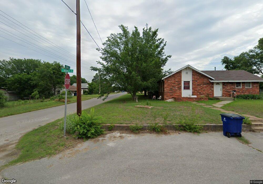
1265 W Maple Ave Duncan, OK 73533
Estimated Value: $80,000 - $94,000
1
Bed
1
Bath
1,677
Sq Ft
$52/Sq Ft
Est. Value
About This Home
This home is located at 1265 W Maple Ave, Duncan, OK 73533 and is currently estimated at $86,416, approximately $51 per square foot. 1265 W Maple Ave is a home with nearby schools including Emerson Elementary School, Duncan Middle School, and Duncan High School.
Ownership History
Date
Name
Owned For
Owner Type
Purchase Details
Closed on
Dec 10, 2021
Sold by
Dwight Kunze Ronnie
Bought by
Kunze Ronnie Dwight and Kunze Karen Jean
Current Estimated Value
Purchase Details
Closed on
Feb 27, 2009
Sold by
Maple Street Academy Llc
Bought by
Kunze Ronnie Dwight and Kunze Audrea Jean
Home Financials for this Owner
Home Financials are based on the most recent Mortgage that was taken out on this home.
Original Mortgage
$43,572
Interest Rate
4.7%
Mortgage Type
Commercial
Purchase Details
Closed on
Jun 27, 2002
Sold by
Mitchell Jimmy and Mitchell Vonda
Purchase Details
Closed on
Sep 29, 1994
Sold by
Rodgers Rick and Rodgers Carolyn
Create a Home Valuation Report for This Property
The Home Valuation Report is an in-depth analysis detailing your home's value as well as a comparison with similar homes in the area
Purchase History
| Date | Buyer | Sale Price | Title Company |
|---|---|---|---|
| Kunze Ronnie Dwight | -- | None Listed On Document | |
| Kunze Ronnie Dwight | $42,000 | Stewart Abstract & Title Of | |
| -- | $30,000 | -- | |
| -- | $26,500 | -- |
Source: Public Records
Mortgage History
| Date | Status | Borrower | Loan Amount |
|---|---|---|---|
| Previous Owner | Kunze Ronnie Dwight | $43,572 |
Source: Public Records
Tax History
| Year | Tax Paid | Tax Assessment Tax Assessment Total Assessment is a certain percentage of the fair market value that is determined by local assessors to be the total taxable value of land and additions on the property. | Land | Improvement |
|---|---|---|---|---|
| 2025 | $300 | $3,565 | $558 | $3,007 |
| 2024 | $191 | $3,233 | $558 | $2,675 |
| 2023 | $191 | $3,233 | $558 | $2,675 |
| 2022 | $174 | $3,048 | $712 | $2,336 |
| 2021 | $339 | $4,985 | $712 | $4,273 |
| 2020 | $319 | $4,699 | $712 | $3,987 |
| 2019 | $308 | $4,562 | $712 | $3,850 |
| 2018 | $305 | $4,562 | $712 | $3,850 |
| 2017 | $284 | $4,429 | $712 | $3,717 |
| 2016 | $270 | $4,175 | $712 | $3,463 |
| 2015 | $358 | $4,175 | $712 | $3,463 |
| 2014 | $358 | $4,509 | $440 | $4,069 |
Source: Public Records
Map
Nearby Homes
- 305 S 12th St
- 27 N 14th St
- 1203 W Walnut Ave
- 507 S 13th St
- 1106 W Ash Ave
- 1314 W Beech Ave
- 713 W Elm Ave
- 0 Alaska Unit 2602709
- 1309 W Beech Ave
- 1105 W Beech Ave
- 708 W Pecan Ave
- 711 S 12th St
- 1240 S 9th St
- 0 W Mulberry Ave
- 174831 N 2844 Rd
- 809 W Beech Ave
- 915 W Chestnut Ave
- 1109 W Stephens Ave
- 1905 W Ash Ave
- 512 W Oak Ave
- 1209 W Maple Ave
- 1209 W Maple Ave Unit 12
- 109 S 13th St
- 1216 W Maple Ave
- 1303 W Maple Ave
- 105 S 13th St
- 1208 W Maple Ave
- 1302 W Maple Ave
- 113 113 S 12th
- 206 S 13th St
- 1304 W Maple Ave
- 113 S 12th St
- 101 S 13th St
- 111 S 12th St
- 1204 W Maple Ave
- 1306 W Willow Ave
- 1307 W Maple Ave
- 1306 W Maple Ave
- 210 S 13th St
- 1309 W Maple Ave
Your Personal Tour Guide
Ask me questions while you tour the home.