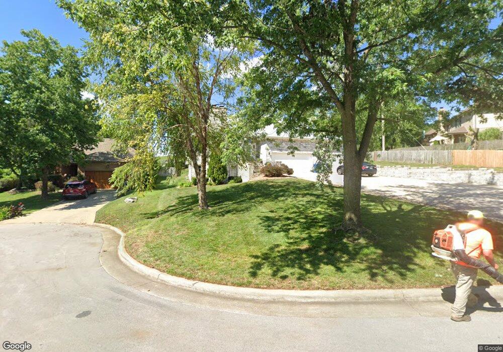
1265 W Pheasant Run St Springfield, MO 65810
Southwest Springfield NeighborhoodEstimated Value: $379,724 - $395,000
4
Beds
3
Baths
2,555
Sq Ft
$153/Sq Ft
Est. Value
About This Home
This home is located at 1265 W Pheasant Run St, Springfield, MO 65810 and is currently estimated at $389,681, approximately $152 per square foot. 1265 W Pheasant Run St is a home located in Greene County with nearby schools including Gray Elementary School, Wilson's Creek Intermediate School, and Cherokee Middle School.
Ownership History
Date
Name
Owned For
Owner Type
Purchase Details
Closed on
Oct 29, 2020
Sold by
Dittrich John P and Dittrich Cynthia
Bought by
Dittrich John P and Dittrich Cynthia R
Current Estimated Value
Purchase Details
Closed on
Aug 7, 2020
Sold by
Anderson Danny Bob and Anderson Mary
Bought by
Dittrich John P and Dittrich Cynthia
Purchase Details
Closed on
Aug 6, 2020
Sold by
Anderson Stuart Brad
Bought by
Dittrich John P and Dittrich Cynthia
Create a Home Valuation Report for This Property
The Home Valuation Report is an in-depth analysis detailing your home's value as well as a comparison with similar homes in the area
Home Values in the Area
Average Home Value in this Area
Purchase History
| Date | Buyer | Sale Price | Title Company |
|---|---|---|---|
| Dittrich John P | -- | None Available | |
| Dittrich John P | -- | None Available | |
| Dittrich John P | -- | None Available |
Source: Public Records
Tax History
| Year | Tax Paid | Tax Assessment Tax Assessment Total Assessment is a certain percentage of the fair market value that is determined by local assessors to be the total taxable value of land and additions on the property. | Land | Improvement |
|---|---|---|---|---|
| 2025 | $2,750 | $53,380 | $7,130 | $46,250 |
| 2024 | $2,590 | $46,760 | $4,750 | $42,010 |
| 2023 | $2,576 | $46,760 | $4,750 | $42,010 |
| 2022 | $2,261 | $42,070 | $4,750 | $37,320 |
| 2021 | $2,260 | $42,070 | $4,750 | $37,320 |
| 2020 | $2,223 | $39,220 | $4,750 | $34,470 |
| 2019 | $2,159 | $39,220 | $4,750 | $34,470 |
| 2018 | $2,217 | $40,190 | $4,750 | $35,440 |
| 2017 | $2,195 | $36,840 | $4,750 | $32,090 |
| 2016 | $2,013 | $36,840 | $4,750 | $32,090 |
| 2015 | $1,997 | $36,840 | $4,750 | $32,090 |
| 2014 | $1,939 | $35,490 | $4,750 | $30,740 |
Source: Public Records
Map
Nearby Homes
- 5393 S Newton Ave
- 5381 S Newton Ave
- 5615 S Newton Ave
- 1331 W Evans St
- 5204 S Nettleton Ave
- 5228 S Nettleton Ave
- 5216 S Nettleton Ave
- 1395 W Evans St
- 5726 S Ferguson Ave
- 5637 S Lexington Ave
- 1532 W Fancrest Ln
- 989 E Siler Pkwy
- 5337 S Dayton Ave
- 5341 S Dayton Ave
- 5333 S Dayton Ave
- 00 W Farm Road 182
- 5328 S Dayton Ave
- 5332 S Dayton Ave
- 5336 S Dayton Ave
- 000 W Farm Road 186
- 1277 W Pheasant Run St
- 5469 S Fort Ave
- 1288 W Pheasant Run St
- 5483 S Fort Ave
- 1264 W Pheasant Run St
- 1276 W Pheasant Run St
- 1250 W Pheasant Run St
- 1238 W Pheasant Run St
- 5468 S Fort Ave
- 1207 W Pheasant Run St
- 5482 S Fort Ave
- 5512 S Newton Ave
- 1336 W Farm Road 182
- 5526 S Newton Ave
- 1216 W Pheasant Run St
- 1220 W Farm Road 182
- 1289 W Highpoint St
- 1435 W Pheasant Run St
- 1193 W Pheasant Run St
- 1275 W Highpoint St
Your Personal Tour Guide
Ask me questions while you tour the home.