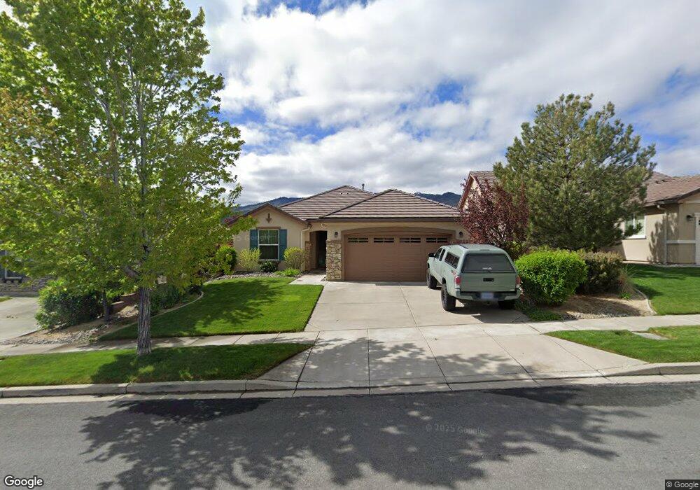
1265 Walking Stick Way Reno, NV 89523
Somersett NeighborhoodEstimated Value: $586,006 - $655,000
2
Beds
2
Baths
1,644
Sq Ft
$379/Sq Ft
Est. Value
About This Home
This home is located at 1265 Walking Stick Way, Reno, NV 89523 and is currently estimated at $622,502, approximately $378 per square foot. 1265 Walking Stick Way is a home located in Washoe County with nearby schools including B D Billinghurst Middle School and Robert McQueen High School.
Ownership History
Date
Name
Owned For
Owner Type
Purchase Details
Closed on
May 9, 2012
Sold by
Swanson John W and Swanson Linda M
Bought by
Swanson John W and Swanson Linda M
Current Estimated Value
Purchase Details
Closed on
Dec 6, 2007
Sold by
Pn Ii Inc
Bought by
Swanson John W and Swanson Linda M
Home Financials for this Owner
Home Financials are based on the most recent Mortgage that was taken out on this home.
Original Mortgage
$237,800
Interest Rate
6.3%
Mortgage Type
Balloon
Create a Home Valuation Report for This Property
The Home Valuation Report is an in-depth analysis detailing your home's value as well as a comparison with similar homes in the area
Home Values in the Area
Average Home Value in this Area
Purchase History
| Date | Buyer | Sale Price | Title Company |
|---|---|---|---|
| Swanson John W | -- | None Available | |
| Swanson John W | $297,500 | First American Title Reno |
Source: Public Records
Mortgage History
| Date | Status | Borrower | Loan Amount |
|---|---|---|---|
| Previous Owner | Swanson John W | $237,800 |
Source: Public Records
Tax History Compared to Growth
Tax History
| Year | Tax Paid | Tax Assessment Tax Assessment Total Assessment is a certain percentage of the fair market value that is determined by local assessors to be the total taxable value of land and additions on the property. | Land | Improvement |
|---|---|---|---|---|
| 2026 | $2,475 | $126,332 | $45,500 | $80,832 |
| 2025 | $3,213 | $124,831 | $42,805 | $82,026 |
| 2024 | $3,213 | $119,201 | $36,680 | $82,521 |
| 2023 | $3,119 | $121,063 | $43,190 | $77,873 |
| 2022 | $3,029 | $98,588 | $33,775 | $64,813 |
| 2021 | $2,941 | $90,548 | $26,215 | $64,333 |
| 2020 | $2,852 | $92,493 | $28,385 | $64,108 |
| 2019 | $2,769 | $91,394 | $30,310 | $61,084 |
| 2018 | $2,689 | $80,586 | $21,000 | $59,586 |
| 2017 | $2,611 | $79,325 | $19,775 | $59,550 |
| 2016 | $2,546 | $78,910 | $18,235 | $60,675 |
| 2015 | $639 | $76,369 | $15,995 | $60,374 |
| 2014 | $2,466 | $73,653 | $15,085 | $58,568 |
| 2013 | -- | $65,267 | $10,780 | $54,487 |
Source: Public Records
Map
Nearby Homes
- 1170 Del Webb Pkwy W
- 1380 Wakefield Trail
- 9380 Copper Mountain Cir
- 1240 Cliff Park Way
- 1220 Cliff Park Way
- 1170 Cliff Park Way
- 9190 Quilberry Way
- 9225 Sassafras Trail
- 9161 Quilberry Way
- 9165 Kenton Trail
- 861 Larrimore Trail
- 1591 Elk Run Trail
- 0 Mountain Daisy Rd
- 0 Mountain Haven Ln
- 270 Mogul Mountain Dr
- 1590 Scott Valley Rd
- 1755 Back Nine Trail
- 35 Mogul Mountain Cir
- 1640 Scott Valley Rd
- 1671 Crescent Pointe Ct
- 1255 Walking Stick Way
- 1275 Walking Stick Way
- 1245 Walking Stick Way Unit n/a
- 1245 Walking Stick Way
- 1285 Walking Stick Way
- 1235 Walking Stick Way
- 1320 Walking Stick Way
- 1270 Sugar Creek Trail
- 1330 Walking Stick Way
- 1295 Walking Stick Way
- 1260 Sugar Creek Trail
- 1280 Sugar Creek Trail
- 1305 Hidden River Way
- 1305 Walking Stick Way
- 1295 Hidden River Ct
- 1315 Hidden River Way
- 1325 Hidden River Way
- 1285 Hidden River Ct
- 1250 Sugar Creek Trail
- 1350 Walking Stick Way