Estimated Value: $208,000 - $294,000
3
Beds
1
Bath
1,600
Sq Ft
$151/Sq Ft
Est. Value
About This Home
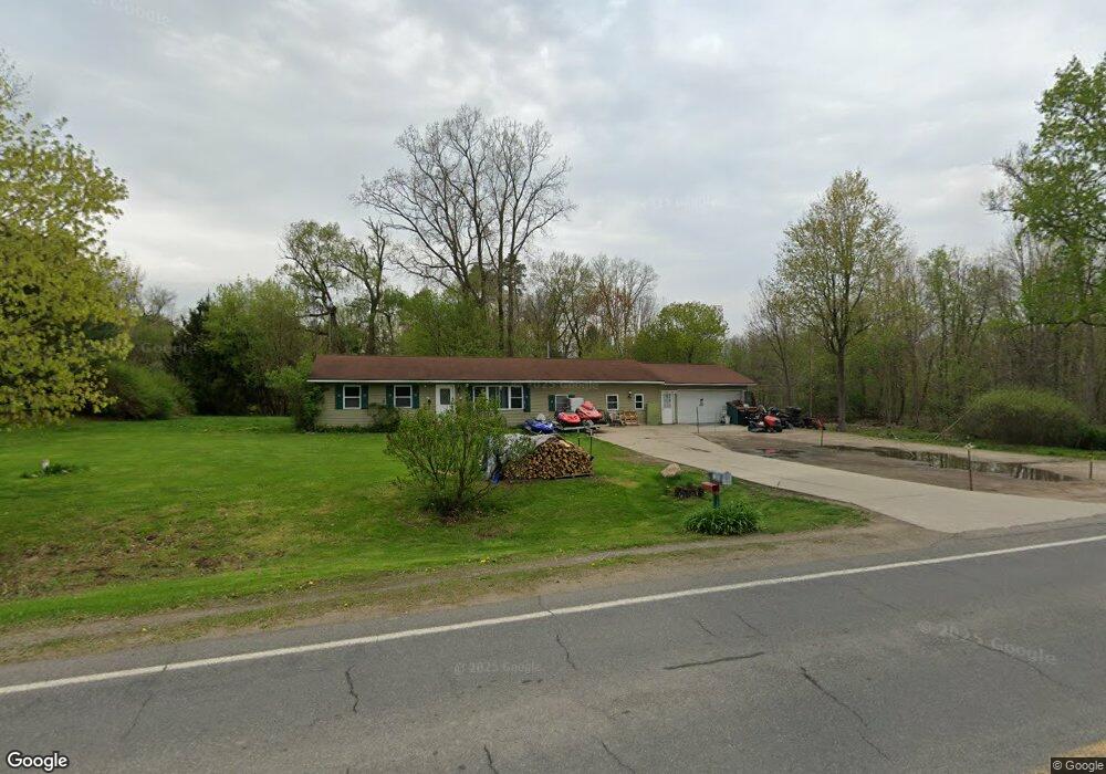
This home is located at 12650 Byron Rd, Byron, MI 48418 and is currently estimated at $240,913, approximately $150 per square foot. 12650 Byron Rd is a home located in Shiawassee County with nearby schools including Byron Area Elementary School, Byron Area Middle School, and Byron Area High School.
Ownership History
Date
Name
Owned For
Owner Type
Purchase Details
Closed on
Nov 22, 2011
Sold by
Secretary Of H U D
Bought by
Couseneau Ronette
Current Estimated Value
Purchase Details
Closed on
Aug 16, 2011
Sold by
Towne Mortgage Company
Bought by
Secretary Of H U D
Purchase Details
Closed on
Dec 29, 2010
Sold by
Spalletta Keith M
Bought by
Towne Mortgage Company
Purchase Details
Closed on
Nov 11, 2005
Sold by
Lott Brian S and Lott Sherri L
Bought by
Spalletta Keith M
Home Financials for this Owner
Home Financials are based on the most recent Mortgage that was taken out on this home.
Original Mortgage
$126,000
Interest Rate
8.84%
Mortgage Type
Fannie Mae Freddie Mac
Create a Home Valuation Report for This Property
The Home Valuation Report is an in-depth analysis detailing your home's value as well as a comparison with similar homes in the area
Purchase History
| Date | Buyer | Sale Price | Title Company |
|---|---|---|---|
| Couseneau Ronette | $51,100 | -- | |
| Secretary Of H U D | -- | -- | |
| Towne Mortgage Company | $228,801 | -- | |
| Spalletta Keith M | $140,000 | Multiple |
Source: Public Records
Mortgage History
| Date | Status | Borrower | Loan Amount |
|---|---|---|---|
| Previous Owner | Spalletta Keith M | $126,000 |
Source: Public Records
Tax History
| Year | Tax Paid | Tax Assessment Tax Assessment Total Assessment is a certain percentage of the fair market value that is determined by local assessors to be the total taxable value of land and additions on the property. | Land | Improvement |
|---|---|---|---|---|
| 2025 | $1,578 | $116,600 | $0 | $0 |
| 2024 | $1,504 | $105,800 | $0 | $0 |
| 2023 | $616 | $100,700 | $0 | $0 |
| 2022 | $1,393 | $90,600 | $0 | $0 |
| 2021 | $1,294 | $82,700 | $0 | $0 |
| 2020 | $1,266 | $73,100 | $0 | $0 |
| 2019 | $1,246 | $61,000 | $0 | $0 |
| 2018 | $1,218 | $55,900 | $0 | $0 |
| 2017 | $1,163 | $48,800 | $0 | $0 |
| 2016 | -- | $48,800 | $0 | $0 |
| 2015 | -- | $45,300 | $0 | $0 |
| 2014 | $6 | $44,300 | $0 | $0 |
Source: Public Records
Map
Nearby Homes
- 211 N Church St
- 11250 S New Lothrop Rd
- 12102 Rolston Rd
- 00 Lehring and Britton Roads
- Parcel E Turkey Trail
- Parcel F Turkey Trail
- Parcel D Turkey Trail
- 206 Emmett
- vl Lehring Rd
- 14830 County Line Rd
- 0 Williams Rd
- 0 Lovejoy Rd Unit 20261017550
- 7960 Beard Rd
- 16141 Duffield Rd
- 11202 Bach Ln
- 11050 Charles Dr
- 11036 Charles Dr
- Pine Knob Rd Lot Unit WP001
- 2555 E Cohoctah Rd
- 14408 McCaslin Lake Rd
- 12654 Byron Rd
- 12660 Byron Rd
- 12690 Byron Rd
- VL Church St
- 0 Byron Rd Unit 100004070
- 0 Byron Rd Unit 30053351
- 0 Byron Rd Unit 30063318
- 0 Byron Rd Unit 30070153
- 0 Byron Rd Unit 217084495
- 00 Byron Rd
- 0 Byron Rd Unit G21437985
- 0 Byron Rd Unit G31267998
- 0 Byron Rd Unit G31291299
- 0 Byron Rd Unit G21505148
- 0 Byron Rd Unit R2200031195
- 0 Byron Rd Unit R2210018138
- 0 Byron Rd Unit 2299668
- 0 Byron Rd Unit 2839419
- 12671 Byron Rd
- 12671 Byron Rd
Your Personal Tour Guide
Ask me questions while you tour the home.