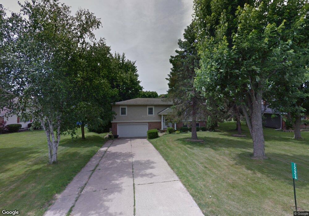
12656 Deborah Dr Kenton, OH 43326
Estimated Value: $212,608 - $318,000
3
Beds
3
Baths
1,456
Sq Ft
$169/Sq Ft
Est. Value
About This Home
This home is located at 12656 Deborah Dr, Kenton, OH 43326 and is currently estimated at $245,402, approximately $168 per square foot. 12656 Deborah Dr is a home located in Hardin County with nearby schools including Kenton Elementary School, Kenton Middle School, and Kenton High School.
Ownership History
Date
Name
Owned For
Owner Type
Purchase Details
Closed on
Mar 4, 2015
Sold by
Donnal Judith and Donnal Melvin M
Bought by
Donnal Judith and Donnal Melvin M
Current Estimated Value
Purchase Details
Closed on
Mar 26, 2003
Bought by
Donnal Melvin and Donnal Judy
Purchase Details
Closed on
Dec 18, 2000
Bought by
Schreiner William Michae
Purchase Details
Closed on
Aug 23, 1999
Bought by
Schreiner William M
Purchase Details
Closed on
Aug 12, 1999
Bought by
Keel George A
Purchase Details
Closed on
Jun 5, 1997
Bought by
Parshall Nancy
Create a Home Valuation Report for This Property
The Home Valuation Report is an in-depth analysis detailing your home's value as well as a comparison with similar homes in the area
Home Values in the Area
Average Home Value in this Area
Purchase History
| Date | Buyer | Sale Price | Title Company |
|---|---|---|---|
| Donnal Judith | -- | None Available | |
| Donnal Melvin | $152,000 | -- | |
| Schreiner William Michae | -- | -- | |
| Schreiner William M | $118,500 | -- | |
| Keel George A | -- | -- | |
| Parshall Nancy | -- | -- |
Source: Public Records
Tax History
| Year | Tax Paid | Tax Assessment Tax Assessment Total Assessment is a certain percentage of the fair market value that is determined by local assessors to be the total taxable value of land and additions on the property. | Land | Improvement |
|---|---|---|---|---|
| 2024 | $2,364 | $56,080 | $9,980 | $46,100 |
| 2023 | $2,366 | $56,080 | $9,980 | $46,100 |
| 2022 | $2,151 | $47,390 | $4,890 | $42,500 |
| 2021 | $2,159 | $47,390 | $4,890 | $42,500 |
| 2020 | $1,866 | $47,390 | $4,890 | $42,500 |
| 2019 | $1,453 | $38,310 | $4,660 | $33,650 |
| 2018 | $1,455 | $38,310 | $4,660 | $33,650 |
| 2017 | $1,433 | $38,310 | $4,660 | $33,650 |
| 2016 | $1,371 | $38,580 | $4,560 | $34,020 |
| 2015 | $1,345 | $38,580 | $4,560 | $34,020 |
| 2014 | $1,367 | $38,580 | $4,560 | $34,020 |
| 2013 | -- | $41,620 | $4,560 | $37,060 |
Source: Public Records
Map
Nearby Homes
- 12160 Pamela Dr
- 16439 County Road 144
- 11925 County Road 175
- 11896 Parklane Dr
- 501 East St
- 920 Cooper St
- 820 King St
- 89 Broadway St
- 79 Broadway St
- 39 Grape St
- 530 E Franklin St
- 619 E North St
- 510 Decatur St
- 354 S Barron St
- 508 Decatur St
- 509 E North St
- 13450 State Route 292
- 121 S High St
- 120 Oak Ln Unit 7
- 405 E Carrol St Unit 405 1/2
Your Personal Tour Guide
Ask me questions while you tour the home.