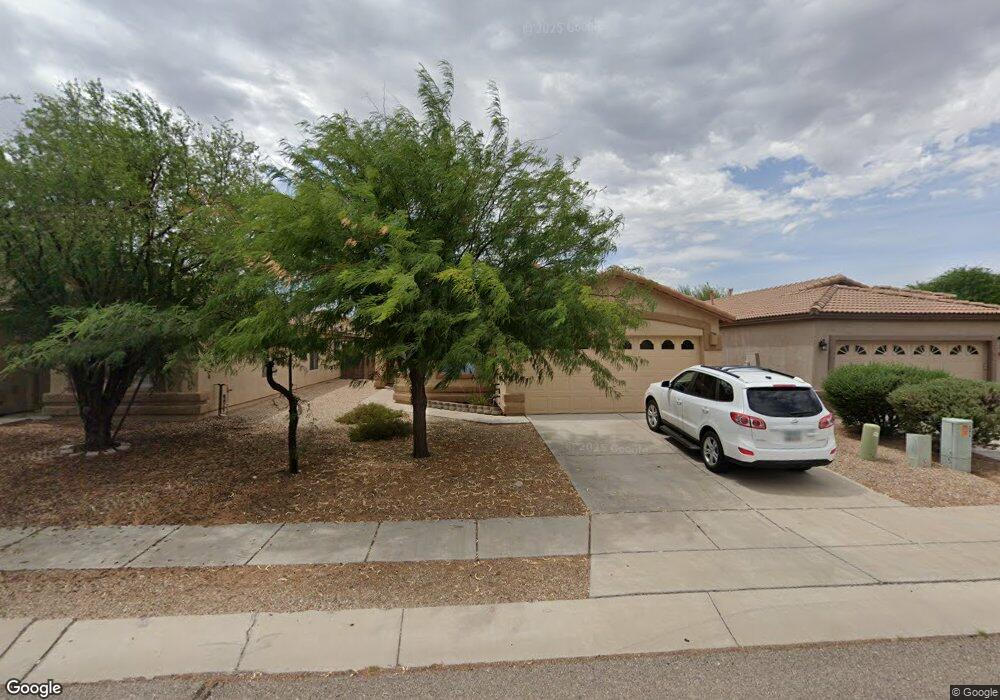
12656 E Red Iron Trail Vail, AZ 85641
Rancho Del Lago NeighborhoodEstimated Value: $298,021 - $329,000
--
Bed
2
Baths
1,538
Sq Ft
$204/Sq Ft
Est. Value
About This Home
This home is located at 12656 E Red Iron Trail, Vail, AZ 85641 and is currently estimated at $313,005, approximately $203 per square foot. 12656 E Red Iron Trail is a home located in Pima County with nearby schools including Acacia Elementary School, Vail Academy and High School, and Old Vail Middle School.
Ownership History
Date
Name
Owned For
Owner Type
Purchase Details
Closed on
Jan 23, 2021
Sold by
Tinnell Nancyann Kamaluonalani and The Tinnell Living Trust
Bought by
Tinnell Nancyann Kamaluonalani
Current Estimated Value
Home Financials for this Owner
Home Financials are based on the most recent Mortgage that was taken out on this home.
Original Mortgage
$153,000
Outstanding Balance
$136,288
Interest Rate
2.6%
Mortgage Type
New Conventional
Estimated Equity
$176,717
Purchase Details
Closed on
Oct 16, 2007
Sold by
Fidelity National Title Agency Inc
Bought by
Tinnell Nancyann K and Tinnell Patrick W
Home Financials for this Owner
Home Financials are based on the most recent Mortgage that was taken out on this home.
Original Mortgage
$179,684
Interest Rate
6.42%
Mortgage Type
New Conventional
Create a Home Valuation Report for This Property
The Home Valuation Report is an in-depth analysis detailing your home's value as well as a comparison with similar homes in the area
Home Values in the Area
Average Home Value in this Area
Purchase History
| Date | Buyer | Sale Price | Title Company |
|---|---|---|---|
| Tinnell Nancyann Kamaluonalani | -- | Solidifi | |
| Tinnell Nancyann K | $199,649 | Tfnti | |
| Tinnell Nancyann K | $199,649 | Tfnti |
Source: Public Records
Mortgage History
| Date | Status | Borrower | Loan Amount |
|---|---|---|---|
| Open | Tinnell Nancyann Kamaluonalani | $153,000 | |
| Closed | Tinnell Nancyann K | $179,684 |
Source: Public Records
Tax History Compared to Growth
Tax History
| Year | Tax Paid | Tax Assessment Tax Assessment Total Assessment is a certain percentage of the fair market value that is determined by local assessors to be the total taxable value of land and additions on the property. | Land | Improvement |
|---|---|---|---|---|
| 2025 | $2,774 | $18,380 | -- | -- |
| 2024 | $2,774 | $17,505 | -- | -- |
| 2023 | $2,589 | $16,671 | $0 | $0 |
| 2022 | $2,589 | $15,877 | $0 | $0 |
| 2021 | $2,631 | $14,401 | $0 | $0 |
| 2020 | $2,540 | $14,401 | $0 | $0 |
| 2019 | $2,268 | $15,020 | $0 | $0 |
| 2018 | $2,128 | $12,440 | $0 | $0 |
| 2017 | $2,073 | $12,440 | $0 | $0 |
| 2016 | $1,923 | $11,848 | $0 | $0 |
| 2015 | $1,854 | $11,284 | $0 | $0 |
Source: Public Records
Map
Nearby Homes
- 12561 E Red Canyon Place
- 10627 S Varner Dr
- 12517 E Red Iron Trail
- 12772 E Red Iron Trail
- 10432 S Cienega Knolls Loop
- 10394 S Cienega Knolls Loop
- 12458 E Corte Manta
- 12431 E Calle Riobamba
- 12729 E Quail Wash Canyon Ln
- 12414 E Calle Riobamba
- 12867 E Pantano View Dr
- 10136 S Arnold Ranch Rd
- 10423 S Keegan Ave
- 10128 S Arnold Ranch Rd
- 10128 Arnold Ranch Ct
- 10112 S Arnold Ranch Rd
- 10112 Arnold Ranch Ct
- 10104 S Arnold Ranch Rd
- 10104 Arnold Ranch Ct
- 10096 S Arnold Ranch Rd
- 12662 E Red Iron Trail
- 12650 E Red Iron Trail
- 12668 E Red Iron Trail
- 12655 E Mandell Pass Unit PS
- 12649 E Mandell Pass Unit PS
- 12661 E Mandell Pass Unit PS
- 12674 E Red Iron Trail
- 12653 E Red Iron Trail
- 12667 E Mandell Pass Unit PS
- 12673 E Mandell Pass Unit PS
- 12673 E Mandell Ps Dr E
- 12680 E Red Iron Trail
- 10548 S Sean Dr
- 10554 S Sean Dr
- 12683 E Red Iron Trail
- 10562 S Sean Dr
- 12651 E Red Iron Trail
- 12679 E Mandell Pass Unit PS
- 10568 S Sean Dr
- 12637 E Red Iron Trail