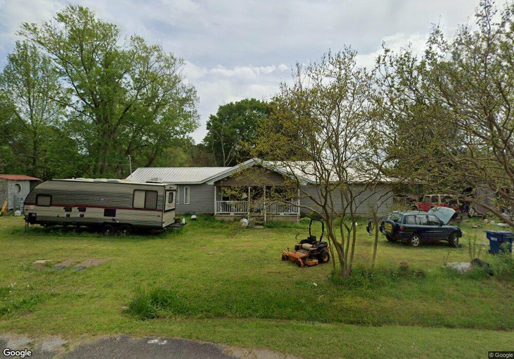
1266 Beason Cove Rd Steele, AL 35987
Estimated Value: $123,000 - $550,000
3
Beds
1
Bath
1,821
Sq Ft
$155/Sq Ft
Est. Value
About This Home
This home is located at 1266 Beason Cove Rd, Steele, AL 35987 and is currently estimated at $281,656, approximately $154 per square foot. 1266 Beason Cove Rd is a home located in St. Clair County with nearby schools including Steele Elementary School and Ashville High School.
Ownership History
Date
Name
Owned For
Owner Type
Purchase Details
Closed on
Feb 17, 2009
Sold by
Navy Fcu
Bought by
Mostillo James Warren and Mostillo Constance Justeen
Current Estimated Value
Home Financials for this Owner
Home Financials are based on the most recent Mortgage that was taken out on this home.
Original Mortgage
$55,000
Interest Rate
5.15%
Mortgage Type
New Conventional
Purchase Details
Closed on
Mar 14, 2007
Sold by
Drake Joel L and Drake Melissa S
Bought by
Dodd James C and Dodd Vicki K
Home Financials for this Owner
Home Financials are based on the most recent Mortgage that was taken out on this home.
Original Mortgage
$107,590
Interest Rate
6.27%
Mortgage Type
New Conventional
Create a Home Valuation Report for This Property
The Home Valuation Report is an in-depth analysis detailing your home's value as well as a comparison with similar homes in the area
Home Values in the Area
Average Home Value in this Area
Purchase History
| Date | Buyer | Sale Price | Title Company |
|---|---|---|---|
| Mostillo James Warren | -- | None Available | |
| Dodd James C | $106,000 | None Available |
Source: Public Records
Mortgage History
| Date | Status | Borrower | Loan Amount |
|---|---|---|---|
| Closed | Mostillo James Warren | $55,000 | |
| Previous Owner | Dodd James C | $107,590 |
Source: Public Records
Tax History
| Year | Tax Paid | Tax Assessment Tax Assessment Total Assessment is a certain percentage of the fair market value that is determined by local assessors to be the total taxable value of land and additions on the property. | Land | Improvement |
|---|---|---|---|---|
| 2024 | $383 | $27,722 | $3,300 | $24,422 |
| 2023 | $387 | $27,722 | $3,300 | $24,422 |
| 2022 | $394 | $14,226 | $1,570 | $12,656 |
| 2021 | $308 | $14,229 | $1,573 | $12,656 |
| 2020 | $302 | $11,451 | $1,570 | $9,881 |
| 2019 | $302 | $11,258 | $1,570 | $9,688 |
| 2018 | $275 | $10,420 | $0 | $0 |
| 2017 | $271 | $10,420 | $0 | $0 |
| 2016 | $275 | $10,420 | $0 | $0 |
| 2015 | $271 | $10,420 | $0 | $0 |
| 2014 | $271 | $10,280 | $0 | $0 |
Source: Public Records
Map
Nearby Homes
- 15 Dorough St
- 61 Hartsfield Dr
- 0 Legion Dr Unit 893391
- 0 Legion Dr Unit 19987726
- 0 Highway 11 Unit 21427361
- 3074 Beason Cove Rd
- 0 Sweatt Rd Unit 21415006
- 36240 US Hwy 231
- 560 Phillips Dr
- 620 Washburn Dr
- 0 Cliff Springs Rd Unit 21429334
- 0 Cliff Springs Rd Unit 24577101
- 0 Sumatanga Rd
- 2405 Cliff Springs Rd
- 4396 Shore Dr
- 0 County Road 42 Unit 26157833
- 0 County Road 42 Unit 21442134
- 16845 US Highway 11
- 115 Canoe Dr
- 0 US Hwy 231 Unit 21398012
- 1216 Beason Cove Rd
- 1368 Beason Cove Rd
- 1218 Beason Cove Rd
- 1420 Beason Cove Rd
- 992 Beason Cove Rd
- 1441 Beason Cove Rd
- 1441 Beason Cove Rd
- 507 Penny Ln
- 1610 Beason Cove Rd
- 768 Beason Cove Rd
- 470 Hummingbird Hill
- 100 Lee Ln
- 764 Beason Cove Rd
- 684 Beason Cove Rd
- 215 Lee Ln
- 65 Tolbert Dr
- 707 Tolbert Dr
- 70 Tolbert Dr
- 70 Tolbert Dr Unit 1
- 369 Tolbert Dr
Your Personal Tour Guide
Ask me questions while you tour the home.