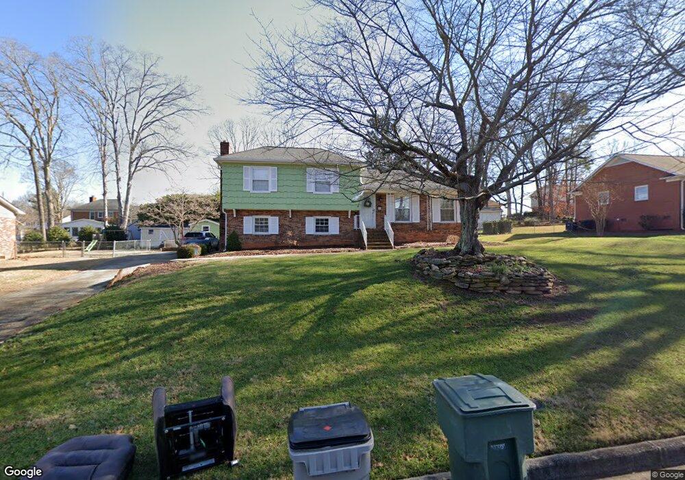
1266 Cambridge Ave Gastonia, NC 28054
Estimated Value: $332,328 - $391,000
4
Beds
3
Baths
1,925
Sq Ft
$187/Sq Ft
Est. Value
About This Home
This home is located at 1266 Cambridge Ave, Gastonia, NC 28054 and is currently estimated at $360,082, approximately $187 per square foot. 1266 Cambridge Ave is a home located in Gaston County with nearby schools including Sherwood Elementary School, W P Grier Middle School, and Ashbrook High School.
Ownership History
Date
Name
Owned For
Owner Type
Purchase Details
Closed on
Jan 22, 2024
Sold by
Brock Freida
Bought by
Brock Heather
Current Estimated Value
Purchase Details
Closed on
Sep 19, 2014
Sold by
Cox Leon D
Bought by
Brock Paul D and Brock Freida
Home Financials for this Owner
Home Financials are based on the most recent Mortgage that was taken out on this home.
Original Mortgage
$147,000
Interest Rate
4.2%
Mortgage Type
VA
Purchase Details
Closed on
Feb 13, 1990
Bought by
Cox Leon D
Create a Home Valuation Report for This Property
The Home Valuation Report is an in-depth analysis detailing your home's value as well as a comparison with similar homes in the area
Home Values in the Area
Average Home Value in this Area
Purchase History
| Date | Buyer | Sale Price | Title Company |
|---|---|---|---|
| Brock Heather | -- | None Listed On Document | |
| Brock Paul D | $147,000 | None Available | |
| Cox Leon D | -- | -- |
Source: Public Records
Mortgage History
| Date | Status | Borrower | Loan Amount |
|---|---|---|---|
| Previous Owner | Brock Paul D | $147,000 |
Source: Public Records
Tax History Compared to Growth
Tax History
| Year | Tax Paid | Tax Assessment Tax Assessment Total Assessment is a certain percentage of the fair market value that is determined by local assessors to be the total taxable value of land and additions on the property. | Land | Improvement |
|---|---|---|---|---|
| 2025 | $3,409 | $318,860 | $27,000 | $291,860 |
| 2024 | $3,324 | $310,980 | $27,000 | $283,980 |
| 2023 | $3,359 | $310,980 | $27,000 | $283,980 |
| 2022 | $1,777 | $178,590 | $25,000 | $153,590 |
| 2021 | $2,411 | $178,590 | $25,000 | $153,590 |
| 2019 | $2,429 | $178,590 | $25,000 | $153,590 |
| 2018 | $1,887 | $134,771 | $24,000 | $110,771 |
| 2017 | $1,845 | $131,757 | $24,000 | $107,757 |
| 2016 | $1,845 | $131,757 | $0 | $0 |
| 2014 | -- | $137,119 | $30,000 | $107,119 |
Source: Public Records
Map
Nearby Homes
- 1287 Queensgate St
- 1272 Queensgate St
- 1280 Queensgate St
- 1115 Dumbarton Rd
- 1110 Dumbarton Rd
- 1613 Dixon Rd
- 1026 Holly Dr
- 1604 Buckingham Ave
- 946 Scotch Dr
- 1637 Buckingham Ave
- 922 Holly Dr
- 1079 Laurel Ln
- 1040 Laurel Ln
- 1212 Monroe Dr
- 917 Sandswood Dr
- 1380 Carmen Ln
- 1678 Union Rd
- 1735 Robinwood Rd Unit 1735
- 921 Nottingham Dr
- 1634 Union Rd
- 1274 Cambridge Ave
- 1258 Cambridge Ave
- 1271 Queensgate St
- 1279 Queensgate St
- 1263 Queensgate St
- 1259 Cambridge Ave
- 1267 Cambridge Ave
- 1250 Cambridge St
- 1250 Cambridge Ave
- 1284 Cambridge Ave
- 1275 Cambridge Ave
- 1284 Cambridge St
- 1255 Queensgate St
- 1251 Cambridge Ave
- 1325 Marilyn St
- 1283 Cambridge Ave
- 1242 Cambridge Ave
- 1264 Queensgate St
- 1247 Queensgate St
- 1243 Cambridge Ave