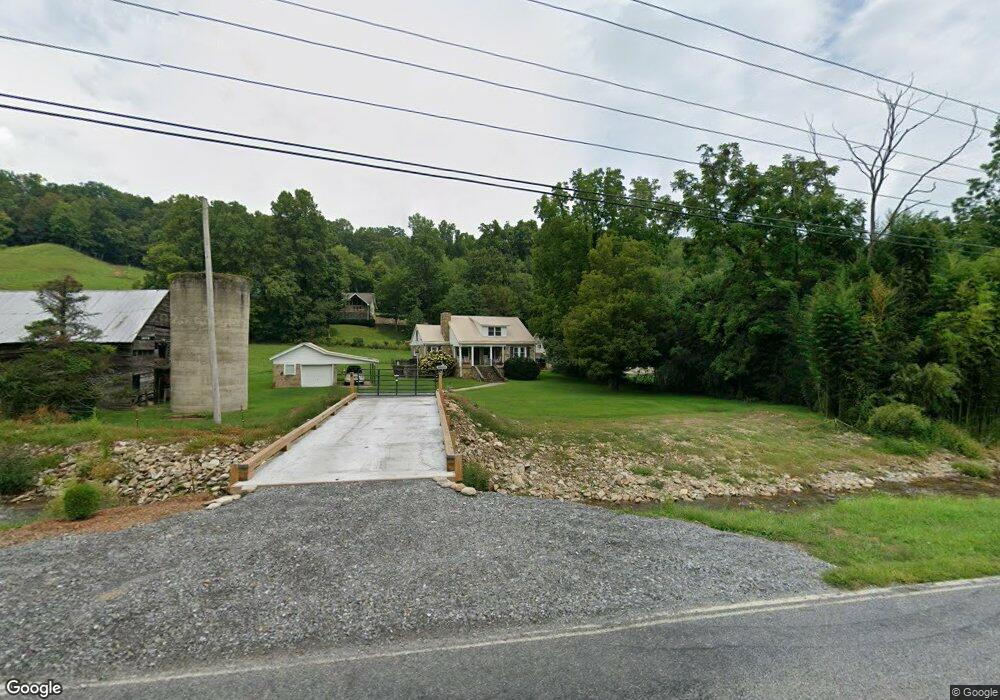
1266 Hemphill Rd Waynesville, NC 28785
Estimated Value: $369,000 - $525,383
2
Beds
1
Bath
1,172
Sq Ft
$361/Sq Ft
Est. Value
About This Home
This home is located at 1266 Hemphill Rd, Waynesville, NC 28785 and is currently estimated at $422,846, approximately $360 per square foot. 1266 Hemphill Rd is a home located in Haywood County with nearby schools including Jonathan Valley Elementary School, Waynesville Middle, and Tuscola High.
Ownership History
Date
Name
Owned For
Owner Type
Purchase Details
Closed on
Jul 26, 2023
Sold by
Barnhardt Rita Carver
Bought by
Barnhardt Rita Carver and Rita Carver Barnhardt Revocable Trust
Current Estimated Value
Purchase Details
Closed on
Oct 1, 2011
Sold by
Turner Elizabeth Carver and Turner John Milton
Bought by
Blue Sky Communities Inc
Purchase Details
Closed on
Apr 14, 2010
Sold by
Moore Donald R
Bought by
Barnhardt Rita Carver
Create a Home Valuation Report for This Property
The Home Valuation Report is an in-depth analysis detailing your home's value as well as a comparison with similar homes in the area
Home Values in the Area
Average Home Value in this Area
Purchase History
| Date | Buyer | Sale Price | Title Company |
|---|---|---|---|
| Barnhardt Rita Carver | -- | None Listed On Document | |
| Barnhardt Rita Carver | -- | None Listed On Document | |
| Blue Sky Communities Inc | $10,000 | None Available | |
| Barnhardt Rita Carver | -- | None Available |
Source: Public Records
Tax History Compared to Growth
Tax History
| Year | Tax Paid | Tax Assessment Tax Assessment Total Assessment is a certain percentage of the fair market value that is determined by local assessors to be the total taxable value of land and additions on the property. | Land | Improvement |
|---|---|---|---|---|
| 2025 | -- | $279,100 | $105,500 | $173,600 |
| 2024 | $1,891 | $279,400 | $105,500 | $173,900 |
| 2023 | $1,846 | $272,100 | $98,200 | $173,900 |
| 2022 | $1,805 | $272,100 | $98,200 | $173,900 |
| 2021 | $1,805 | $272,100 | $98,200 | $173,900 |
| 2020 | $1,486 | $202,600 | $98,200 | $104,400 |
| 2019 | $1,491 | $202,600 | $98,200 | $104,400 |
| 2018 | $1,491 | $202,600 | $98,200 | $104,400 |
| 2017 | $1,491 | $202,600 | $0 | $0 |
| 2016 | $1,443 | $201,000 | $0 | $0 |
| 2015 | $1,443 | $201,000 | $0 | $0 |
| 2014 | $1,321 | $201,000 | $0 | $0 |
Source: Public Records
Map
Nearby Homes
- 0 Cradling Cove Unit 3
- 64 Cradling Cove
- 0 Asa Trail
- Lot 23 Asa Trail
- Lot 17 Covered Bridge Trail Unit 17
- Lot 24 Covered Bridge Trail Unit 24
- 00 Buckeye Dr Unit 35
- 85 Garnet Spring Ln
- 99999 Molasses Way Unit 18
- 443 Cedarwood Dr
- 367 Biodome Dr
- 269 Oakstone Dr
- 429 Biodome Dr
- 000 Songbird Trail
- 31 Windsong Dr
- 150 Sorghum Dr
- 61 Calm Creek Rd
- 25 Summer Place Dr
- 284 Aqua Vista Loop
- 52 Strollers Ln
- 3 Cradling Cove 3
- 3 Cradling Cove Unit 3
- 51 Cradling Cove
- 00 Cradling Cove Unit 2
- 00 Cradling Cove Unit 1
- 35 Cradling Cove
- 107 Cradling Cove
- 151 Cradling Cove
- 124 Cradling Cove Unit 6
- 143 Asa Trail
- 143 Asa Trail Unit 23
- 00 Asa Trail
- 15 Asa Trail Unit 15
- 170 Cradling Cove
- Lot 14 Cranberry Ln Unit 14
- 000 Cranberry Unit 15
- 000 Cranberry Unit 14
- 1149 Hemphill Rd
- 211 Asa Trail
- 14 Asa Trail Unit 14