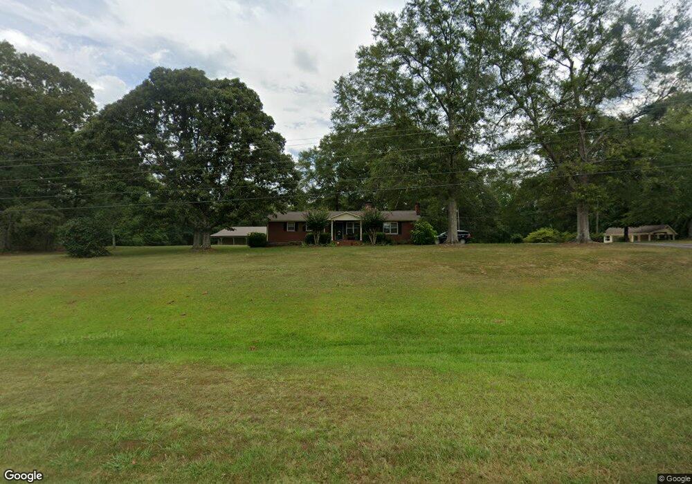
1266 Highway 41 S Barnesville, GA 30204
Estimated Value: $293,000 - $403,844
3
Beds
2
Baths
2,380
Sq Ft
$144/Sq Ft
Est. Value
About This Home
This home is located at 1266 Highway 41 S, Barnesville, GA 30204 and is currently estimated at $342,711, approximately $143 per square foot. 1266 Highway 41 S is a home with nearby schools including Lamar County Primary School, Lamar County Elementary School, and Lamar County Middle School.
Ownership History
Date
Name
Owned For
Owner Type
Purchase Details
Closed on
Aug 24, 2020
Sold by
Maynard Mary R
Bought by
Maynard Mary R and Benneth Meredith Allen
Current Estimated Value
Purchase Details
Closed on
Aug 21, 2007
Sold by
Maynard M Carlton
Bought by
Department Of Transportation
Purchase Details
Closed on
May 1, 1993
Bought by
Maynard M Carlton
Create a Home Valuation Report for This Property
The Home Valuation Report is an in-depth analysis detailing your home's value as well as a comparison with similar homes in the area
Home Values in the Area
Average Home Value in this Area
Purchase History
| Date | Buyer | Sale Price | Title Company |
|---|---|---|---|
| Maynard Mary R | -- | -- | |
| Department Of Transportation | -- | -- | |
| Maynard M Carlton | -- | -- |
Source: Public Records
Tax History Compared to Growth
Tax History
| Year | Tax Paid | Tax Assessment Tax Assessment Total Assessment is a certain percentage of the fair market value that is determined by local assessors to be the total taxable value of land and additions on the property. | Land | Improvement |
|---|---|---|---|---|
| 2024 | $2,539 | $117,394 | $33,090 | $84,304 |
| 2023 | $2,551 | $110,599 | $33,090 | $77,509 |
| 2022 | $2,106 | $94,493 | $26,916 | $67,577 |
| 2021 | $2,321 | $79,104 | $20,082 | $59,022 |
| 2020 | $2,444 | $79,104 | $20,082 | $59,022 |
| 2019 | $2,450 | $79,104 | $20,082 | $59,022 |
| 2018 | $2,353 | $79,104 | $20,082 | $59,022 |
| 2017 | $2,340 | $79,104 | $20,082 | $59,022 |
| 2016 | $2,341 | $79,104 | $20,082 | $59,022 |
| 2015 | $2,358 | $79,888 | $20,082 | $59,806 |
| 2014 | $2,263 | $79,104 | $20,082 | $59,022 |
| 2013 | -- | $77,110 | $20,082 | $57,028 |
Source: Public Records
Map
Nearby Homes
- 3474 Old Atlanta Hwy
- 239 Walters Rd
- 239 Walters Rd Unit TRACT 5
- 239 Walters Rd Unit TRACT 3
- 0 Crawford Rd Unit 10611435
- 880 Johnstonville Rd
- 0 Zellner Rd Unit 10572316
- 0 Zellner Rd Unit 180679
- 0 Parks Rd Unit 181867
- 0 Parks Rd Unit 10629635
- 941 Floyd Rd
- 325 Parks Rd
- 301 Parks Rd
- TRACT 9 Ramah Church Rd Unit 9
- TRACT 6 Ramah Church Rd Unit 6
- 342 Ramah Church Rd
- 310 Preakness Way
- 331 Preakness Way
- 151 Derby Dr
- 507 N North Ridge Rd
- 1288 Highway 41 S
- 1288 Highway 41 S
- 1234 Highway 41 S
- 1247 Highway 41 S
- 1269 Highway 41 S
- 1310 Highway 41 S
- 1207 Highway 41 S
- 1324 U S 41
- 1771 Crawford Rd
- 1194 Highway 41 S
- 1695 Crawford Rd
- 1365 U S 41
- 1365 Highway 41 S
- 131 Potts Pond Rd
- 1138 U S 41
- 1138 Highway 41 S
- 1138 Highway 41 S
- 1138 Highway 41 S
- 107 Potts Pond Rd
- 1661 Crawford Rd