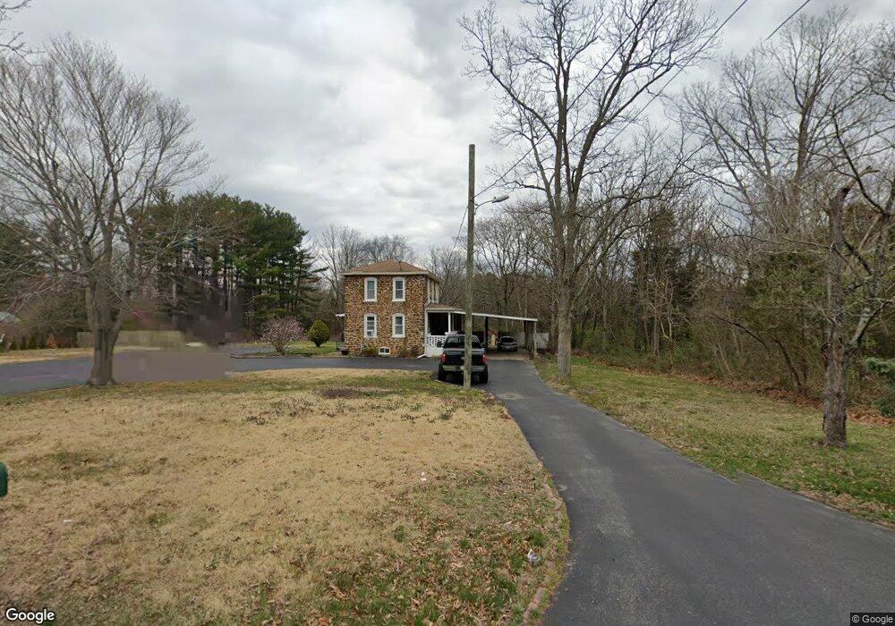
1266 W Wheat Rd Vineland, NJ 08360
Estimated Value: $262,000 - $322,000
--
Bed
--
Bath
1,450
Sq Ft
$198/Sq Ft
Est. Value
About This Home
This home is located at 1266 W Wheat Rd, Vineland, NJ 08360 and is currently estimated at $286,497, approximately $197 per square foot. 1266 W Wheat Rd is a home located in Cumberland County with nearby schools including Marie D. Durand Elementary School, T.W. Wallace Middle School, and Vineland Senior High School.
Ownership History
Date
Name
Owned For
Owner Type
Purchase Details
Closed on
Jul 13, 2015
Sold by
Lagares Jesus and Lagares Debra
Bought by
Lagares Jesus
Current Estimated Value
Purchase Details
Closed on
Apr 29, 1999
Sold by
Halpin Isabel C
Bought by
Lagares Jesus and Lagares Debra
Home Financials for this Owner
Home Financials are based on the most recent Mortgage that was taken out on this home.
Original Mortgage
$86,307
Outstanding Balance
$22,134
Interest Rate
6.95%
Mortgage Type
FHA
Estimated Equity
$264,363
Purchase Details
Closed on
Aug 14, 1995
Sold by
Tamagni Henry Joseph
Bought by
Halpin Isabel
Create a Home Valuation Report for This Property
The Home Valuation Report is an in-depth analysis detailing your home's value as well as a comparison with similar homes in the area
Home Values in the Area
Average Home Value in this Area
Purchase History
| Date | Buyer | Sale Price | Title Company |
|---|---|---|---|
| Lagares Jesus | -- | None Available | |
| Lagares Jesus | $87,000 | -- | |
| Halpin Isabel | $50,000 | Colonial Title Agency Inc |
Source: Public Records
Mortgage History
| Date | Status | Borrower | Loan Amount |
|---|---|---|---|
| Open | Lagares Jesus | $86,307 |
Source: Public Records
Tax History Compared to Growth
Tax History
| Year | Tax Paid | Tax Assessment Tax Assessment Total Assessment is a certain percentage of the fair market value that is determined by local assessors to be the total taxable value of land and additions on the property. | Land | Improvement |
|---|---|---|---|---|
| 2025 | $4,671 | $146,700 | $39,900 | $106,800 |
| 2024 | $4,671 | $146,700 | $39,900 | $106,800 |
| 2023 | $4,640 | $146,700 | $39,900 | $106,800 |
| 2022 | $4,502 | $146,700 | $39,900 | $106,800 |
| 2021 | $4,420 | $146,700 | $39,900 | $106,800 |
| 2020 | $4,294 | $146,700 | $39,900 | $106,800 |
| 2019 | $4,235 | $146,700 | $39,900 | $106,800 |
| 2018 | $4,124 | $146,700 | $39,900 | $106,800 |
| 2017 | $3,917 | $146,700 | $39,900 | $106,800 |
| 2016 | $3,779 | $146,700 | $39,900 | $106,800 |
| 2015 | $3,640 | $146,700 | $39,900 | $106,800 |
| 2014 | $3,442 | $146,700 | $39,900 | $106,800 |
Source: Public Records
Map
Nearby Homes
- 1811 N Delsea Dr Unit 4
- 1489 N Delsea Dr
- 1469 N Mill Rd
- 1392 W Oak Rd
- 1252 W Oak Rd
- 1050 W Oak Rd
- 1032 W Oak Rd
- 1111 N Orchard Rd
- 1020 W Oak Rd
- 829 W Garden Rd
- 663 Wayne Ave
- 1887 N Delsea Dr Unit 135 HOLLY HOCK DR.
- 1887 N Delsea Dr Unit 19
- 1887 N Delsea Dr Unit 39
- 1378 Venus Dr
- 1632 W Garden Rd
- 1573 Neptune Terrace
- 811 W Garden Rd
- 2246 N West Ave
- 1230 Almond Rd
- 1316 W Wheat Rd
- 1267 W Wheat Rd
- 1239 W Wheat Rd
- 1305 W Wheat Rd
- 1338 W Wheat Rd
- 1219 W Wheat Rd
- 1321 W Wheat Rd
- 1347 W Wheat Rd
- 1571 N Orchard Rd
- 1158 W Wheat Rd
- 1179 W Wheat Rd
- 1380 W Wheat Rd
- 1555 N Orchard Rd Unit A & B
- 1555 N Orchard Rd
- 1392 N Orchard Rd
- 1149 W Wheat Rd
- 1142 W Wheat Rd
- 1688 Hubbard Ln
- 1545 N Orchard Rd Unit 1547
- 1690 Hubbard Ln