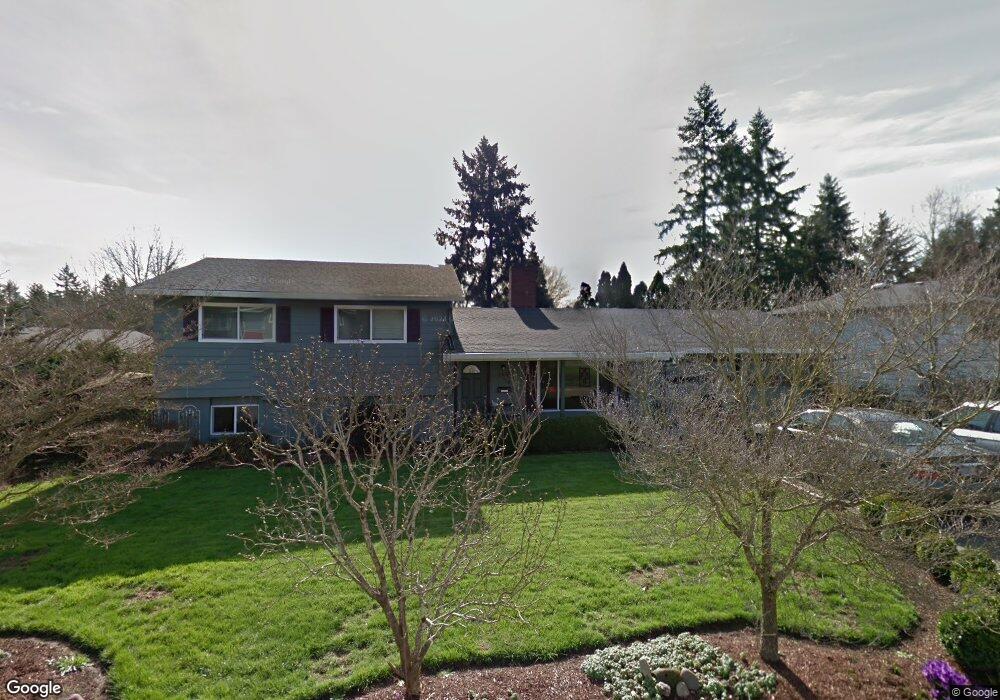
12660 SW Rita Dr Beaverton, OR 97005
Estimated Value: $563,000 - $603,000
3
Beds
2
Baths
1,255
Sq Ft
$462/Sq Ft
Est. Value
About This Home
This home is located at 12660 SW Rita Dr, Beaverton, OR 97005 and is currently estimated at $579,903, approximately $462 per square foot. 12660 SW Rita Dr is a home located in Washington County with nearby schools including Ridgewood Elementary School, Cedar Park Middle School, and Beaverton High School.
Ownership History
Date
Name
Owned For
Owner Type
Purchase Details
Closed on
Sep 17, 1997
Sold by
Edtl David R and Edtl Judy E
Bought by
Kato Scott R and Stabio Linda K
Current Estimated Value
Home Financials for this Owner
Home Financials are based on the most recent Mortgage that was taken out on this home.
Original Mortgage
$161,500
Outstanding Balance
$24,984
Interest Rate
7.45%
Estimated Equity
$554,919
Purchase Details
Closed on
Jun 20, 1997
Sold by
Schuman Winifred B and Schuman Phillip A
Bought by
Edtl David R and Edtl Judy E
Home Financials for this Owner
Home Financials are based on the most recent Mortgage that was taken out on this home.
Original Mortgage
$125,900
Interest Rate
7.91%
Create a Home Valuation Report for This Property
The Home Valuation Report is an in-depth analysis detailing your home's value as well as a comparison with similar homes in the area
Home Values in the Area
Average Home Value in this Area
Purchase History
| Date | Buyer | Sale Price | Title Company |
|---|---|---|---|
| Kato Scott R | $170,000 | -- | |
| Edtl David R | $139,900 | Chicago Title Insurance Co | |
| Schuman Phillip A | $40,000 | Chicago Title Insurance Co |
Source: Public Records
Mortgage History
| Date | Status | Borrower | Loan Amount |
|---|---|---|---|
| Open | Kato Scott R | $161,500 | |
| Previous Owner | Edtl David R | $125,900 |
Source: Public Records
Tax History Compared to Growth
Tax History
| Year | Tax Paid | Tax Assessment Tax Assessment Total Assessment is a certain percentage of the fair market value that is determined by local assessors to be the total taxable value of land and additions on the property. | Land | Improvement |
|---|---|---|---|---|
| 2025 | $4,959 | $271,010 | -- | -- |
| 2024 | $4,658 | $263,120 | -- | -- |
| 2023 | $4,658 | $255,460 | $0 | $0 |
| 2022 | $4,502 | $255,460 | $0 | $0 |
| 2021 | $4,339 | $240,800 | $0 | $0 |
| 2020 | $4,208 | $233,790 | $0 | $0 |
| 2019 | $4,075 | $226,990 | $0 | $0 |
| 2018 | $3,942 | $220,380 | $0 | $0 |
| 2017 | $3,801 | $213,970 | $0 | $0 |
| 2016 | $3,666 | $207,740 | $0 | $0 |
| 2015 | $3,544 | $201,690 | $0 | $0 |
| 2014 | $3,482 | $195,820 | $0 | $0 |
Source: Public Records
Map
Nearby Homes
- 414 SW Frenwood Way
- 12825 SW Evergreen St
- 13120 SW Rita Dr
- 11990 SW Corby Dr Unit 6
- 11990 SW Corby (#6) Dr
- 938 SW Adrian Terrace
- 245 SW 133rd Ave
- 12604 NW Barnes Rd Unit 3
- 12614 NW Barnes Rd Unit 12
- 12634 NW Barnes Rd Unit 8
- 12618 NW Barnes Rd Unit 11
- 12620 NW Barnes Rd Unit 5
- 13115 NW Glenridge Dr
- 12622 NW Barnes Rd Unit 2
- 12622 NW Barnes Rd Unit 6
- 244 NW 117th Loop
- 595 NW Lost Springs Terrace Unit 303
- 11845 NW Stone Mountain Ln Unit 304
- 11845 NW Stone Mountain Ln Unit 403
- 11830 NW Holly Springs Ln Unit 403
- 405 SW Frenwood Way
- 12700 SW Rita Dr
- 425 SW Frenwood Way
- 12645 SW Evergreen St
- 12665 SW Rita Dr
- 12695 SW Rita Dr
- 12605 SW Rita Dr
- 455 SW Frenwood Way
- 12635 SW Rita Dr
- 12725 SW Rita Dr
- 396 SW Frenwood Way
- 12675 SW Evergreen St
- 12760 SW Rita Dr
- 432 SW Frenwood Way
- 378 SW Frenwood Way
- 335 SW Frenwood Way
- 12755 SW Rita Dr
- 12710 SW Morrison St
- 450 SW Frenwood Way
- 12680 SW Morrison St