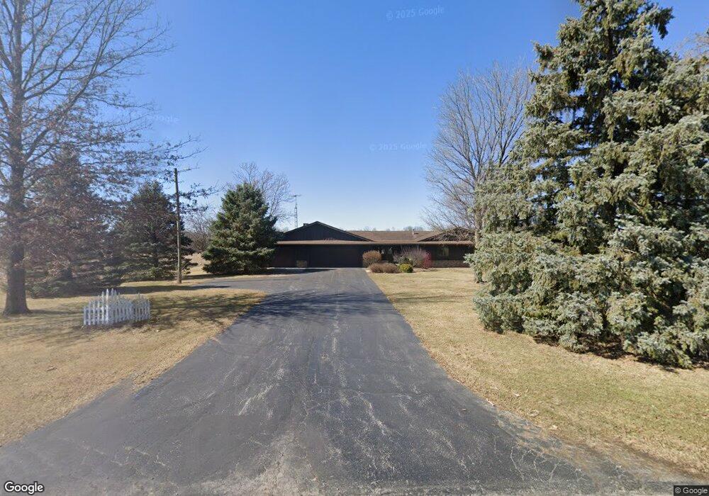
12660 Township Road 67 Findlay, OH 45840
Estimated Value: $342,029 - $391,000
4
Beds
2
Baths
2,496
Sq Ft
$147/Sq Ft
Est. Value
About This Home
This home is located at 12660 Township Road 67, Findlay, OH 45840 and is currently estimated at $366,257, approximately $146 per square foot. 12660 Township Road 67 is a home located in Hancock County with nearby schools including Liberty-Benton Elementary School, Liberty-Benton Middle School, and Liberty-Benton High School.
Ownership History
Date
Name
Owned For
Owner Type
Purchase Details
Closed on
Dec 15, 2020
Sold by
Cover Laurel A and Adams Cover Laurel
Bought by
Walters Zachary D and Walters Brooke M
Current Estimated Value
Home Financials for this Owner
Home Financials are based on the most recent Mortgage that was taken out on this home.
Original Mortgage
$242,250
Outstanding Balance
$215,675
Interest Rate
2.7%
Mortgage Type
New Conventional
Estimated Equity
$150,582
Purchase Details
Closed on
Apr 2, 1993
Bought by
Cover Mark I and Adams-Cover Laurel A
Purchase Details
Closed on
Mar 30, 1990
Bought by
Rennels Craig A and Rennels Linda L
Purchase Details
Closed on
Jul 7, 1987
Bought by
Oman Stephen F
Create a Home Valuation Report for This Property
The Home Valuation Report is an in-depth analysis detailing your home's value as well as a comparison with similar homes in the area
Home Values in the Area
Average Home Value in this Area
Purchase History
| Date | Buyer | Sale Price | Title Company |
|---|---|---|---|
| Walters Zachary D | $255,000 | Flag City Title Agency Inc | |
| Cover Mark I | $153,000 | -- | |
| Rennels Craig A | $137,000 | -- | |
| Oman Stephen F | -- | -- |
Source: Public Records
Mortgage History
| Date | Status | Borrower | Loan Amount |
|---|---|---|---|
| Open | Walters Zachary D | $242,250 |
Source: Public Records
Tax History Compared to Growth
Tax History
| Year | Tax Paid | Tax Assessment Tax Assessment Total Assessment is a certain percentage of the fair market value that is determined by local assessors to be the total taxable value of land and additions on the property. | Land | Improvement |
|---|---|---|---|---|
| 2024 | $3,202 | $90,270 | $7,030 | $83,240 |
| 2023 | $3,122 | $90,270 | $7,030 | $83,240 |
| 2022 | $3,090 | $90,270 | $7,030 | $83,240 |
| 2021 | $2,913 | $74,980 | $6,760 | $68,220 |
| 2020 | $2,939 | $74,980 | $6,760 | $68,220 |
| 2019 | $2,884 | $74,980 | $6,760 | $68,220 |
| 2018 | $2,264 | $65,200 | $5,880 | $59,320 |
| 2017 | $1,171 | $65,200 | $5,880 | $59,320 |
| 2016 | $2,270 | $65,200 | $5,880 | $59,320 |
| 2015 | $2,765 | $77,550 | $5,880 | $71,670 |
| 2014 | $2,805 | $77,880 | $5,880 | $72,000 |
| 2012 | $2,931 | $77,880 | $5,880 | $72,000 |
Source: Public Records
Map
Nearby Homes
- 3323 Western Ave
- 0 Township Road 77
- 0 Penrose Dr
- 0 Virbunum Ct Unit 87 305267
- 0 Viburnum Ct Unit 6121366
- 0 Viburnum Ct Unit 20243687
- 3065 S Main St
- 401 Bittersweet Dr
- 500 Blue Bonnet Dr
- 10601 County Road 9
- 11741 Township Road 10
- 164 Church Hill Dr
- 128 Church Hill Dr
- 1609 Foraker Ave
- 0 Bushwillow Dr Unit Lot 154
- 0 Bushwillow Dr Lot 156 Unit 6079046
- 0 Rock Candy Rd Lot 162 Unit 6079070
- 0 Bushwillow Dr Unit Lot 156
- 0 Bearcat Way Or 0 Rock Candy Rd Lot 167 Unit 6079083
- 0 Bushwillow Dr Lot 154 Unit 6079043
- 12867 Township Road 67
- 10200 Township Road 48
- 12634 Township Road 67
- 10061 Trail 48
- 12606 Township Road 67
- 13028 Trail 67
- 13028 Township Road 67
- 10169 Township Road 48
- 12502 Trail 67
- 13060 Township Road 67
- 12502 Township Road 67
- 12500 Trail 67
- 13090 Township Road 67
- 10061 Township Road 48
- 12481 Township Road 67
- 12500 Township Road 67
- 9791 Township Road 48
- 12309 Township Road 67
- 10123 Township Road 50
- 13364 Township Road 67