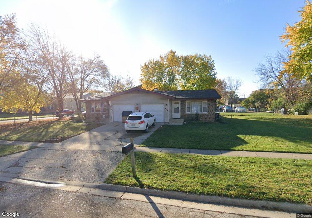
1267 Fairwood Dr Unit 69 Elgin, IL 60123
Century Oaks NeighborhoodEstimated Value: $332,958 - $370,000
4
Beds
2
Baths
1,624
Sq Ft
$213/Sq Ft
Est. Value
About This Home
This home is located at 1267 Fairwood Dr Unit 69, Elgin, IL 60123 and is currently estimated at $345,990, approximately $213 per square foot. 1267 Fairwood Dr Unit 69 is a home located in Kane County with nearby schools including Century Oaks Elementary School, Kimball Middle School, and Larkin High School.
Ownership History
Date
Name
Owned For
Owner Type
Purchase Details
Closed on
May 3, 2021
Sold by
Hager Swanson Mary M
Bought by
Mary 300 Llc
Current Estimated Value
Purchase Details
Closed on
Aug 27, 1999
Sold by
Flores Onorio and Flores Margarita
Bought by
Swanson Evan and Swanson Mary Hager
Home Financials for this Owner
Home Financials are based on the most recent Mortgage that was taken out on this home.
Original Mortgage
$117,400
Interest Rate
7.77%
Create a Home Valuation Report for This Property
The Home Valuation Report is an in-depth analysis detailing your home's value as well as a comparison with similar homes in the area
Home Values in the Area
Average Home Value in this Area
Purchase History
| Date | Buyer | Sale Price | Title Company |
|---|---|---|---|
| Mary 300 Llc | -- | None Available | |
| Swanson Evan | $157,000 | -- |
Source: Public Records
Mortgage History
| Date | Status | Borrower | Loan Amount |
|---|---|---|---|
| Previous Owner | Swanson Evan | $117,400 | |
| Closed | Swanson Evan | $23,500 |
Source: Public Records
Tax History Compared to Growth
Tax History
| Year | Tax Paid | Tax Assessment Tax Assessment Total Assessment is a certain percentage of the fair market value that is determined by local assessors to be the total taxable value of land and additions on the property. | Land | Improvement |
|---|---|---|---|---|
| 2024 | $7,053 | $88,135 | $25,563 | $62,572 |
| 2023 | $6,787 | $79,623 | $23,094 | $56,529 |
| 2022 | $6,296 | $72,603 | $21,058 | $51,545 |
| 2021 | $6,056 | $67,879 | $19,688 | $48,191 |
| 2020 | $5,910 | $64,801 | $18,795 | $46,006 |
| 2019 | $5,765 | $61,727 | $17,903 | $43,824 |
| 2018 | $5,749 | $58,151 | $16,866 | $41,285 |
| 2017 | $5,654 | $54,973 | $15,944 | $39,029 |
| 2016 | $5,439 | $51,000 | $14,792 | $36,208 |
| 2015 | -- | $46,746 | $13,558 | $33,188 |
| 2014 | -- | $46,169 | $13,391 | $32,778 |
| 2013 | -- | $47,387 | $13,744 | $33,643 |
Source: Public Records
Map
Nearby Homes
- 1235 Meadow Ln
- 997 Meadow Ln
- 1223 Ridgeway Dr
- 938 Hillcrest Rd
- 1121 Forest Dr
- 89 Brookwood Ct
- 801 N Mclean Blvd Unit 220
- 801 N Mclean Blvd Unit 226
- 801 N Mclean Blvd Unit 316
- 801 N Mclean Blvd Unit 362
- 1142 Morningside Dr
- 1104 Florimond Dr
- 900 Ruth Dr
- 587 N Clifton Ave
- LOT 17 Teal Ave
- LOTS 14 & 15 Teal Ave
- 41 Lockman Cir Unit 5
- 54 Genesee Ave
- 5 Creekside Cir Unit B
- 1405 Creekside Ct Unit B
- 1267 Fairwood Dr Unit 69
- 1267 Fairwood Dr
- 1259 Fairwood Ct
- 1257 Fairwood Ct
- 1071 Todd Farm Dr
- 1051 Todd Farm Dr Unit 3
- 1051 Todd Farm Dr Unit 1
- 1051 Todd Farm Dr Unit 2
- 1280 Fairwood Dr
- 1260 Fairwood Dr
- 1207 Fairwood Dr Unit 1209
- 1219 Fairwood Ct
- 1045 Todd Farm Dr Unit 1
- 1045 Todd Farm Dr Unit 4
- 1045 Todd Farm Dr Unit 4
- 1045 Todd Farm Dr Unit 2
- 1045 Todd Farm Dr Unit 3
- 1300-02 Fairwood Dr
- 1300 Fairwood Dr Unit 2
- 1240 Fairwood Dr