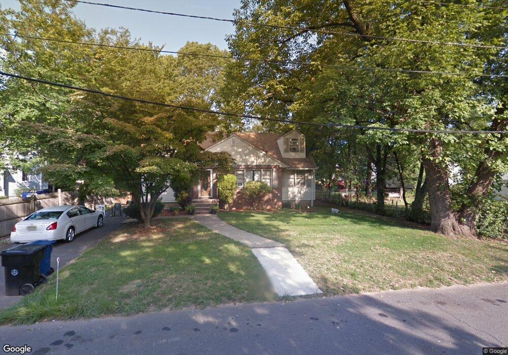
1267 Milton Place Unit 71 Plainfield, NJ 07062
Estimated Value: $419,092 - $554,000
Studio
--
Bath
1,146
Sq Ft
$413/Sq Ft
Est. Value
About This Home
This home is located at 1267 Milton Place Unit 71, Plainfield, NJ 07062 and is currently estimated at $473,523, approximately $413 per square foot. 1267 Milton Place Unit 71 is a home located in Union County with nearby schools including Emerson Community School, Maxson Middle School, and Plainfield High School.
Ownership History
Date
Name
Owned For
Owner Type
Purchase Details
Closed on
Sep 15, 2006
Sold by
Darrell Samuel R
Bought by
Kyser Paul and Kyser Lisa D
Current Estimated Value
Home Financials for this Owner
Home Financials are based on the most recent Mortgage that was taken out on this home.
Original Mortgage
$236,000
Outstanding Balance
$141,108
Interest Rate
6.59%
Estimated Equity
$332,415
Purchase Details
Closed on
Dec 14, 1999
Sold by
Home Loan & Investment Bank Fsb
Bought by
Darrell Samuel R
Home Financials for this Owner
Home Financials are based on the most recent Mortgage that was taken out on this home.
Original Mortgage
$119,000
Interest Rate
7.81%
Mortgage Type
FHA
Purchase Details
Closed on
Feb 9, 1999
Sold by
Robinson Lawrence and Robinson Catherine
Bought by
Home Loan & Investment Bank Fsb
Create a Home Valuation Report for This Property
The Home Valuation Report is an in-depth analysis detailing your home's value as well as a comparison with similar homes in the area
Home Values in the Area
Average Home Value in this Area
Purchase History
| Date | Buyer | Sale Price | Title Company |
|---|---|---|---|
| Kyser Paul | $295,000 | -- | |
| Darrell Samuel R | $120,000 | Chicago Title Insurance Co | |
| Home Loan & Investment Bank Fsb | -- | -- |
Source: Public Records
Mortgage History
| Date | Status | Borrower | Loan Amount |
|---|---|---|---|
| Open | Kyser Paul | $236,000 | |
| Previous Owner | Darrell Samuel R | $119,000 |
Source: Public Records
Tax History
| Year | Tax Paid | Tax Assessment Tax Assessment Total Assessment is a certain percentage of the fair market value that is determined by local assessors to be the total taxable value of land and additions on the property. | Land | Improvement |
|---|---|---|---|---|
| 2025 | $8,732 | $100,000 | $47,300 | $52,700 |
| 2024 | $8,646 | $100,000 | $47,300 | $52,700 |
| 2023 | $8,646 | $100,000 | $47,300 | $52,700 |
| 2022 | $8,459 | $100,000 | $47,300 | $52,700 |
| 2021 | $8,385 | $100,000 | $47,300 | $52,700 |
| 2020 | $8,361 | $100,000 | $47,300 | $52,700 |
| 2019 | $8,361 | $100,000 | $47,300 | $52,700 |
| 2018 | $8,186 | $100,000 | $47,300 | $52,700 |
| 2017 | $7,986 | $100,000 | $47,300 | $52,700 |
| 2016 | $7,823 | $100,000 | $47,300 | $52,700 |
| 2015 | $8,457 | $111,400 | $47,300 | $64,100 |
| 2014 | -- | $111,400 | $47,300 | $64,100 |
Source: Public Records
Map
Nearby Homes
- 93 Raymond Ave
- 95 Raymond Ave Unit 97
- 99 Raymond Ave
- 58 Raymond Ave
- 56-58 Raymond Ave
- 124 Hillcrest Ave
- 155 Netherwood Ave
- 125 Leland Ave Unit 27
- 162 Mali Dr
- 925 E Front St Unit 66
- 949 E Front St
- 949 E Front St Unit A
- 225 Sumner Ave Unit 27
- 1412 E 2nd St Unit 16
- 935 E Front St Unit C
- 1455 Mccrea Place
- 344 Hoe Ave
- 358-400 E 2nd St
- 835 E 2nd St
- 836 E 2nd St Unit 38
- 1261 Milton Place Unit 2
- 1261 Milton Place Unit 65
- 87 Raymond Ave
- 81 Raymond Ave Unit 85
- 1259 Milton Place
- 87A Raymond Ave
- 82 Deborah Ct
- 91 Raymond Ave
- 75 Raymond Ave Unit 79
- 78 Deborah Ct Unit 80
- 71 Raymond Ave Unit 73
- 81 Deborah Ct
- 84 Raymond Ave Unit 86
- 88 Raymond Ave
- 74 Deborah Ct Unit 76
- 67 Raymond Ave Unit 69
- 77 Deborah Ct Unit 79
- 76 Raymond Ave Unit 80
- 82 Raymond Ave
- 70 Deborah Ct Unit 72
Your Personal Tour Guide
Ask me questions while you tour the home.