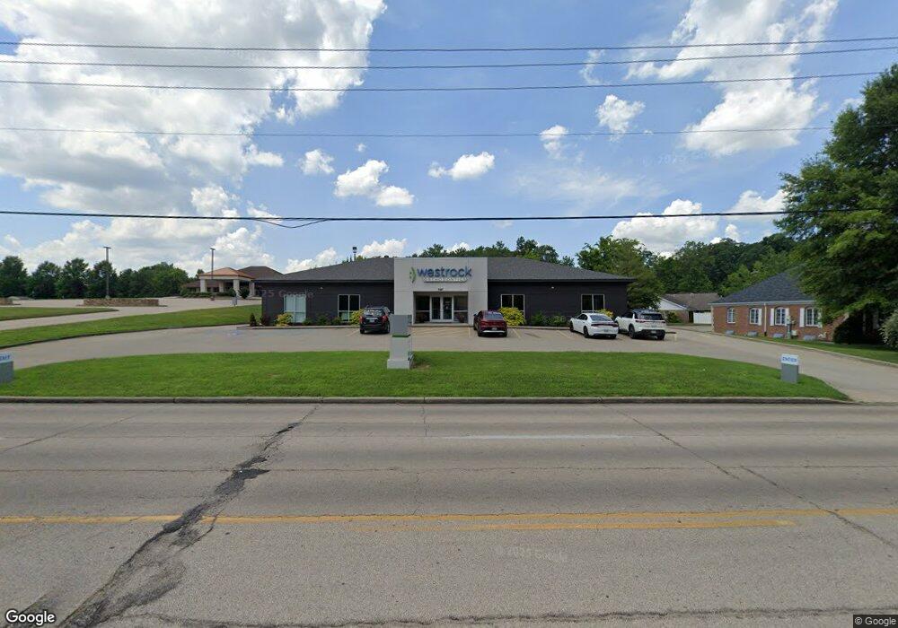
1267 N Mount Auburn Rd Cape Girardeau, MO 63701
--
Bed
--
Bath
4,800
Sq Ft
0.81
Acres
About This Home
This home is located at 1267 N Mount Auburn Rd, Cape Girardeau, MO 63701. 1267 N Mount Auburn Rd is a home located in Cape Girardeau County with nearby schools including Clippard Elementary School, Central Junior High School, and Central Middle School.
Ownership History
Date
Name
Owned For
Owner Type
Purchase Details
Closed on
Apr 5, 2022
Sold by
Melissa Properties Llc
Bought by
Scf Rc Funding Iv Llc
Purchase Details
Closed on
May 14, 2019
Sold by
Ag Jones Properties Llc
Bought by
Melissa Properties Llc
Home Financials for this Owner
Home Financials are based on the most recent Mortgage that was taken out on this home.
Original Mortgage
$1,160,000
Interest Rate
4.1%
Mortgage Type
Commercial
Purchase Details
Closed on
Mar 16, 2018
Sold by
Mrv Banks
Bought by
Ag Jones Properties Llc
Home Financials for this Owner
Home Financials are based on the most recent Mortgage that was taken out on this home.
Original Mortgage
$750,000
Interest Rate
4.38%
Mortgage Type
Commercial
Create a Home Valuation Report for This Property
The Home Valuation Report is an in-depth analysis detailing your home's value as well as a comparison with similar homes in the area
Home Values in the Area
Average Home Value in this Area
Purchase History
| Date | Buyer | Sale Price | Title Company |
|---|---|---|---|
| Scf Rc Funding Iv Llc | -- | First American Title | |
| Melissa Properties Llc | -- | None Available | |
| Ag Jones Properties Llc | -- | -- |
Source: Public Records
Mortgage History
| Date | Status | Borrower | Loan Amount |
|---|---|---|---|
| Previous Owner | Melissa Properties Llc | $1,160,000 | |
| Previous Owner | Ag Jones Properties Llc | $750,000 |
Source: Public Records
Tax History Compared to Growth
Tax History
| Year | Tax Paid | Tax Assessment Tax Assessment Total Assessment is a certain percentage of the fair market value that is determined by local assessors to be the total taxable value of land and additions on the property. | Land | Improvement |
|---|---|---|---|---|
| 2025 | $153 | $287,760 | $72,670 | $215,090 |
| 2024 | $153 | $274,060 | $69,210 | $204,850 |
| 2023 | $15,255 | $274,060 | $69,210 | $204,850 |
| 2022 | $15,262 | $274,060 | $69,210 | $204,850 |
| 2021 | $15,261 | $274,060 | $69,210 | $204,850 |
| 2020 | $8,986 | $160,930 | $61,410 | $99,520 |
| 2019 | $8,973 | $160,930 | $0 | $0 |
| 2018 | $8,957 | $160,930 | $0 | $0 |
| 2017 | $8,977 | $160,930 | $0 | $0 |
| 2016 | $0 | $0 | $0 | $0 |
| 2015 | -- | $0 | $0 | $0 |
| 2014 | -- | $0 | $0 | $0 |
Source: Public Records
Map
Nearby Homes
- 1000 N Mount Auburn Rd
- 3014 Keystone Dr
- 3036 Keystone Dr
- 3269 Hopper Rd
- 901 Pheasant Cove Dr
- 3046 Beavercreek Dr
- 3022 Beavercreek Dr
- 807 Caribou Ct
- 3552 Mill View Crossing
- 725 Old Mill Dr
- 835 Lochinvar Ln
- 1107 Dorothy St
- 1070 Dorothy St
- 3109 Westfield Dr
- 1705 Paul Revere Dr
- 3657 Engram St
- 3022 Wisteria Dr
- 1246 Marilyn Dr
- 3027 Wisteria Dr
- 3002 Melrose Ave
- 1200 Mt Auburn
- 1316 Copper Dr Unit 1318
- 1315 Copper Dr Unit 1317
- 1315 Copper Dr
- 3011 Keystone Dr
- 3452 Hopper Rd
- 1319 Copper Dr
- 1335 N Mount Auburn Rd
- 3010 Keystone Dr
- 1327 Copper Dr
- 2911 Breckenridge Dr
- 3453 Hopper Rd
- 3433 Hopper Rd
- 1345 N Mount Auburn Rd Unit A
- 3015 Keystone Dr
- 3445 Hopper Rd
- 3461 Hopper Rd
- 15 Lochinvar Ln
- 14 Lochinvar Ln
- 1331 Copper Dr Unit 1333