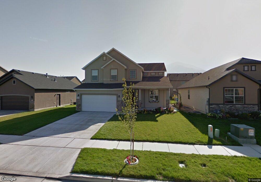
1267 S 2060 E Spanish Fork, UT 84660
Estimated Value: $556,664 - $593,000
4
Beds
3
Baths
3,094
Sq Ft
$185/Sq Ft
Est. Value
About This Home
This home is located at 1267 S 2060 E, Spanish Fork, UT 84660 and is currently estimated at $572,221, approximately $184 per square foot. 1267 S 2060 E is a home located in Utah County with nearby schools including East Meadows Elementary School, Spanish Fork Jr High School, and Spanish Fork High School.
Ownership History
Date
Name
Owned For
Owner Type
Purchase Details
Closed on
Sep 28, 2020
Sold by
Hancock Bryan
Bought by
Gonzalez Nicolas Andres and Gonzalez Laura Elizabeth
Current Estimated Value
Home Financials for this Owner
Home Financials are based on the most recent Mortgage that was taken out on this home.
Original Mortgage
$330,000
Outstanding Balance
$290,851
Interest Rate
2.9%
Mortgage Type
New Conventional
Estimated Equity
$281,370
Purchase Details
Closed on
Apr 21, 2010
Sold by
Homes By Harmony Inc
Bought by
Hancock Bryan
Home Financials for this Owner
Home Financials are based on the most recent Mortgage that was taken out on this home.
Original Mortgage
$192,136
Interest Rate
4.87%
Mortgage Type
FHA
Purchase Details
Closed on
Mar 5, 2010
Sold by
Spanish Vista Plat 1 Llc
Bought by
Home By Harmony Inc
Home Financials for this Owner
Home Financials are based on the most recent Mortgage that was taken out on this home.
Original Mortgage
$192,136
Interest Rate
4.87%
Mortgage Type
FHA
Create a Home Valuation Report for This Property
The Home Valuation Report is an in-depth analysis detailing your home's value as well as a comparison with similar homes in the area
Home Values in the Area
Average Home Value in this Area
Purchase History
| Date | Buyer | Sale Price | Title Company |
|---|---|---|---|
| Gonzalez Nicolas Andres | -- | Rudd & Hawkes Ttl Ins Agcy L | |
| Hancock Bryan | -- | Provo Land Title Company | |
| Home By Harmony Inc | -- | Provo Land Title Company |
Source: Public Records
Mortgage History
| Date | Status | Borrower | Loan Amount |
|---|---|---|---|
| Open | Gonzalez Nicolas Andres | $330,000 | |
| Previous Owner | Hancock Bryan | $192,136 | |
| Previous Owner | Home By Harmony Inc | $152,900 |
Source: Public Records
Tax History
| Year | Tax Paid | Tax Assessment Tax Assessment Total Assessment is a certain percentage of the fair market value that is determined by local assessors to be the total taxable value of land and additions on the property. | Land | Improvement |
|---|---|---|---|---|
| 2025 | $2,412 | $266,585 | -- | -- |
| 2024 | $2,412 | $248,600 | $0 | $0 |
| 2023 | $2,499 | $257,895 | $0 | $0 |
| 2022 | $2,550 | $258,060 | $0 | $0 |
| 2021 | $2,212 | $358,200 | $104,600 | $253,600 |
| 2020 | $2,096 | $329,900 | $95,100 | $234,800 |
| 2019 | $1,885 | $312,100 | $79,200 | $232,900 |
| 2018 | $1,817 | $290,800 | $74,800 | $216,000 |
| 2017 | $1,724 | $148,335 | $0 | $0 |
| 2016 | $1,605 | $136,290 | $0 | $0 |
| 2015 | $1,483 | $124,410 | $0 | $0 |
| 2014 | $1,457 | $122,650 | $0 | $0 |
Source: Public Records
Map
Nearby Homes
- 1282 S 2000 E
- 2237 E 1400 S
- 1166 S 1920 E
- 417 E 1460 S Unit 48
- 1061 S 2230 E
- 1878 E 1050 S
- 2397 E 1370 S
- 357 E 1460 S Unit 45
- 385 E 1460 S Unit 47
- 1147 S 1660 E
- 2044 E 800 S
- 2034 E 800 S
- 1692 E 1000 S
- 2342 E 830 S Unit 27
- 2342 E 830 S
- 2342 E 830 S Unit 26
- 938 S 1740 E
- 2308 E 850 South St Unit 10
- 868 S 2560 E
- 2710 E Canyon Rd
- 1267 S 2060 E Unit SV227I
- 1247 S 2060 E
- 1273 S 2060 E
- 1273 S 2060 E Unit SV226I
- 1266 S 2130 E
- 1283 S 2060 E Unit 225i
- 1283 S 2060 E
- 1237 S 2060 E
- 1293 S 2060 E Unit SV225I
- 1272 S 2130 E
- 1286 S 2130 E
- 1268 S 2060 E Unit 191
- 1252 S 2060 E Unit CONCOR
- 1252 S 2060 E Unit 190
- 1297 S 2060 E
- 1276 S 2060 E
- 1276 S 2060 E Unit 192
- 1238 S 2060 E Unit 189i
- 1238 S 2060 E
- 1296 S 2130 E
Your Personal Tour Guide
Ask me questions while you tour the home.