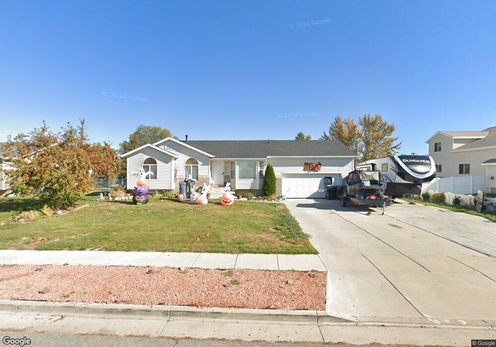
1267 S 4000 W Syracuse, UT 84075
Estimated Value: $479,000 - $498,000
3
Beds
2
Baths
1,284
Sq Ft
$379/Sq Ft
Est. Value
About This Home
This home is located at 1267 S 4000 W, Syracuse, UT 84075 and is currently estimated at $486,112, approximately $378 per square foot. 1267 S 4000 W is a home located in Davis County with nearby schools including Buffalo Point School, Syracuse Junior High School, and Syracuse High School.
Ownership History
Date
Name
Owned For
Owner Type
Purchase Details
Closed on
Mar 26, 2021
Sold by
James Randy and James Jean
Bought by
James Randy L and James Jean K
Current Estimated Value
Home Financials for this Owner
Home Financials are based on the most recent Mortgage that was taken out on this home.
Original Mortgage
$150,000
Outstanding Balance
$134,691
Interest Rate
2.8%
Mortgage Type
New Conventional
Estimated Equity
$351,421
Purchase Details
Closed on
Oct 12, 2005
Sold by
Porter Fred C and Porter Treasa R
Bought by
James Randy and James Jean
Purchase Details
Closed on
Oct 15, 2001
Sold by
Porter Fred C and Porter Treasa R
Bought by
Porter Fred C and Porter Treasa R
Home Financials for this Owner
Home Financials are based on the most recent Mortgage that was taken out on this home.
Original Mortgage
$110,400
Interest Rate
7.72%
Purchase Details
Closed on
Jan 19, 2001
Sold by
Maxim Homes Inc
Bought by
Porter Fred C and Porter Teresa R
Create a Home Valuation Report for This Property
The Home Valuation Report is an in-depth analysis detailing your home's value as well as a comparison with similar homes in the area
Home Values in the Area
Average Home Value in this Area
Purchase History
| Date | Buyer | Sale Price | Title Company |
|---|---|---|---|
| James Randy L | -- | Mountain View Title | |
| James Randy | -- | Nations Title Agency Of Ut | |
| Porter Fred C | -- | Equity Title Agency | |
| Porter Fred C | -- | Meridian Title Company |
Source: Public Records
Mortgage History
| Date | Status | Borrower | Loan Amount |
|---|---|---|---|
| Open | James Randy L | $150,000 | |
| Previous Owner | Porter Fred C | $110,400 |
Source: Public Records
Tax History Compared to Growth
Tax History
| Year | Tax Paid | Tax Assessment Tax Assessment Total Assessment is a certain percentage of the fair market value that is determined by local assessors to be the total taxable value of land and additions on the property. | Land | Improvement |
|---|---|---|---|---|
| 2025 | $2,451 | $236,500 | $108,430 | $128,070 |
| 2024 | $2,339 | $227,150 | $86,174 | $140,976 |
| 2023 | $2,187 | $387,000 | $131,506 | $255,494 |
| 2022 | $2,352 | $228,250 | $65,607 | $162,643 |
| 2021 | $2,004 | $301,000 | $95,684 | $205,316 |
| 2020 | $1,774 | $258,000 | $76,838 | $181,162 |
| 2019 | $1,748 | $251,000 | $80,854 | $170,146 |
| 2018 | $1,607 | $229,000 | $78,767 | $150,233 |
| 2016 | $1,310 | $97,900 | $33,098 | $64,802 |
| 2015 | $1,383 | $98,395 | $33,098 | $65,297 |
| 2014 | $1,345 | $97,553 | $33,098 | $64,455 |
| 2013 | -- | $94,681 | $31,123 | $63,558 |
Source: Public Records
Map
Nearby Homes
- 3951 Baltimore Cir
- 3867 Rungsted Cir
- 3882 Turnberry Dr
- 1084 S 4090 W
- 3736 W 1225 S
- 4191 W 1425 S
- 1039 S 4250 W
- 1238 S 4290 W
- 1157 S 4425 W
- 3564 Princeville Dr
- 835 S Criddle Rd
- 1155 S 4475 W
- 1139 S 4475 W
- Bradford Plan at Harvest Fields
- Avery Plan at Harvest Fields
- Sullivan Plan at Harvest Fields
- Presley Plan at Harvest Fields
- Ashmore Plan at Harvest Fields
- Bridgeport Plan at Harvest Fields
- Malan Plan at Harvest Fields
- 1249 S 4000 W
- 1285 S 4000 W
- 3948 Saunton Cir
- 3949 Saunton Cir
- 1276 S 4000 W
- 1256 S 4000 W
- 1303 S 4000 W
- 1294 S 4000 W
- 1231 S 4000 W
- 1236 S 4000 W
- 3962 Hammon Ln
- 3941 Saunton Cir
- 3940 Saunton Cir
- 1216 S 4000 W
- 3944 Hammon Ln
- 3943 Baltimore Cir
- 1213 S 4000 W
- 3923 Saunton Cir
- 3922 Saunton Cir
- 1237 S 4050 W