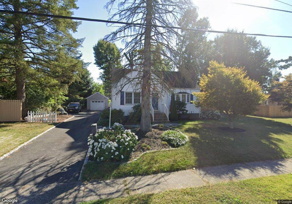
1267 S 9th St South Plainfield, NJ 07080
Estimated Value: $464,343 - $586,000
--
Bed
--
Bath
--
Sq Ft
0.29
Acres
About This Home
This home is located at 1267 S 9th St, South Plainfield, NJ 07080 and is currently estimated at $536,836. 1267 S 9th St is a home located in Middlesex County with nearby schools including South Plainfield High School and The Queen City Academy Charter School.
Ownership History
Date
Name
Owned For
Owner Type
Purchase Details
Closed on
Dec 15, 2000
Sold by
Check David
Bought by
Paras Juan and Paras Leonora
Current Estimated Value
Home Financials for this Owner
Home Financials are based on the most recent Mortgage that was taken out on this home.
Original Mortgage
$151,200
Outstanding Balance
$55,478
Interest Rate
7.64%
Estimated Equity
$481,358
Purchase Details
Closed on
Apr 29, 1994
Sold by
Price John
Bought by
Check Anton and Termini Lisa
Home Financials for this Owner
Home Financials are based on the most recent Mortgage that was taken out on this home.
Original Mortgage
$115,000
Interest Rate
7.7%
Create a Home Valuation Report for This Property
The Home Valuation Report is an in-depth analysis detailing your home's value as well as a comparison with similar homes in the area
Home Values in the Area
Average Home Value in this Area
Purchase History
| Date | Buyer | Sale Price | Title Company |
|---|---|---|---|
| Paras Juan | $189,000 | -- | |
| Check Anton | $137,500 | -- |
Source: Public Records
Mortgage History
| Date | Status | Borrower | Loan Amount |
|---|---|---|---|
| Open | Paras Juan | $151,200 | |
| Previous Owner | Check Anton | $115,000 |
Source: Public Records
Tax History Compared to Growth
Tax History
| Year | Tax Paid | Tax Assessment Tax Assessment Total Assessment is a certain percentage of the fair market value that is determined by local assessors to be the total taxable value of land and additions on the property. | Land | Improvement |
|---|---|---|---|---|
| 2025 | $7,722 | $110,600 | $29,600 | $81,000 |
| 2024 | $7,386 | $110,600 | $29,600 | $81,000 |
| 2023 | $7,386 | $110,600 | $29,600 | $81,000 |
| 2022 | $7,294 | $110,600 | $29,600 | $81,000 |
| 2021 | $7,123 | $110,600 | $29,600 | $81,000 |
| 2020 | $7,019 | $110,600 | $29,600 | $81,000 |
| 2019 | $6,734 | $110,600 | $29,600 | $81,000 |
| 2018 | $6,561 | $110,600 | $29,600 | $81,000 |
| 2017 | $6,477 | $110,600 | $29,600 | $81,000 |
| 2016 | $6,411 | $110,600 | $29,600 | $81,000 |
| 2015 | $6,301 | $110,600 | $29,600 | $81,000 |
| 2014 | $6,120 | $110,600 | $29,600 | $81,000 |
Source: Public Records
Map
Nearby Homes
- 1271 S 9th St
- 1263 S 9th St
- 1264 S 10th St
- 1203 New Brunswick Ave
- 1260 S 9th St
- 1259 S 9th St
- 1258 S 9th St
- 1254 S 9th St
- 1254 S 10th St
- 1252 S 9th St
- 1204 New Brunswick Ave
- 1250 S 9th St
- 1247 S 9th St
- 1250 S 10th St
- 1205 New Brunswick Ave
- 1271 S 10th St
- 1206 New Brunswick Ave
- 1267 S 10th St
- 1248 S 9th St
- 2 Page Ct