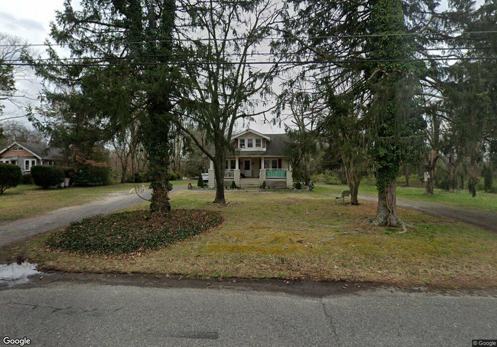
1267 W Wheat Rd Vineland, NJ 08360
Estimated Value: $239,000 - $294,000
4
Beds
2
Baths
2,271
Sq Ft
$113/Sq Ft
Est. Value
About This Home
This home is located at 1267 W Wheat Rd, Vineland, NJ 08360 and is currently estimated at $256,536, approximately $112 per square foot. 1267 W Wheat Rd is a home located in Cumberland County with nearby schools including Marie D. Durand Elementary School, T.W. Wallace Middle School, and Vineland Senior High School.
Ownership History
Date
Name
Owned For
Owner Type
Purchase Details
Closed on
Mar 14, 2025
Sold by
R Barclay Foundation Trust and R Barclay Foundation Incorporation
Bought by
1267 W Wheat Road Llc
Current Estimated Value
Home Financials for this Owner
Home Financials are based on the most recent Mortgage that was taken out on this home.
Original Mortgage
$184,000
Outstanding Balance
$183,073
Interest Rate
6.95%
Mortgage Type
New Conventional
Estimated Equity
$73,463
Purchase Details
Closed on
Feb 12, 2015
Sold by
Methuselah Incorporated
Bought by
The R Barclay Foundation Trust and R Barclay Foundation
Purchase Details
Closed on
May 22, 2007
Sold by
Graban Paul J S
Bought by
The R Barclay Foundation Inc
Create a Home Valuation Report for This Property
The Home Valuation Report is an in-depth analysis detailing your home's value as well as a comparison with similar homes in the area
Home Values in the Area
Average Home Value in this Area
Purchase History
| Date | Buyer | Sale Price | Title Company |
|---|---|---|---|
| 1267 W Wheat Road Llc | $230,000 | None Listed On Document | |
| 1267 W Wheat Road Llc | $230,000 | None Listed On Document | |
| The R Barclay Foundation Trust | -- | Attorney | |
| The R Barclay Foundation Inc | -- | -- |
Source: Public Records
Mortgage History
| Date | Status | Borrower | Loan Amount |
|---|---|---|---|
| Open | 1267 W Wheat Road Llc | $184,000 | |
| Closed | 1267 W Wheat Road Llc | $184,000 |
Source: Public Records
Tax History Compared to Growth
Tax History
| Year | Tax Paid | Tax Assessment Tax Assessment Total Assessment is a certain percentage of the fair market value that is determined by local assessors to be the total taxable value of land and additions on the property. | Land | Improvement |
|---|---|---|---|---|
| 2025 | $7,158 | $224,800 | $63,000 | $161,800 |
| 2024 | $7,158 | $224,800 | $63,000 | $161,800 |
| 2023 | $7,110 | $224,800 | $63,000 | $161,800 |
| 2022 | $6,899 | $224,800 | $63,000 | $161,800 |
| 2021 | $6,490 | $224,800 | $63,000 | $161,800 |
| 2020 | $6,580 | $224,800 | $63,000 | $161,800 |
| 2019 | $6,490 | $224,800 | $63,000 | $161,800 |
| 2018 | $6,319 | $224,800 | $63,000 | $161,800 |
| 2017 | $6,002 | $224,800 | $63,000 | $161,800 |
| 2016 | $5,791 | $224,800 | $63,000 | $161,800 |
| 2015 | $5,007 | $201,800 | $40,000 | $161,800 |
| 2014 | $5,274 | $224,800 | $63,000 | $161,800 |
Source: Public Records
Map
Nearby Homes
- 1811 N Delsea Dr Unit 4
- 1489 N Delsea Dr
- 1469 N Mill Rd
- 1392 W Oak Rd
- 1252 W Oak Rd
- 1050 W Oak Rd
- 1032 W Oak Rd
- 1111 N Orchard Rd
- 1020 W Oak Rd
- 829 W Garden Rd
- 663 Wayne Ave
- 1887 N Delsea Dr Unit 135 HOLLY HOCK DR.
- 1887 N Delsea Dr Unit 19
- 1887 N Delsea Dr Unit 39
- 1378 Venus Dr
- 1632 W Garden Rd
- 1573 Neptune Terrace
- 811 W Garden Rd
- 2246 N West Ave
- 1230 Almond Rd
- 1239 W Wheat Rd
- 1305 W Wheat Rd
- 1219 W Wheat Rd
- 1266 W Wheat Rd
- 1321 W Wheat Rd
- 1316 W Wheat Rd
- 1571 N Orchard Rd
- 1179 W Wheat Rd
- 1555 N Orchard Rd Unit A & B
- 1555 N Orchard Rd
- 1347 W Wheat Rd
- 1338 W Wheat Rd
- 1545 N Orchard Rd Unit 1547
- 1149 W Wheat Rd
- 1158 W Wheat Rd
- 1529 N Orchard Rd
- 1135 W Wheat Rd
- 1392 N Orchard Rd
- 1142 W Wheat Rd
- 1515 N Orchard Rd