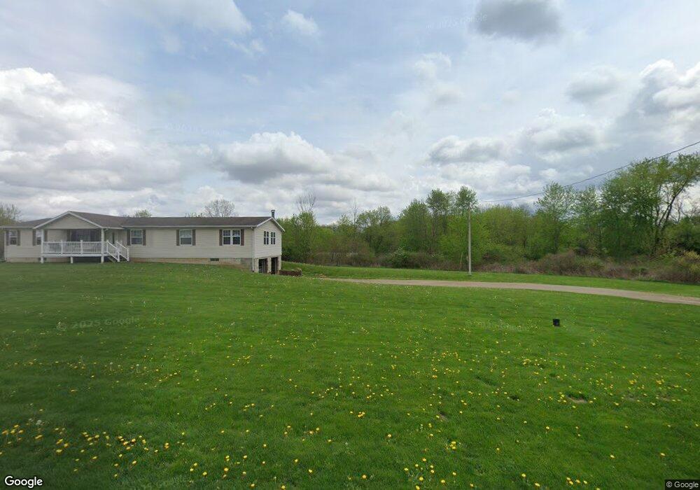
12670 Bottom Rd Dresden, OH 43821
Estimated Value: $41,000 - $208,000
Studio
1
Bath
--
Sq Ft
30,492
Sq Ft Lot
About This Home
This home is located at 12670 Bottom Rd, Dresden, OH 43821 and is currently estimated at $110,333. 12670 Bottom Rd is a home located in Muskingum County with nearby schools including Tri-Valley High School.
Ownership History
Date
Name
Owned For
Owner Type
Purchase Details
Closed on
Oct 22, 2007
Sold by
Novaria Patrick R and Demoss Janelle C
Bought by
Bowen Mark A and Bowen Alma
Current Estimated Value
Purchase Details
Closed on
Jun 22, 2007
Sold by
Stotts Cynthia E
Bought by
Novaria Patrick R
Purchase Details
Closed on
Oct 20, 2006
Sold by
Stotts Cynthia E
Bought by
Darr Daniel D and Darr Sheryl
Purchase Details
Closed on
May 13, 2005
Sold by
Stotts Cynthia E
Bought by
Novaria Patrick R and Demoss Janelle C
Home Financials for this Owner
Home Financials are based on the most recent Mortgage that was taken out on this home.
Original Mortgage
$50,558
Interest Rate
5.91%
Mortgage Type
Purchase Money Mortgage
Create a Home Valuation Report for This Property
The Home Valuation Report is an in-depth analysis detailing your home's value as well as a comparison with similar homes in the area
Purchase History
| Date | Buyer | Sale Price | Title Company |
|---|---|---|---|
| Bowen Mark A | $25,000 | Attorney | |
| Novaria Patrick R | -- | Attorney | |
| Darr Daniel D | $12,500 | Attorney | |
| Novaria Patrick R | $14,000 | -- |
Source: Public Records
Mortgage History
| Date | Status | Borrower | Loan Amount |
|---|---|---|---|
| Previous Owner | Novaria Patrick R | $50,558 |
Source: Public Records
Tax History
| Year | Tax Paid | Tax Assessment Tax Assessment Total Assessment is a certain percentage of the fair market value that is determined by local assessors to be the total taxable value of land and additions on the property. | Land | Improvement |
|---|---|---|---|---|
| 2025 | $22 | $350 | $350 | $0 |
| 2024 | $14 | $350 | $350 | $0 |
| 2023 | $15 | $245 | $245 | $0 |
| 2022 | $15 | $245 | $245 | $0 |
| 2021 | $15 | $245 | $245 | $0 |
| 2020 | $15 | $245 | $245 | $0 |
| 2019 | $9 | $245 | $245 | $0 |
| 2018 | $9 | $245 | $245 | $0 |
| 2017 | $9 | $245 | $245 | $0 |
| 2016 | $9 | $250 | $250 | $0 |
| 2015 | $9 | $250 | $250 | $0 |
| 2013 | $10 | $250 | $250 | $0 |
Source: Public Records
Map
Nearby Homes
- 12545 3rd Ave
- 416 High St
- 26 W 11th St
- 1207 Chestnut St
- 1309 Main St
- 4797 Narrows Rd
- 10200 N River Rd
- 10170 N Morrison Rd
- 3595 Maplecraft Dr
- 9385 N River Rd Unit 33
- 9220 N River Rd
- 13300 Mount Zion Rd
- 0 Eddleblute Dr
- 16200 County Road 436
- 11700 Scout Rd
- 0 County Road 436 Unit 5182503
- 0 County Road 436 Unit 226001996
- 10445 Shannon Rd
- 29 1/2 S Canal St
- 7360 Jones Rd
- 12750 Hunters Trail
- 12785 3rd Ave
- 12765 3rd Ave
- 3140 3rd St
- 12725 Hunters Trail
- 12735 3rd Ave
- 12800 Hunters Trail
- 12755 Hunters Trail
- 12715 3rd Ave
- 12820 Bottom Rd
- 12695 3rd Ave
- 12695 3rd Ave
- 12750 3rd Ave
- 12840 Bottom Rd
- 3160 2nd St
- 3185 2nd St
- 12740 3rd Ave
- 12850 Hunters Trail
- 0 Railroad St
- 12860 Bottom Rd
Your Personal Tour Guide
Ask me questions while you tour the home.