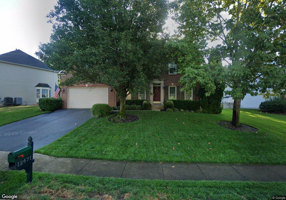
12671 Arthur Graves jr Ct Bristow, VA 20136
Braemar NeighborhoodEstimated Value: $802,752 - $886,000
4
Beds
4
Baths
2,840
Sq Ft
$301/Sq Ft
Est. Value
About This Home
This home is located at 12671 Arthur Graves jr Ct, Bristow, VA 20136 and is currently estimated at $856,188, approximately $301 per square foot. 12671 Arthur Graves jr Ct is a home located in Prince William County with nearby schools including Patriot High School, Cedar Point Elementary School, and E.H. Marsteller Middle School.
Ownership History
Date
Name
Owned For
Owner Type
Purchase Details
Closed on
Aug 18, 2010
Sold by
Lyman Daniel J and Lyman Julia L
Bought by
Wangsness Jonathan and Wangsness Stephanie
Current Estimated Value
Home Financials for this Owner
Home Financials are based on the most recent Mortgage that was taken out on this home.
Original Mortgage
$279,000
Outstanding Balance
$182,853
Interest Rate
4.37%
Mortgage Type
New Conventional
Estimated Equity
$673,335
Purchase Details
Closed on
Oct 26, 2000
Sold by
N V R Inc
Bought by
Lyman Daniel J
Home Financials for this Owner
Home Financials are based on the most recent Mortgage that was taken out on this home.
Original Mortgage
$234,000
Interest Rate
7.83%
Create a Home Valuation Report for This Property
The Home Valuation Report is an in-depth analysis detailing your home's value as well as a comparison with similar homes in the area
Home Values in the Area
Average Home Value in this Area
Purchase History
| Date | Buyer | Sale Price | Title Company |
|---|---|---|---|
| Wangsness Jonathan | $439,000 | Stewart Title Guaranty | |
| Lyman Daniel J | $303,315 | -- |
Source: Public Records
Mortgage History
| Date | Status | Borrower | Loan Amount |
|---|---|---|---|
| Open | Wangsness Jonathan | $279,000 | |
| Previous Owner | Lyman Daniel J | $234,000 |
Source: Public Records
Tax History Compared to Growth
Tax History
| Year | Tax Paid | Tax Assessment Tax Assessment Total Assessment is a certain percentage of the fair market value that is determined by local assessors to be the total taxable value of land and additions on the property. | Land | Improvement |
|---|---|---|---|---|
| 2025 | $6,592 | $742,700 | $203,000 | $539,700 |
| 2024 | $6,592 | $662,800 | $193,300 | $469,500 |
| 2023 | $6,566 | $631,000 | $174,600 | $456,400 |
| 2022 | $6,800 | $603,700 | $169,100 | $434,600 |
| 2021 | $6,584 | $540,700 | $142,000 | $398,700 |
| 2020 | $7,903 | $509,900 | $132,000 | $377,900 |
| 2019 | $7,593 | $489,900 | $131,600 | $358,300 |
| 2018 | $5,708 | $472,700 | $125,300 | $347,400 |
| 2017 | $5,682 | $461,800 | $125,300 | $336,500 |
| 2016 | $5,580 | $457,800 | $123,600 | $334,200 |
| 2015 | $5,365 | $444,500 | $123,600 | $320,900 |
| 2014 | $5,365 | $430,500 | $118,900 | $311,600 |
Source: Public Records
Map
Nearby Homes
- Hampton II Plan at Parkgate Estates
- 10045 Pentland Hills Way
- 12151 Hayfield Ct
- 12054 Nokesville Rd
- 10512 Blazing Star Loop
- 12021 Spring Beauty Rd
- 9478 Merrimont Trace Cir
- 12048 Elliots Oak Place
- 9475 Sarah Mill Terrace
- 9656 Bedder Stone Place
- 9318 Crestview Ridge Dr
- 9244 Crestview Ridge Dr
- 9293 Crestview Ridge Dr
- 9381 Crestview Ridge Dr
- 9579 Scales Place
- 10554 Andrew Humphreys Ct
- 9256 Crestview Ridge Dr
- 10423 Rifle Rd
- 9107 Kearney Place
- 12417 Nokesville Rd
- 12667 Arthur Graves jr Ct
- 12679 Arthur Graves jr Ct
- 12622 Garry Glen Dr
- 12626 Garry Glen Dr
- 12663 Arthur Graves jr Ct
- 12676 Arthur Graves jr Ct
- 12672 Arthur Graves jr Ct
- 12618 Garry Glen Dr
- 12668 Arthur Graves jr Ct
- 12680 Arthur Graves jr Ct
- 12664 Arthur Graves jr Ct
- 12705 Laird Way
- 12659 Arthur Graves jr Ct
- 12684 Arthur Graves jr Ct
- 12614 Garry Glen Dr
- 12662 Arthur Graves jr Ct
- 12686 Arthur Graves jr Ct
- 12658 Arthur Graves jr Ct
- 12634 Garry Glen Dr
- 12690 Arthur Graves jr Ct