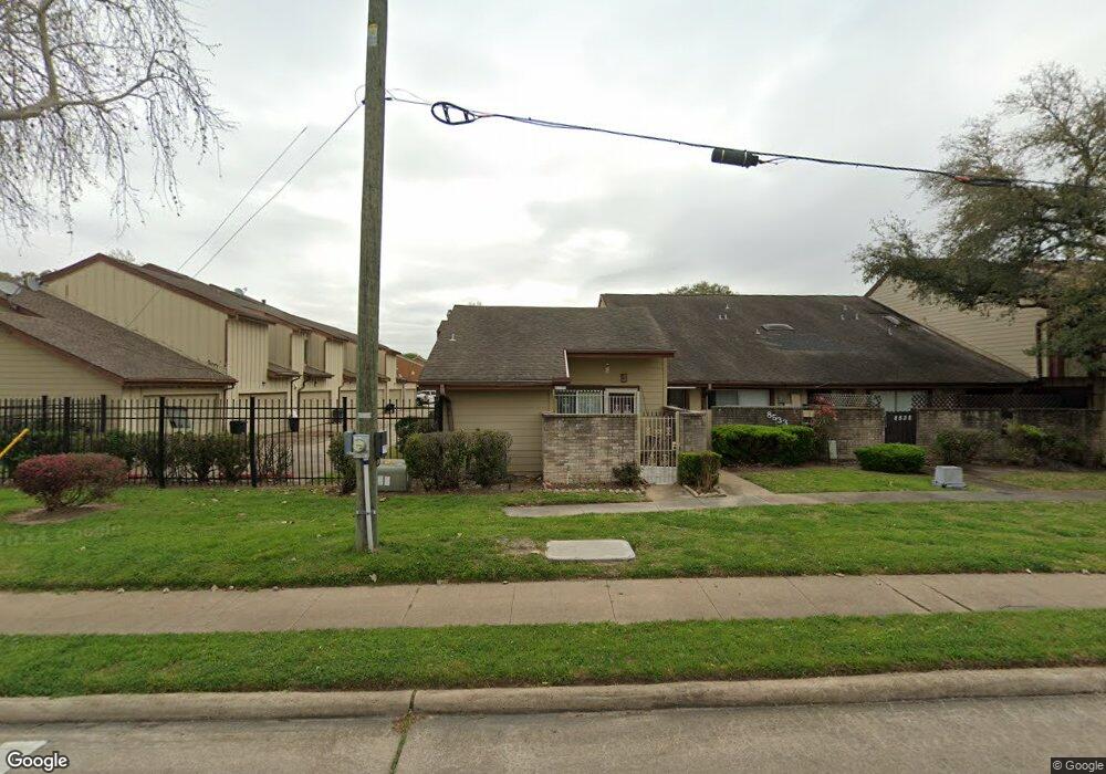
12672 Newbrook Dr Unit 49 Houston, TX 77072
Alief NeighborhoodEstimated Value: $150,000 - $172,000
3
Beds
2
Baths
1,264
Sq Ft
$126/Sq Ft
Est. Value
About This Home
This home is located at 12672 Newbrook Dr Unit 49, Houston, TX 77072 and is currently estimated at $159,151, approximately $125 per square foot. 12672 Newbrook Dr Unit 49 is a home located in Harris County with nearby schools including Alexander Elementary School, Youngblood Intermediate School, and Holub Middle School.
Ownership History
Date
Name
Owned For
Owner Type
Purchase Details
Closed on
Jan 16, 2013
Sold by
Diamond Investment Properties Llc
Bought by
Jimenez Analine
Current Estimated Value
Purchase Details
Closed on
Nov 25, 2011
Sold by
Residential Funding Company Llc
Bought by
Diamond Investment Properties Llc
Purchase Details
Closed on
Nov 10, 2011
Sold by
Douglas Demetri D
Bought by
Residential Funding Company Llc
Purchase Details
Closed on
Aug 8, 1995
Sold by
Hud
Bought by
Douglass Demetri D
Home Financials for this Owner
Home Financials are based on the most recent Mortgage that was taken out on this home.
Original Mortgage
$25,100
Interest Rate
7.54%
Mortgage Type
Purchase Money Mortgage
Create a Home Valuation Report for This Property
The Home Valuation Report is an in-depth analysis detailing your home's value as well as a comparison with similar homes in the area
Home Values in the Area
Average Home Value in this Area
Purchase History
| Date | Buyer | Sale Price | Title Company |
|---|---|---|---|
| Jimenez Analine | -- | First American Title | |
| Jimenez Analine | -- | First American Title | |
| Diamond Investment Properties Llc | -- | Lsi Title Agency Inc | |
| Residential Funding Company Llc | $34,200 | None Available | |
| Douglass Demetri D | $26,501 | -- |
Source: Public Records
Mortgage History
| Date | Status | Borrower | Loan Amount |
|---|---|---|---|
| Previous Owner | Douglass Demetri D | $25,100 |
Source: Public Records
Tax History
| Year | Tax Paid | Tax Assessment Tax Assessment Total Assessment is a certain percentage of the fair market value that is determined by local assessors to be the total taxable value of land and additions on the property. | Land | Improvement |
|---|---|---|---|---|
| 2025 | $4,135 | $182,008 | $37,884 | $144,124 |
| 2024 | $4,135 | $182,008 | $37,884 | $144,124 |
| 2023 | $4,135 | $184,127 | $37,884 | $146,243 |
| 2022 | $3,653 | $150,603 | $30,307 | $120,296 |
| 2021 | $3,154 | $129,190 | $22,730 | $106,460 |
| 2020 | $3,128 | $123,700 | $22,730 | $100,970 |
| 2019 | $3,061 | $111,172 | $16,101 | $95,071 |
| 2018 | $1,384 | $104,033 | $13,259 | $90,774 |
| 2017 | $2,837 | $104,033 | $13,259 | $90,774 |
| 2016 | $2,189 | $80,266 | $13,259 | $67,007 |
| 2015 | $1,454 | $64,589 | $13,259 | $51,330 |
| 2014 | $1,454 | $54,771 | $13,259 | $41,512 |
Source: Public Records
Map
Nearby Homes
- 12682 Newbrook Dr
- 12581 Wellington Park Dr
- 12553 Wellington Park Dr
- 12569 Wellington Park Dr
- 12543 Wellington Park Dr
- 12550 Newbrook Dr
- 12502 Newbrook Dr
- 12503 Newbrook Dr
- 12519 Lima Dr
- 12802 Newbrook Dr
- 12722 Yoshino Cherry St
- 12503 Wellington Park Dr
- 8498 Dairy View Ln
- 8494 Dairy View Ln
- 12510 Shannon Hills Dr
- 12738 Shannon Hills Dr
- 12711 Shannon Hills Dr
- 12420 Newbrook Dr
- 9010 Mellow Brook Dr
- 12326 Bexley Dr
- 12672 Newbrook Dr Unit 497
- 12670 Newbrook Dr
- 12670 Newbrook Dr Unit 496
- 12668 Newbrook Dr
- 12668 Newbrook Dr Unit 495
- 12666 Newbrook Dr
- 12676 Newbrook Dr
- 12676 Newbrook Dr Unit 462
- 12674 Newbrook Dr
- 12674 Newbrook Dr Unit 461
- 12664 Newbrook Dr
- 12678 Newbrook Dr
- 12680 Newbrook Dr
- 12680 Newbrook Dr Unit 464
- 8531 S Dairy Ashford Rd
- 8531 S Dairy Ashford St
- 12662 Newbrook Dr
- 8533 S Dairy Ashford St
- 12682 Newbrook Dr Unit 465
- 12650 Newbrook Dr
Your Personal Tour Guide
Ask me questions while you tour the home.