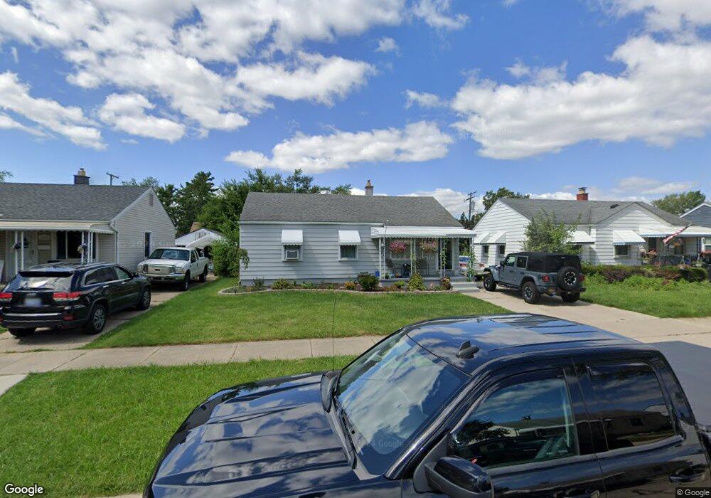
12674 Agnes St Southgate, MI 48195
Estimated Value: $166,698 - $200,000
--
Bed
--
Bath
1,120
Sq Ft
$164/Sq Ft
Est. Value
About This Home
This home is located at 12674 Agnes St, Southgate, MI 48195 and is currently estimated at $183,925, approximately $164 per square foot. 12674 Agnes St is a home located in Wayne County with nearby schools including Shelters Elementary School, Davidson Middle School, and Southgate Anderson High School.
Ownership History
Date
Name
Owned For
Owner Type
Purchase Details
Closed on
Jun 11, 2024
Sold by
Walsh Tammy L
Bought by
Walsh Tammy L and Greene Shawn
Current Estimated Value
Purchase Details
Closed on
Oct 18, 2022
Sold by
Walsh Brian Gerard
Bought by
Brian G Walsh And Tammy L Walsh Revocable Liv
Purchase Details
Closed on
May 9, 2001
Sold by
Walsh Laura A
Bought by
Walsh Brian G
Purchase Details
Closed on
Jun 6, 1994
Sold by
Baker Eugene M
Bought by
Kathryn Eugene and Kathryn Baker
Home Financials for this Owner
Home Financials are based on the most recent Mortgage that was taken out on this home.
Original Mortgage
$57,000
Interest Rate
8.58%
Mortgage Type
New Conventional
Create a Home Valuation Report for This Property
The Home Valuation Report is an in-depth analysis detailing your home's value as well as a comparison with similar homes in the area
Home Values in the Area
Average Home Value in this Area
Purchase History
| Date | Buyer | Sale Price | Title Company |
|---|---|---|---|
| Walsh Tammy L | -- | None Listed On Document | |
| Walsh Tammy L | -- | None Listed On Document | |
| Brian G Walsh And Tammy L Walsh Revocable Liv | -- | -- | |
| Walsh Brian G | -- | -- | |
| Kathryn Eugene | $60,000 | -- |
Source: Public Records
Mortgage History
| Date | Status | Borrower | Loan Amount |
|---|---|---|---|
| Previous Owner | Kathryn Eugene | $57,000 |
Source: Public Records
Tax History Compared to Growth
Tax History
| Year | Tax Paid | Tax Assessment Tax Assessment Total Assessment is a certain percentage of the fair market value that is determined by local assessors to be the total taxable value of land and additions on the property. | Land | Improvement |
|---|---|---|---|---|
| 2025 | $2,094 | $84,500 | $0 | $0 |
| 2024 | $2,094 | $79,200 | $0 | $0 |
| 2023 | $1,995 | $71,400 | $0 | $0 |
| 2022 | $2,309 | $64,400 | $0 | $0 |
| 2021 | $2,246 | $58,200 | $0 | $0 |
| 2020 | $2,211 | $52,400 | $0 | $0 |
| 2019 | $2,184 | $47,700 | $0 | $0 |
| 2018 | $1,667 | $41,300 | $0 | $0 |
| 2017 | $977 | $38,500 | $0 | $0 |
| 2016 | $2,021 | $38,300 | $0 | $0 |
| 2015 | $3,458 | $37,100 | $0 | $0 |
| 2013 | $3,350 | $35,000 | $0 | $0 |
| 2012 | $1,478 | $32,900 | $6,000 | $26,900 |
Source: Public Records
Map
Nearby Homes
- 12750 Longtin St
- 12685 Fordline St
- 12177 Agnes St
- 13631 Rosedale St
- 12200 Helen St
- 12125 Helen St
- 13367 Fordline St
- 12792 Elaine Dr
- 12720 Elaine Dr Unit 31
- 12215 Manor Dr
- 13546 Trenton Rd
- 13381 Callender St
- 4241 Fordline Rd
- 13632 Pearl St
- 4227 Coolidge Ave
- 13395 Pullman St
- 13543 Poplar St
- 13272 Callender St
- 13249 Edison St
- 13487 Brest St