Estimated Value: $691,000 - $1,779,783
2
Beds
2
Baths
2,370
Sq Ft
$569/Sq Ft
Est. Value
About This Home
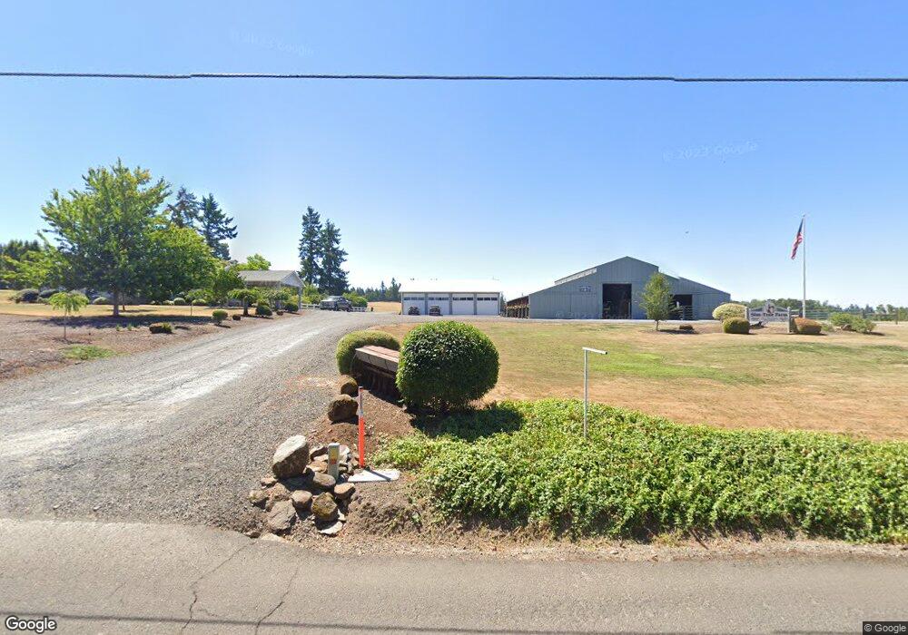
This home is located at 12676 S Union Hall Rd, Canby, OR 97013 and is currently estimated at $1,348,928, approximately $569 per square foot. 12676 S Union Hall Rd is a home located in Clackamas County with nearby schools including Josefa L. Sambrano Elementary School, Carus School, and Cecile Trost Elementary School.
Ownership History
Date
Name
Owned For
Owner Type
Purchase Details
Closed on
Dec 5, 2019
Sold by
Sandberg Daniel E and Sandberg Rory O
Bought by
Sandberg Daniel E and Sandberg Rory O
Current Estimated Value
Purchase Details
Closed on
Feb 4, 1999
Sold by
Reed Arthur L and Reed Esther K
Bought by
Sandberg Daniel E and Sandberg Rory O
Home Financials for this Owner
Home Financials are based on the most recent Mortgage that was taken out on this home.
Original Mortgage
$165,000
Outstanding Balance
$38,369
Interest Rate
6.79%
Estimated Equity
$1,310,559
Create a Home Valuation Report for This Property
The Home Valuation Report is an in-depth analysis detailing your home's value as well as a comparison with similar homes in the area
Home Values in the Area
Average Home Value in this Area
Purchase History
| Date | Buyer | Sale Price | Title Company |
|---|---|---|---|
| Sandberg Daniel E | -- | None Available | |
| Sandberg Daniel E | $475,000 | Chicago Title Insurance Co |
Source: Public Records
Mortgage History
| Date | Status | Borrower | Loan Amount |
|---|---|---|---|
| Open | Sandberg Daniel E | $165,000 |
Source: Public Records
Tax History Compared to Growth
Tax History
| Year | Tax Paid | Tax Assessment Tax Assessment Total Assessment is a certain percentage of the fair market value that is determined by local assessors to be the total taxable value of land and additions on the property. | Land | Improvement |
|---|---|---|---|---|
| 2025 | $4,759 | $358,851 | -- | -- |
| 2024 | $4,629 | $348,573 | -- | -- |
| 2023 | $4,629 | $338,595 | $0 | $0 |
| 2022 | $4,572 | $328,908 | $0 | $0 |
| 2021 | $4,396 | $319,507 | $0 | $0 |
| 2020 | $4,332 | $310,329 | $0 | $0 |
| 2019 | $4,107 | $301,430 | $0 | $0 |
| 2018 | $4,025 | $292,805 | $0 | $0 |
| 2017 | $3,928 | $284,369 | $0 | $0 |
| 2016 | $3,795 | $276,293 | $0 | $0 |
| 2015 | $3,058 | $224,078 | $0 | $0 |
| 2014 | $2,972 | $217,728 | $0 | $0 |
Source: Public Records
Map
Nearby Homes
- 12192 S Mulino Rd
- 13511 S Freeman Rd
- 24450 S Highway 213
- 11800 S Carus Rd
- 26684 S Fish Rd
- 26740 S Fish Rd
- 11700 S Makin Ln
- 24843 S Blundell Rd
- 12720 S Carus Rd
- 26250 S Milk Creek Cir
- 13392 S Carus Rd
- 14980 S Buckner Creek Rd
- 0 S Ranch Hills Rd
- 13920 S Lucia Ln
- 0 S MacKsburg Rd
- 22396 S Parrot Creek Rd
- 14212 S Mueller Rd
- 22876 S Highway 213
- 11600 S Emerson Rd
- 12051 S Riggs Damm Rd
- 12599 S Union Hall Rd
- 12559 S Union Hall Rd
- 12530 S Union Hall Rd
- 12773 S Union Hall Rd
- 12950 S Union Hall Rd
- 12501 S Union Hall Rd
- 12962 S Union Hall Rd
- 12919 S Union Hall Rd
- 12587 S Union Hall Rd
- 12777 S Union Hall Rd
- 25015 S Zeller Dr
- 12885 S Union Hall Rd
- 25185 S Zeller Dr
- 25025 S Zeller Dr
- 13010 S Union Hall Rd
- 12850 S Union Hall Rd
- 25125 S Zeller Dr
- 25165 S Zeller Dr
- 25255 S Zeller Dr
- 25235 S Zeller Dr