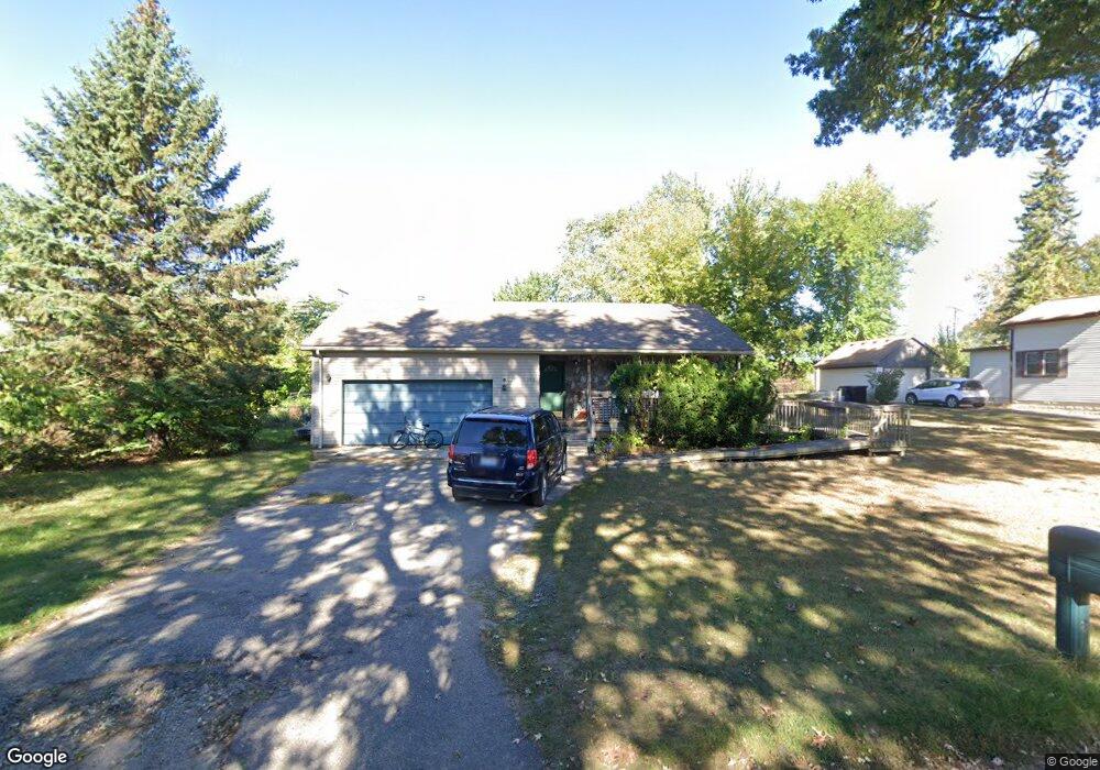
1268 Atkinson Ave Bloomfield Hills, MI 48302
Estimated Value: $331,000 - $409,000
3
Beds
2
Baths
1,672
Sq Ft
$225/Sq Ft
Est. Value
About This Home
This home is located at 1268 Atkinson Ave, Bloomfield Hills, MI 48302 and is currently estimated at $376,094, approximately $224 per square foot. 1268 Atkinson Ave is a home located in Oakland County with nearby schools including Walt Whitman Elementary School, Pontiac Middle School, and Pontiac High School.
Ownership History
Date
Name
Owned For
Owner Type
Purchase Details
Closed on
Jul 13, 1995
Sold by
Dagostino Joseph T
Bought by
Martin L Brenner
Current Estimated Value
Home Financials for this Owner
Home Financials are based on the most recent Mortgage that was taken out on this home.
Original Mortgage
$87,200
Interest Rate
7.59%
Mortgage Type
New Conventional
Create a Home Valuation Report for This Property
The Home Valuation Report is an in-depth analysis detailing your home's value as well as a comparison with similar homes in the area
Home Values in the Area
Average Home Value in this Area
Purchase History
| Date | Buyer | Sale Price | Title Company |
|---|---|---|---|
| Martin L Brenner | $109,000 | -- |
Source: Public Records
Mortgage History
| Date | Status | Borrower | Loan Amount |
|---|---|---|---|
| Closed | Martin L Brenner | $87,200 |
Source: Public Records
Tax History Compared to Growth
Tax History
| Year | Tax Paid | Tax Assessment Tax Assessment Total Assessment is a certain percentage of the fair market value that is determined by local assessors to be the total taxable value of land and additions on the property. | Land | Improvement |
|---|---|---|---|---|
| 2024 | $1,187 | $191,290 | $0 | $0 |
| 2023 | $1,133 | $171,650 | $0 | $0 |
| 2022 | $1,937 | $144,180 | $0 | $0 |
| 2021 | $1,898 | $124,530 | $0 | $0 |
| 2020 | $1,043 | $119,750 | $0 | $0 |
| 2019 | $1,856 | $109,030 | $0 | $0 |
| 2018 | $1,824 | $99,390 | $0 | $0 |
| 2017 | $1,797 | $98,910 | $0 | $0 |
| 2016 | $1,792 | $92,650 | $0 | $0 |
| 2015 | -- | $89,040 | $0 | $0 |
| 2014 | -- | $84,340 | $0 | $0 |
| 2011 | -- | $51,920 | $0 | $0 |
Source: Public Records
Map
Nearby Homes
- 1160 Dorchester Ave
- 1785 Ward Rd
- 1061 Dorchester Ave
- 1205 Leinbach Ave
- 0000 Ward Road Ward Rd
- 1075 Canterbury Dr
- 49 Canal Dr Unit 300-049
- 21 Canal Dr Unit 300-021
- 1675 Dell Rose Dr
- 25 Riverbank Dr Unit 300-125
- 27 Riverbank Dr Unit 300-127
- 14 Riverbank Dr Unit 300-114
- 26 Edna Ave
- 1796 Briarcliff St
- 1968 Maplewood Ave
- 1947 Maplewood Ave
- 901 Argyle Ave
- 1775 Woodland Ave
- 8 Myra Ave
- 2216 Middlebelt Rd
- 1278 Atkinson Ave
- 1254 Atkinson Ave
- 1865 Orchard Lake Rd
- 1284 Atkinson Ave
- 1265 Atkinson Ave
- 1271 Atkinson Ave
- 1234 Atkinson Ave
- 1283 Atkinson Ave
- 1239 Atkinson Ave
- 1292 Atkinson Ave
- 1289 Atkinson Ave
- 1248 Desiax Ave
- 1276 Desiax Ave
- 1877 Orchard Lake Rd
- 1877 Orchard Lake Rd Unit 104
- 1877 Orchard Lake Rd Unit 101
- 1877 Orchard Lake Rd Unit 204
- 1877 Orchard Lake Rd Unit 201
- 1877 Orchard Lake Rd Unit 202
- 1877 Orchard Lake Rd