Estimated Value: $229,900 - $373,000
Studio
--
Bath
1,568
Sq Ft
$198/Sq Ft
Est. Value
About This Home
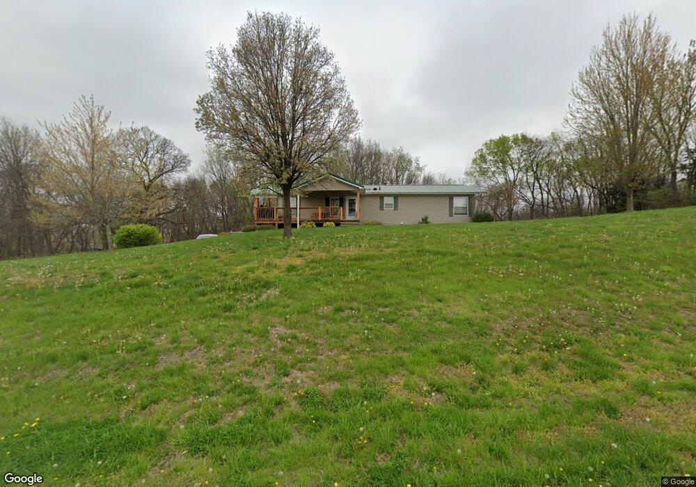
This home is located at 12681 SE Mt Moriah Rd, Gower, MO 64454 and is currently estimated at $310,725, approximately $198 per square foot. 12681 SE Mt Moriah Rd is a home located in Buchanan County with nearby schools including East Buchanan Middle School and East Buchanan High School.
Ownership History
Date
Name
Owned For
Owner Type
Purchase Details
Closed on
Mar 29, 2021
Sold by
Stapleton Richard W and Stapleton Robin L
Bought by
Ostrander Aaron Brock
Current Estimated Value
Home Financials for this Owner
Home Financials are based on the most recent Mortgage that was taken out on this home.
Original Mortgage
$225,000
Outstanding Balance
$201,342
Interest Rate
2.73%
Mortgage Type
New Conventional
Estimated Equity
$109,383
Create a Home Valuation Report for This Property
The Home Valuation Report is an in-depth analysis detailing your home's value as well as a comparison with similar homes in the area
Purchase History
| Date | Buyer | Sale Price | Title Company |
|---|---|---|---|
| Ostrander Aaron Brock | -- | First American Title Ins Co | |
| Ostrander Aaron Brock | -- | First American Title |
Source: Public Records
Mortgage History
| Date | Status | Borrower | Loan Amount |
|---|---|---|---|
| Open | Ostrander Aaron Brock | $225,000 | |
| Closed | Ostrander Aaron Brock | $225,000 |
Source: Public Records
Tax History
| Year | Tax Paid | Tax Assessment Tax Assessment Total Assessment is a certain percentage of the fair market value that is determined by local assessors to be the total taxable value of land and additions on the property. | Land | Improvement |
|---|---|---|---|---|
| 2025 | $1,719 | $23,950 | $3,800 | $20,150 |
| 2024 | $1,649 | $22,670 | $3,800 | $18,870 |
| 2023 | $1,649 | $22,670 | $3,800 | $18,870 |
| 2022 | $1,481 | $22,670 | $3,800 | $18,870 |
| 2021 | $1,468 | $22,670 | $3,800 | $18,870 |
| 2020 | $1,487 | $22,670 | $3,800 | $18,870 |
| 2019 | $1,481 | $22,670 | $3,800 | $18,870 |
| 2018 | $1,336 | $20,510 | $1,200 | $19,310 |
| 2017 | $1,345 | $20,510 | $0 | $0 |
| 2015 | $2 | $20,510 | $0 | $0 |
| 2014 | $1,360 | $20,510 | $0 | $0 |
Source: Public Records
Map
Nearby Homes
- 703 Judith Ave
- 0 Highway 169
- 316 Gregory Dr
- 332 Matthews Ln
- 328 Matthews Ln
- 327 Lincoln Dr
- 325 Matthews Ln
- 511 Santa fe Dr
- 406 Frederick Dr
- 104 Ac Graves Ln
- 0 S East 95th Rd
- 12120 SE West Rd
- 15500 70th Rd SE
- 27 Partridge Dr
- 0 6 Hwy Unit HMS2587486
- 7693 SE Benner Lake Rd
- 4480 NW 312th St
- 0 SE 36 Hwy
- 0 NW 356th St
- 2 Tara Ln
- 12601 SE Mt Moriah Rd
- 12640 SE Mt Moriah Rd
- 12830 SE Mt Moriah Rd
- 12950 SE Mt Moriah Rd
- 12945 SE Mt Moriah Rd
- 12820 SE Mt Moriah Rd
- 12230 SE Mt Moriah Rd
- 12210 SE Mt Moriah Rd
- 12206 SE Mt Moriah Rd
- 12900 SE 130th Rd
- 12900 SE 130 Rd
- 13291 SE Mt Moriah Rd
- 13291 SE Mount Moriah Rd
- 12121 SE Mt Moriah Rd
- 13271 SE Mt Moriah Rd
- 13050 SE 130th Rd
- 12493 SE 135th Rd
- 12211 SE 135th Rd
- 13300 SE 130th Rd
- 12655 State Route H SE
Your Personal Tour Guide
Ask me questions while you tour the home.