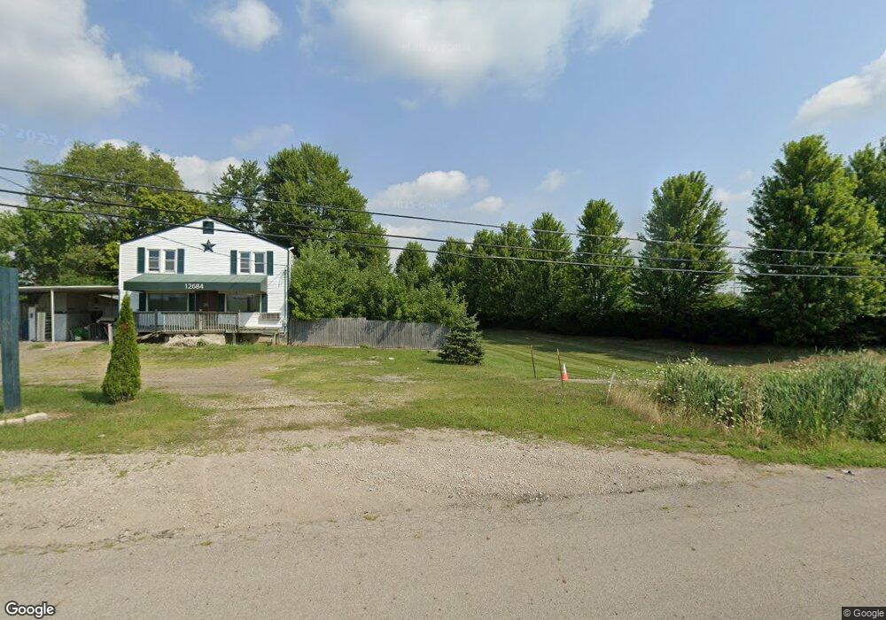
12684 Broad St SW Pataskala, OH 43062
Estimated Value: $256,842
--
Bed
--
Bath
650
Sq Ft
$395/Sq Ft
Est. Value
About This Home
This home is located at 12684 Broad St SW, Pataskala, OH 43062 and is currently estimated at $256,842, approximately $395 per square foot. 12684 Broad St SW is a home located in Licking County with nearby schools including North Elementary School, Licking Heights Central, and Licking Heights High School.
Ownership History
Date
Name
Owned For
Owner Type
Purchase Details
Closed on
May 23, 2018
Sold by
Cheng Laura and Cheng Yung Rang
Bought by
Harlor Dwight H
Current Estimated Value
Purchase Details
Closed on
Jan 30, 2012
Sold by
Jackson James and Jackson Keith
Bought by
Harlor Dwight H and Cheng Yungrang
Purchase Details
Closed on
Jun 29, 2011
Sold by
Estate Of Jonathan Robert Jackson
Bought by
Jackson Keith and Jackson James
Home Financials for this Owner
Home Financials are based on the most recent Mortgage that was taken out on this home.
Original Mortgage
$5,034
Interest Rate
4.52%
Mortgage Type
Commercial
Purchase Details
Closed on
Jan 16, 1997
Sold by
Rozanczyk Henry
Bought by
Willis Charles E and Willis Sheila L
Home Financials for this Owner
Home Financials are based on the most recent Mortgage that was taken out on this home.
Original Mortgage
$112,924
Interest Rate
7.54%
Mortgage Type
Commercial
Create a Home Valuation Report for This Property
The Home Valuation Report is an in-depth analysis detailing your home's value as well as a comparison with similar homes in the area
Home Values in the Area
Average Home Value in this Area
Purchase History
| Date | Buyer | Sale Price | Title Company |
|---|---|---|---|
| Harlor Dwight H | -- | None Available | |
| Harlor Dwight H | $90,000 | All Ohio Ti | |
| Jackson Keith | -- | Attorney | |
| Willis Charles E | $115,000 | -- |
Source: Public Records
Mortgage History
| Date | Status | Borrower | Loan Amount |
|---|---|---|---|
| Previous Owner | Jackson Keith | $5,034 | |
| Previous Owner | Jackson Keith | $10,500 | |
| Previous Owner | Willis Charles E | $112,924 |
Source: Public Records
Tax History Compared to Growth
Tax History
| Year | Tax Paid | Tax Assessment Tax Assessment Total Assessment is a certain percentage of the fair market value that is determined by local assessors to be the total taxable value of land and additions on the property. | Land | Improvement |
|---|---|---|---|---|
| 2024 | $2,885 | $51,070 | $19,950 | $31,120 |
| 2023 | $2,973 | $51,070 | $19,950 | $31,120 |
| 2022 | $3,014 | $43,340 | $25,450 | $17,890 |
| 2021 | $3,141 | $43,340 | $25,450 | $17,890 |
| 2020 | $3,090 | $43,340 | $25,450 | $17,890 |
| 2019 | $3,157 | $43,340 | $25,450 | $17,890 |
| 2018 | $3,236 | $0 | $0 | $0 |
| 2017 | $3,253 | $0 | $0 | $0 |
| 2016 | $3,284 | $0 | $0 | $0 |
| 2015 | $3,128 | $0 | $0 | $0 |
| 2014 | $3,736 | $0 | $0 | $0 |
| 2013 | $3,176 | $0 | $0 | $0 |
Source: Public Records
Map
Nearby Homes
- 65 Daley Dr SW
- 7376 Mink St SW
- 209 Rona Blvd
- 211 Rona Blvd
- 220 Woodland Sky Dr
- 131 Broadmoore Blvd
- 507 Curry Dr
- 413 Halton Dr
- 13771 Cleveland Rd SW
- 0 Mink St SW
- 0 Mink St SW Unit 13 225006231
- 13770 Cleveland Rd SW
- 7954 Mink St SW
- 5181 Mink St SW
- 805 Saddle Ave
- 23 1st St SW
- 55 1st St SW
- 11034 Broad St SW
- Somerset Plan at Borders Place
- Carlisle Plan at Borders Place
- 12694 Broad St SW
- 12676 Broad St SW
- 12706 Broad St SW
- 12724 Broad St SW
- 12726 Broad St SW
- 12746 Broad St SW
- 12768 Broad St SW
- 6607 Mink St SW
- 12778 Broad St SW
- 12778 Broad St SW
- 6554 Mink St SW
- 12477 E Broad St SW
- 12800 Adams Ln SW
- 6770 Mink St SW
- 12876 Broad St SW
- 6359 Mink St SW
- 12908 Broad St SW
- 12908 Broad St SW
- 12924 Cleveland Rd SW
- 6331 Mink St SW