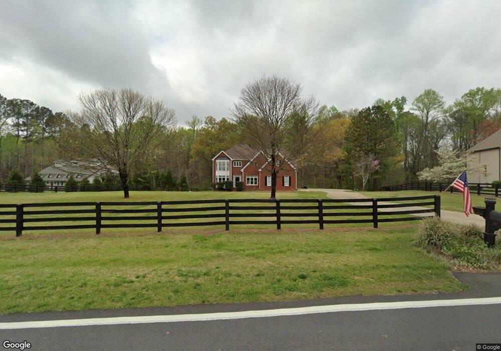
12685 Etris Rd Roswell, GA 30075
Estimated Value: $420,000 - $747,000
4
Beds
4
Baths
2,201
Sq Ft
$293/Sq Ft
Est. Value
About This Home
This home is located at 12685 Etris Rd, Roswell, GA 30075 and is currently estimated at $645,295, approximately $293 per square foot. 12685 Etris Rd is a home located in Fulton County with nearby schools including Sweet Apple Elementary School, Elkins Pointe Middle School, and Fulton Academy of Science and Technology.
Ownership History
Date
Name
Owned For
Owner Type
Purchase Details
Closed on
Jun 24, 2021
Sold by
Idris Samia
Bought by
Checkon Matthew Joseph and Checkon Coleen M
Current Estimated Value
Home Financials for this Owner
Home Financials are based on the most recent Mortgage that was taken out on this home.
Original Mortgage
$467,400
Outstanding Balance
$423,172
Interest Rate
2.9%
Mortgage Type
New Conventional
Estimated Equity
$222,123
Purchase Details
Closed on
Jun 11, 2015
Sold by
Jackson Asa C
Bought by
Hamid Idris A and Idris Samia
Purchase Details
Closed on
Jun 1, 1993
Sold by
Mospanyuk Pavel Lyubou
Bought by
Hamid Idris A
Create a Home Valuation Report for This Property
The Home Valuation Report is an in-depth analysis detailing your home's value as well as a comparison with similar homes in the area
Home Values in the Area
Average Home Value in this Area
Purchase History
| Date | Buyer | Sale Price | Title Company |
|---|---|---|---|
| Checkon Matthew Joseph | $492,000 | -- | |
| Hamid Idris A | -- | -- | |
| Hamid Idris A | $90,000 | -- |
Source: Public Records
Mortgage History
| Date | Status | Borrower | Loan Amount |
|---|---|---|---|
| Open | Checkon Matthew Joseph | $467,400 |
Source: Public Records
Tax History Compared to Growth
Tax History
| Year | Tax Paid | Tax Assessment Tax Assessment Total Assessment is a certain percentage of the fair market value that is determined by local assessors to be the total taxable value of land and additions on the property. | Land | Improvement |
|---|---|---|---|---|
| 2025 | $740 | $145,000 | $45,320 | $99,680 |
| 2023 | $4,223 | $149,600 | $45,320 | $104,280 |
| 2022 | $3,936 | $149,600 | $45,320 | $104,280 |
| 2021 | $4,544 | $142,680 | $44,000 | $98,680 |
| 2020 | $4,617 | $141,000 | $43,480 | $97,520 |
| 2019 | $686 | $138,520 | $42,720 | $95,800 |
| 2018 | $3,818 | $135,280 | $41,720 | $93,560 |
| 2017 | $3,533 | $121,080 | $26,960 | $94,120 |
| 2016 | $3,533 | $121,080 | $26,960 | $94,120 |
| 2015 | $4,208 | $121,080 | $26,960 | $94,120 |
| 2014 | $3,711 | $121,080 | $26,960 | $94,120 |
Source: Public Records
Map
Nearby Homes
- 12867 Etris Walk
- 130 Nova Ln
- 161 Brook Ln
- 12660 Ebenezer Pond Ct
- 12655 New Providence Rd
- 12950 New Providence Rd
- 137 Quinn Way
- 127 Quinn Way
- 105 Kensington Pond Ct
- 915 Ebenezer Rd
- 113 Quinn Way
- 580 Stillhouse Ln Unit 2
- 515 Kent Rd
- 257 Ranchette Rd
- 12620 Old Surrey Place
- 1565 Parkside Dr
- 12857 Waterside Dr
- 12842 Waterside Dr Unit 2
- 13150 New Providence Rd
- 12685 Etris Rd
- 12665 Etris Rd
- 12725 Etris Rd
- 12725 Etris Rd
- 12720 Etris Rd
- 12720 Etris Rd Unit 12
- 12735 Etris Rd
- 12735 Etris Rd
- 12780 Etris Rd
- 12635 Etris Rd
- 12740 Etris Rd
- 12745 Etris Rd
- 630 Woodstream Ct
- 620 Woodstream Ct
- 354 Cox Rd
- 12640 Etris Rd
- 12872 Etris Walk
- 12872 Etris Rd
- 364 Cox Rd
- 360 Cox Rd