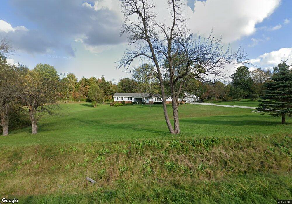
12685 Sperry Rd Chesterland, OH 44026
Estimated Value: $333,000 - $445,000
3
Beds
2
Baths
1,866
Sq Ft
$210/Sq Ft
Est. Value
About This Home
This home is located at 12685 Sperry Rd, Chesterland, OH 44026 and is currently estimated at $391,452, approximately $209 per square foot. 12685 Sperry Rd is a home located in Geauga County with nearby schools including West Geauga High School, St Anselm School, and Notre Dame Elementary School.
Ownership History
Date
Name
Owned For
Owner Type
Purchase Details
Closed on
Feb 15, 2023
Sold by
Sainsbury Timothy D and Sainsbury Claire E
Bought by
Ewers Family Trust
Current Estimated Value
Purchase Details
Closed on
Dec 2, 2014
Sold by
Stumpf Arnold M and Stumpf Evelyn M
Bought by
Stumpf Arnold M and Stumpf Evelyn M
Purchase Details
Closed on
Oct 22, 1999
Sold by
Trustees Stumpf David J & Arnold M & Christi
Bought by
Stumpf David J and Stumpf Arnold M
Purchase Details
Closed on
Jan 1, 1990
Bought by
Stumpf Arnold M
Create a Home Valuation Report for This Property
The Home Valuation Report is an in-depth analysis detailing your home's value as well as a comparison with similar homes in the area
Home Values in the Area
Average Home Value in this Area
Purchase History
| Date | Buyer | Sale Price | Title Company |
|---|---|---|---|
| Ewers Family Trust | -- | Erie Title | |
| Stumpf Arnold M | -- | Attorney | |
| Stumpf David J | -- | -- | |
| Stumpf Arnold M | -- | -- |
Source: Public Records
Tax History Compared to Growth
Tax History
| Year | Tax Paid | Tax Assessment Tax Assessment Total Assessment is a certain percentage of the fair market value that is determined by local assessors to be the total taxable value of land and additions on the property. | Land | Improvement |
|---|---|---|---|---|
| 2024 | $5,482 | $135,910 | $46,240 | $89,670 |
| 2023 | $5,482 | $135,910 | $46,240 | $89,670 |
| 2022 | $4,721 | $101,820 | $38,750 | $63,070 |
| 2021 | $5,601 | $101,820 | $38,750 | $63,070 |
| 2020 | $5,787 | $101,820 | $38,750 | $63,070 |
| 2019 | $5,515 | $93,600 | $38,750 | $54,850 |
| 2018 | $5,478 | $93,600 | $38,750 | $54,850 |
| 2017 | $5,515 | $93,600 | $38,750 | $54,850 |
| 2016 | $5,668 | $91,630 | $36,960 | $54,670 |
| 2015 | $4,295 | $91,630 | $36,960 | $54,670 |
| 2014 | $4,295 | $72,800 | $18,130 | $54,670 |
| 2013 | $4,319 | $72,800 | $18,130 | $54,670 |
Source: Public Records
Map
Nearby Homes
- 9448 Mayfield Rd
- 9475 Mayfield Rd
- 12790 Heath Rd
- 8949 Ranch Dr
- 8701 Mayfield Rd Unit 194
- 9502 Winchester Valley
- 8735 Cedar Rd
- 8547 Camelot Dr
- 12084 Heath Rd
- 9610 Wilson Mills Rd
- 0 Cedar Rd
- 9710 Wilson Mills Rd
- 11865 Africa Acres Dr
- 13031 Dorothy Dr
- 13610 Sperry Rd
- 13655 Sperry Rd
- 10263 Wye Rd
- 8986 Fairmount Rd
- 10036 Wilson Mills Rd
- 0 Merrie Ln
- 12692 Sperry Rd
- 12725 Sperry Rd
- 12676 Sperry Rd
- 12658 Sperry Rd
- 12690 Sperry Rd
- 12726 Sperry Rd
- 9284 Mayfield Rd
- 12638 Sperry Rd
- 12638 Sperry Rd
- 12680 Sperry Rd
- 9300 Mayfield Rd
- 12652 Sperry Rd
- 12629 Sperry Rd
- 9164 Mayfield Rd
- 12780 Sperry Rd
- 9144 Mayfield Rd
- 12602 Sperry Rd
- 9320 Mayfield Rd
- 9165 Mayfield Rd
- 12792 Sperry Rd