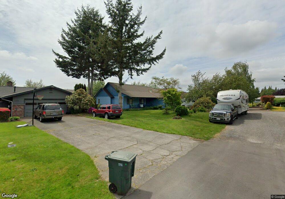
1269 Belfern Dr Bellingham, WA 98226
Estimated Value: $603,000 - $682,000
3
Beds
2
Baths
1,592
Sq Ft
$401/Sq Ft
Est. Value
About This Home
This home is located at 1269 Belfern Dr, Bellingham, WA 98226 and is currently estimated at $639,103, approximately $401 per square foot. 1269 Belfern Dr is a home located in Whatcom County with nearby schools including Central Elementary School, Vista Middle School, and Ferndale High School.
Ownership History
Date
Name
Owned For
Owner Type
Purchase Details
Closed on
Apr 9, 2014
Sold by
Kuntz Eric C and Kuntz Marcella M
Bought by
Kuntz Family Trust and Kuntz Marcella M
Current Estimated Value
Purchase Details
Closed on
Jan 23, 2010
Sold by
Barti Alex and Barti Judy
Bought by
Kuntz Eric C and Kuntz Marcella Moore
Home Financials for this Owner
Home Financials are based on the most recent Mortgage that was taken out on this home.
Original Mortgage
$150,000
Interest Rate
4.35%
Mortgage Type
New Conventional
Purchase Details
Closed on
Mar 16, 2001
Sold by
Roosendaal Honcoop Construction Inc
Bought by
Bartl Alex and Bartl Judy
Home Financials for this Owner
Home Financials are based on the most recent Mortgage that was taken out on this home.
Original Mortgage
$154,600
Interest Rate
7.11%
Create a Home Valuation Report for This Property
The Home Valuation Report is an in-depth analysis detailing your home's value as well as a comparison with similar homes in the area
Home Values in the Area
Average Home Value in this Area
Purchase History
| Date | Buyer | Sale Price | Title Company |
|---|---|---|---|
| Kuntz Family Trust | -- | None Available | |
| Kuntz Eric C | $298,780 | First American Title Insuran | |
| Bartl Alex | $147,670 | Whatcom Land Title |
Source: Public Records
Mortgage History
| Date | Status | Borrower | Loan Amount |
|---|---|---|---|
| Closed | Kuntz Eric C | $150,000 | |
| Previous Owner | Bartl Alex | $154,600 |
Source: Public Records
Tax History Compared to Growth
Tax History
| Year | Tax Paid | Tax Assessment Tax Assessment Total Assessment is a certain percentage of the fair market value that is determined by local assessors to be the total taxable value of land and additions on the property. | Land | Improvement |
|---|---|---|---|---|
| 2024 | $3,680 | $500,198 | $220,675 | $279,523 |
| 2023 | $3,680 | $518,772 | $250,000 | $268,772 |
| 2022 | $3,957 | $522,097 | $148,834 | $373,263 |
| 2021 | $3,994 | $431,485 | $123,003 | $308,482 |
| 2020 | $3,846 | $399,533 | $113,895 | $285,638 |
| 2019 | $3,064 | $347,982 | $99,199 | $248,783 |
| 2018 | $3,513 | $318,149 | $90,695 | $227,454 |
| 2017 | $3,096 | $278,809 | $79,480 | $199,329 |
| 2016 | $2,916 | $262,830 | $77,168 | $185,662 |
| 2015 | $2,935 | $247,299 | $73,059 | $174,240 |
| 2014 | -- | $242,227 | $71,400 | $170,827 |
| 2013 | -- | $238,968 | $70,000 | $168,968 |
Source: Public Records
Map
Nearby Homes
- 5350 Kaitlyn Ct
- 5330 Bel Dr W
- 5306 Myers Dr
- 1333 W Smith Rd
- 5295 Graveline Rd
- 1411 Woods Point Loop
- 5502 Northwest Dr
- 1371 W Axton Rd
- 1245 W Axton Rd
- 1300 W Axton Rd
- 5162 Spoonbill Ln
- 5400 Barrett Rd
- 5391 La Bounty Dr
- 5094 Labounty Rd
- 0 W Axton Rd
- 4958 Pacific Hwy
- 1474 Sunset Ave
- 1655 Main St
- 794 W Smith Rd
- 5925 Longdin Rd
- 1273 Belfern Dr
- 1265 Belfern Dr
- 5409 Bellaire Dr
- 5403 Bellaire Dr
- 5415 Bellaire Dr
- 1268 Belfern Dr
- 1259 Belfern Dr
- 1274 Belfern Dr
- 5421 Bellaire Dr
- 1262 Belfern Dr
- 5397 Bellaire Dr
- 5400 Bellaire Dr
- 5427 Bellaire Dr
- 1256 Belfern Dr
- 5390 Bellaire Dr
- 5391 Bellaire Dr
- 5407 Cypress Dr
- 5410 Bellaire Dr
- 5433 Bellaire Dr
- 1250 Belfern Dr