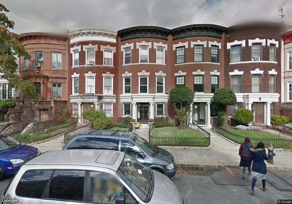
1269 Carroll St Brooklyn, NY 11213
Crown Heights NeighborhoodEstimated Value: $2,032,000 - $2,594,000
--
Bed
--
Bath
3,372
Sq Ft
$675/Sq Ft
Est. Value
About This Home
This home is located at 1269 Carroll St, Brooklyn, NY 11213 and is currently estimated at $2,275,948, approximately $674 per square foot. 1269 Carroll St is a home located in Kings County with nearby schools including P.S. 161 - The Crown School, M.S. 61 Dr. Gladstone H. Atwell Middle School, and St Mark's Day School.
Ownership History
Date
Name
Owned For
Owner Type
Purchase Details
Closed on
Dec 21, 2007
Sold by
Montgomery Roger and Montgomery Selma
Bought by
Hunt Shawn
Current Estimated Value
Home Financials for this Owner
Home Financials are based on the most recent Mortgage that was taken out on this home.
Original Mortgage
$131,200
Outstanding Balance
$83,290
Interest Rate
6.27%
Estimated Equity
$2,192,658
Create a Home Valuation Report for This Property
The Home Valuation Report is an in-depth analysis detailing your home's value as well as a comparison with similar homes in the area
Home Values in the Area
Average Home Value in this Area
Purchase History
| Date | Buyer | Sale Price | Title Company |
|---|---|---|---|
| Hunt Shawn | $875,000 | -- | |
| Hunt Shawn | $875,000 | -- |
Source: Public Records
Mortgage History
| Date | Status | Borrower | Loan Amount |
|---|---|---|---|
| Open | Hunt Shawn | $131,200 | |
| Closed | Hunt Shawn | $131,200 | |
| Open | Hunt Shawn | $700,000 | |
| Closed | Hunt Shawn | $700,000 |
Source: Public Records
Tax History Compared to Growth
Tax History
| Year | Tax Paid | Tax Assessment Tax Assessment Total Assessment is a certain percentage of the fair market value that is determined by local assessors to be the total taxable value of land and additions on the property. | Land | Improvement |
|---|---|---|---|---|
| 2025 | $9,335 | $113,340 | $23,280 | $90,060 |
| 2024 | $9,335 | $133,320 | $23,280 | $110,040 |
| 2023 | $9,422 | $117,960 | $23,280 | $94,680 |
| 2022 | $9,182 | $122,160 | $23,280 | $98,880 |
| 2021 | $9,126 | $111,720 | $23,280 | $88,440 |
| 2020 | $4,273 | $112,500 | $23,280 | $89,220 |
| 2019 | $8,053 | $112,500 | $23,280 | $89,220 |
| 2018 | $7,750 | $39,480 | $7,986 | $31,494 |
| 2017 | $7,687 | $39,181 | $12,502 | $26,679 |
| 2016 | $7,080 | $36,964 | $15,538 | $21,426 |
| 2015 | $4,238 | $34,873 | $21,974 | $12,899 |
| 2014 | $4,238 | $32,900 | $24,877 | $8,023 |
Source: Public Records
Map
Nearby Homes
- 421 Crown St Unit 16R
- 1387 Union St
- 658 Eastern Pkwy
- 767 Eastern Pkwy Unit 1A
- 767 Eastern Pkwy Unit 1B
- 767 Eastern Pkwy Unit 4B
- 773 Eastern Pkwy Unit 3C
- 773 Eastern Pkwy Unit 1A
- 773 Eastern Pkwy Unit 2B
- 773 Eastern Pkwy Unit 2A
- 975 Lincoln Place
- 20 Lamont Ct
- 1478 Union St
- 248 Avenue S
- 968 Saint Johns Place
- 259 New York Ave
- 446 Kingston Ave Unit D9
- 1143 Carroll St
- 1206 Union St
- 1198 Union St
- 1267 Carroll St
- 1271 Carroll St
- 1273 Carroll St
- 1265 Carroll St
- 1263 Carroll St
- 1275 Carroll St
- 1261 Carroll St
- 1279 Carroll St
- 1281 Carroll St
- 1259 Carroll St
- 1257 Carroll St
- 1283 Carroll St
- 1310 President St
- 1316 President St
- 1318 President St
- 1255 Carroll St
- 1285 Carroll St
- 1304 President St
- 1320 President St
- 1253 Carroll St