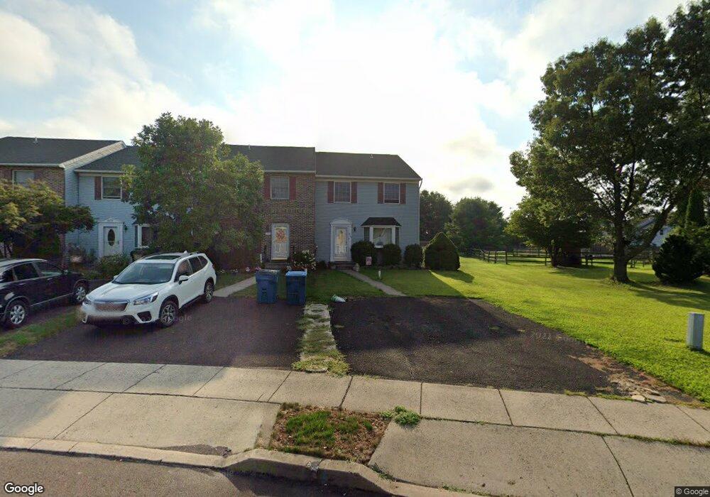
1269 Needham Cir Hatfield, PA 19440
Estimated Value: $399,000 - $425,000
3
Beds
2
Baths
1,672
Sq Ft
$245/Sq Ft
Est. Value
About This Home
This home is located at 1269 Needham Cir, Hatfield, PA 19440 and is currently estimated at $409,810, approximately $245 per square foot. 1269 Needham Cir is a home located in Montgomery County with nearby schools including A. M. Kulp Elementary School, Pennfield Middle School, and North Penn Senior High School.
Ownership History
Date
Name
Owned For
Owner Type
Purchase Details
Closed on
Feb 23, 2007
Sold by
Messa David P and Messa Deborah A
Bought by
Messa Deborah A
Current Estimated Value
Home Financials for this Owner
Home Financials are based on the most recent Mortgage that was taken out on this home.
Original Mortgage
$175,000
Interest Rate
6.3%
Create a Home Valuation Report for This Property
The Home Valuation Report is an in-depth analysis detailing your home's value as well as a comparison with similar homes in the area
Home Values in the Area
Average Home Value in this Area
Purchase History
| Date | Buyer | Sale Price | Title Company |
|---|---|---|---|
| Messa Deborah A | -- | None Available |
Source: Public Records
Mortgage History
| Date | Status | Borrower | Loan Amount |
|---|---|---|---|
| Closed | Messa Deborah A | $175,000 |
Source: Public Records
Tax History Compared to Growth
Tax History
| Year | Tax Paid | Tax Assessment Tax Assessment Total Assessment is a certain percentage of the fair market value that is determined by local assessors to be the total taxable value of land and additions on the property. | Land | Improvement |
|---|---|---|---|---|
| 2025 | $4,898 | $122,320 | $26,670 | $95,650 |
| 2024 | $4,898 | $122,320 | $26,670 | $95,650 |
| 2023 | $4,688 | $122,320 | $26,670 | $95,650 |
| 2022 | $4,535 | $122,320 | $26,670 | $95,650 |
| 2021 | $4,406 | $122,320 | $26,670 | $95,650 |
| 2020 | $4,301 | $122,320 | $26,670 | $95,650 |
| 2019 | $4,230 | $122,320 | $26,670 | $95,650 |
Source: Public Records
Map
Nearby Homes
- 1173 Independence Way
- 6 Township Line Rd
- 4595 County Line Rd
- 0 Fairmount St
- 165 Township Line Rd
- 2943 E Walnut St Unit 59
- 105 Barry Rd
- 83 Bethlehem Pike Unit 1306- HAMILTON PLAN
- 83 Bethlehem Pike Unit 1405
- 83 Bethlehem Pike Unit 1111
- 83 Bethlehem Pike Unit 1213 FIRESTONE
- 83 Bethlehem Pike Unit 1106- MADISON PLAN
- 83 Bethlehem Pike Unit 1102- IVY FLOORPLAN
- 83 Bethlehem Pike Unit 1109 LEWIS FLOORPLAN
- 2248 W Walnut St Unit 6
- 732 Cowpath Rd
- 113 E Vine St
- 36 N Maple Ave
- 144 Briarwood Ln
- 000 Lenape Dr
- 1273 Needham Cir
- 1277 Needham Cir
- 1253 Needham Cir
- 1281 Needham Cir
- 1249 Needham Cir
- 1289 Needham Cir
- 1245 Needham Cir
- 1111 Stoneham Cir
- 1115 Stoneham Cir
- 1119 Stoneham Cir
- 1107 Stoneham Cir
- 1241 Needham Cir
- 1237 Needham Cir
- 1303 Needham Cir
- 1103 Stoneham Cir
- 1139 Stoneham Cir
- 1307 Needham Cir
- 1221 Needham Cir
- 1268 Needham Cir
- 1311 Needham Cir