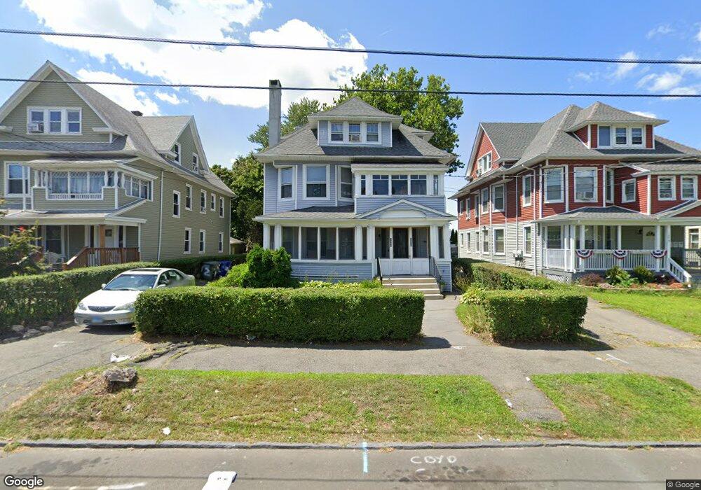
1269 Noble Ave Unit 1271 Bridgeport, CT 06608
North Bridgeport NeighborhoodEstimated Value: $606,000 - $978,106
6
Beds
3
Baths
3,863
Sq Ft
$193/Sq Ft
Est. Value
About This Home
This home is located at 1269 Noble Ave Unit 1271, Bridgeport, CT 06608 and is currently estimated at $744,277, approximately $192 per square foot. 1269 Noble Ave Unit 1271 is a home located in Fairfield County with nearby schools including Read School, Harding High School, and Achievement First Bridgeport Academy Elementary School.
Ownership History
Date
Name
Owned For
Owner Type
Purchase Details
Closed on
Sep 26, 2018
Sold by
Brown Jesse
Bought by
Brown Maisy
Current Estimated Value
Purchase Details
Closed on
Nov 9, 1987
Sold by
Crabtree Leon
Bought by
Brown Jesse
Home Financials for this Owner
Home Financials are based on the most recent Mortgage that was taken out on this home.
Original Mortgage
$145,000
Interest Rate
10.97%
Mortgage Type
Purchase Money Mortgage
Create a Home Valuation Report for This Property
The Home Valuation Report is an in-depth analysis detailing your home's value as well as a comparison with similar homes in the area
Home Values in the Area
Average Home Value in this Area
Purchase History
| Date | Buyer | Sale Price | Title Company |
|---|---|---|---|
| Brown Maisy | -- | -- | |
| Brown Maisy | -- | -- | |
| Brown Jesse | $204,900 | -- |
Source: Public Records
Mortgage History
| Date | Status | Borrower | Loan Amount |
|---|---|---|---|
| Previous Owner | Brown Jesse | $145,000 |
Source: Public Records
Tax History Compared to Growth
Tax History
| Year | Tax Paid | Tax Assessment Tax Assessment Total Assessment is a certain percentage of the fair market value that is determined by local assessors to be the total taxable value of land and additions on the property. | Land | Improvement |
|---|---|---|---|---|
| 2025 | $8,710 | $200,466 | $34,796 | $165,670 |
| 2024 | $8,710 | $200,466 | $34,796 | $165,670 |
| 2023 | $8,710 | $200,466 | $34,796 | $165,670 |
| 2022 | $8,710 | $200,466 | $34,796 | $165,670 |
| 2021 | $8,710 | $200,466 | $34,796 | $165,670 |
| 2020 | $8,360 | $154,840 | $16,490 | $138,350 |
| 2019 | $8,360 | $154,840 | $16,490 | $138,350 |
| 2018 | $8,419 | $154,840 | $16,490 | $138,350 |
| 2017 | $8,347 | $153,530 | $16,490 | $137,040 |
| 2016 | $8,237 | $151,490 | $16,490 | $135,000 |
| 2015 | $8,622 | $204,320 | $34,290 | $170,030 |
| 2014 | $8,622 | $204,320 | $34,290 | $170,030 |
Source: Public Records
Map
Nearby Homes
- 44 Locust St Unit 46
- 957 William St Unit A
- 142 Palm St
- 1014 Noble Ave
- 199 Bradley St Unit 203
- 1218 Kossuth St
- 178 Island Brook Ave
- 2031 E Main St
- 50 Goddard Ave
- 152 River St
- 105 Asylum St
- 202 Goddard Ave
- 502 Berkshire Ave
- 438 Park St
- 110 Asylum St
- 291 Stillman St
- 230 Hickory St
- 604 William St
- 369 Park St
- 83 Berkeley Place Unit 85
- 1259 Noble Ave Unit 1261
- 1279 Noble Ave Unit 1281
- 1251 Noble Ave
- 1318 Noble Ave Unit 1320
- 1237 Noble Ave Unit 1239
- 1246 Noble Ave Unit 1248
- 1315 Noble Ave Unit 10C
- 1315 Noble Ave Unit 9C
- 1315 Noble Ave Unit 8C
- 1315 Noble Ave Unit 7C
- 1315 Noble Ave Unit 6C
- 1315 Noble Ave Unit 5C
- 1315 Noble Ave Unit 4C
- 1315 Noble Ave Unit 3C
- 1315 Noble Ave Unit 2C
- 1315 Noble Ave Unit 1C
- 1315 Noble Ave Unit 10B
- 1315 Noble Ave Unit 9B
- 1315 Noble Ave Unit 8B
- 1315 Noble Ave Unit 7B