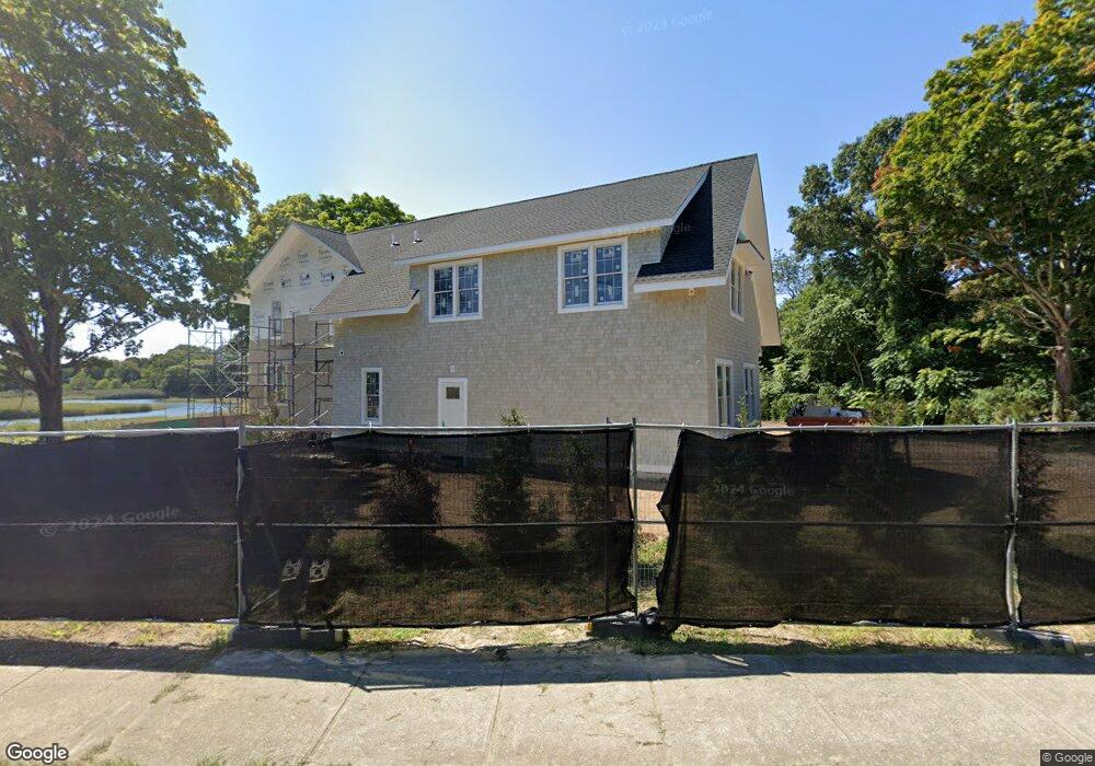
1269 Old Clinton Rd Westbrook, CT 06498
Estimated Value: $536,000 - $1,103,000
4
Beds
--
Bath
4,991
Sq Ft
$183/Sq Ft
Est. Value
About This Home
This home is located at 1269 Old Clinton Rd, Westbrook, CT 06498 and is currently estimated at $915,288, approximately $183 per square foot. 1269 Old Clinton Rd is a home located in Middlesex County with nearby schools including Daisy Ingraham School, Westbrook Middle School, and Westbrook High School.
Ownership History
Date
Name
Owned For
Owner Type
Purchase Details
Closed on
Nov 3, 2023
Sold by
Faucher Brian
Bought by
Porter Bradford J and Porter Melissa X
Current Estimated Value
Purchase Details
Closed on
Mar 30, 2015
Sold by
Live Well Financial In and Live Well Financial In
Bought by
Fnma
Create a Home Valuation Report for This Property
The Home Valuation Report is an in-depth analysis detailing your home's value as well as a comparison with similar homes in the area
Home Values in the Area
Average Home Value in this Area
Purchase History
| Date | Buyer | Sale Price | Title Company |
|---|---|---|---|
| Porter Bradford J | $300,000 | None Available | |
| Porter Bradford J | $300,000 | None Available | |
| Fnma | -- | -- | |
| Fnma | -- | -- | |
| Fnma | -- | -- | |
| Live Well Financial In | $205,000 | -- | |
| Live Well Financial In | $205,000 | -- |
Source: Public Records
Mortgage History
| Date | Status | Borrower | Loan Amount |
|---|---|---|---|
| Previous Owner | Fnma | $267,774 | |
| Previous Owner | Fnma | $60,000 | |
| Previous Owner | Fnma | $73,000 |
Source: Public Records
Tax History Compared to Growth
Tax History
| Year | Tax Paid | Tax Assessment Tax Assessment Total Assessment is a certain percentage of the fair market value that is determined by local assessors to be the total taxable value of land and additions on the property. | Land | Improvement |
|---|---|---|---|---|
| 2025 | $10,490 | $466,230 | $129,230 | $337,000 |
| 2024 | $2,804 | $129,230 | $129,230 | $0 |
| 2023 | $2,719 | $127,540 | $127,540 | $0 |
| 2022 | $2,648 | $127,540 | $127,540 | $0 |
| 2021 | $1,699 | $67,940 | $67,940 | $0 |
| 2020 | $1,699 | $67,940 | $67,940 | $0 |
| 2019 | $1,676 | $67,940 | $67,940 | $0 |
| 2018 | $1,656 | $67,940 | $67,940 | $0 |
| 2017 | $1,656 | $67,940 | $67,940 | $0 |
| 2016 | $6,416 | $277,280 | $77,180 | $200,100 |
| 2015 | $6,242 | $277,280 | $77,180 | $200,100 |
| 2014 | -- | $277,280 | $77,180 | $200,100 |
Source: Public Records
Map
Nearby Homes
- 1110 Old Clinton Rd
- 11a/11b Pond Circle Rd
- 41 Trolley Rd
- 912 Boston Post Rd
- 29 Salt Island Rd
- 49 Seaside Ave
- 30 Dowd Rd
- 951 Old Clinton Rd Unit 15
- 87 McVeagh Rd
- 166 Fiske Ln
- 155 Fawn Hill Dr
- 610 Marina Way Landing Unit 610
- 0 Boston Post Rd Unit 24080344
- 8 Cook Terrace
- 821 Essex Rd
- 321 Old Clinton Rd
- 86 Grove Beach Rd N
- 51 Linden Ave N
- 254 Hidden Cove Rd
- 407 Grove Beach Rd N
- 1269 Old Clinton Rd
- 1261 Old Clinton Rd
- 1278 Old Clinton Rd
- 1275 Old Clinton Rd
- 1249 Old Clinton Rd
- 1257 Old Clinton Rd
- 1244 Old Clinton Rd
- 1259 Old Clinton Rd
- 16 Pond Meadow Rd
- 28 Pond Meadow Rd
- 28 Pond Meadow Rd
- 28 Pond Meadow Rd
- 1221 Old Clinton Rd
- 1203 Old Clinton Rd
- 1335 Old Clinton Rd
- 1218 Old Clinton Rd
- 99 Pond Meadow Rd
- 63 Pond Meadow Rd
- 109 Pond Meadow Rd
- 1243 Old Clinton Rd