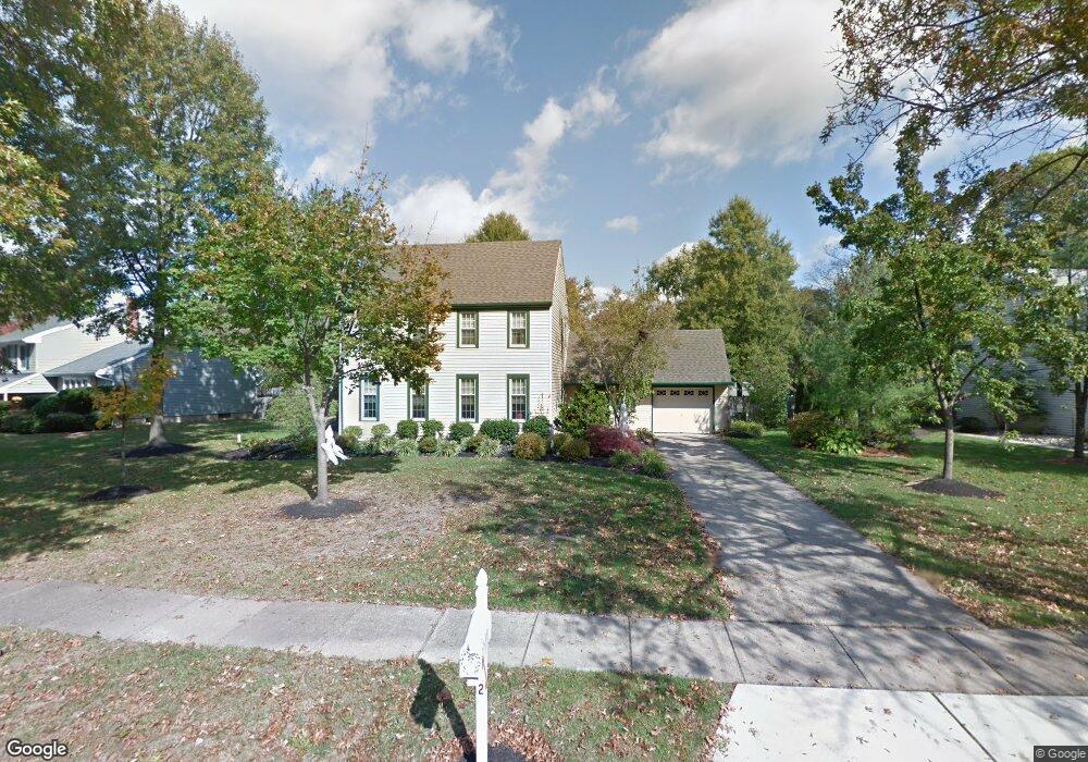
1269 Ollerton Rd West Deptford, NJ 08066
West Deptford Township NeighborhoodEstimated Value: $475,000 - $665,000
--
Bed
--
Bath
2,366
Sq Ft
$229/Sq Ft
Est. Value
About This Home
This home is located at 1269 Ollerton Rd, West Deptford, NJ 08066 and is currently estimated at $542,406, approximately $229 per square foot. 1269 Ollerton Rd is a home located in Gloucester County with nearby schools including Green-Fields Elementary School, Red Bank Elementary School, and Oakview Elementary School.
Ownership History
Date
Name
Owned For
Owner Type
Purchase Details
Closed on
Apr 2, 2002
Sold by
Holston Robert G and Holston Pamela G
Bought by
Carey Brian P and Carey Jennifer M
Current Estimated Value
Home Financials for this Owner
Home Financials are based on the most recent Mortgage that was taken out on this home.
Original Mortgage
$197,000
Outstanding Balance
$81,899
Interest Rate
6.85%
Estimated Equity
$460,507
Create a Home Valuation Report for This Property
The Home Valuation Report is an in-depth analysis detailing your home's value as well as a comparison with similar homes in the area
Home Values in the Area
Average Home Value in this Area
Purchase History
| Date | Buyer | Sale Price | Title Company |
|---|---|---|---|
| Carey Brian P | $219,000 | -- |
Source: Public Records
Mortgage History
| Date | Status | Borrower | Loan Amount |
|---|---|---|---|
| Open | Carey Brian P | $197,000 |
Source: Public Records
Tax History Compared to Growth
Tax History
| Year | Tax Paid | Tax Assessment Tax Assessment Total Assessment is a certain percentage of the fair market value that is determined by local assessors to be the total taxable value of land and additions on the property. | Land | Improvement |
|---|---|---|---|---|
| 2025 | $11,398 | $326,400 | $72,300 | $254,100 |
| 2024 | $11,251 | $326,400 | $72,300 | $254,100 |
| 2023 | $11,251 | $326,400 | $72,300 | $254,100 |
| 2022 | $11,199 | $326,400 | $72,300 | $254,100 |
| 2021 | $11,160 | $326,400 | $72,300 | $254,100 |
| 2020 | $11,134 | $326,400 | $72,300 | $254,100 |
| 2019 | $10,823 | $326,400 | $72,300 | $254,100 |
| 2018 | $10,530 | $326,400 | $72,300 | $254,100 |
| 2017 | $10,285 | $326,400 | $72,300 | $254,100 |
| 2016 | $9,998 | $326,400 | $72,300 | $254,100 |
| 2015 | $9,524 | $326,400 | $72,300 | $254,100 |
| 2014 | $9,051 | $326,400 | $72,300 | $254,100 |
Source: Public Records
Map
Nearby Homes
- 863 Doncaster Dr
- 640 Worcester Dr
- 740 Carter Hill Dr
- 87 Woodway Dr Unit 87
- 1102 Barnesdale Rd
- 1220 Royal Ln
- 12 Highbridge Ln Unit I2
- 125 Lionheart Ln Unit C125
- 1091 Buckingham Dr Unit 45
- 1012 Moore Rd Unit 6
- 1066 Buckingham Dr
- 1311 Barnesdale Rd
- 4 Saint Emilion Ct
- 1810 Fernwood Dr
- 64 Tilden Rd
- 97 Church St
- 433 Crown Point Rd
- 247 Crown Point Rd
- 558 Prince St
- 439 Crown Point Rd
- 1263 Ollerton Rd
- 1275 Ollerton Rd
- 1215 Doncaster Ct
- 1281 Ollerton Rd
- 1257 Ollerton Rd
- 1211 Doncaster Ct
- 1266 Ollerton Rd
- 1270 Ollerton Rd
- 1287 Ollerton Rd
- 1262 Ollerton Rd
- 1247 Ollerton Rd
- 1216 Doncaster Ct
- 1276 Ollerton Rd
- 1258 Ollerton Rd
- 1282 Ollerton Rd
- 854 Doncaster Dr
- 1293 Ollerton Rd
- 1235 Ollerton Rd
- 1254 Ollerton Rd
- 880 Doncaster Dr