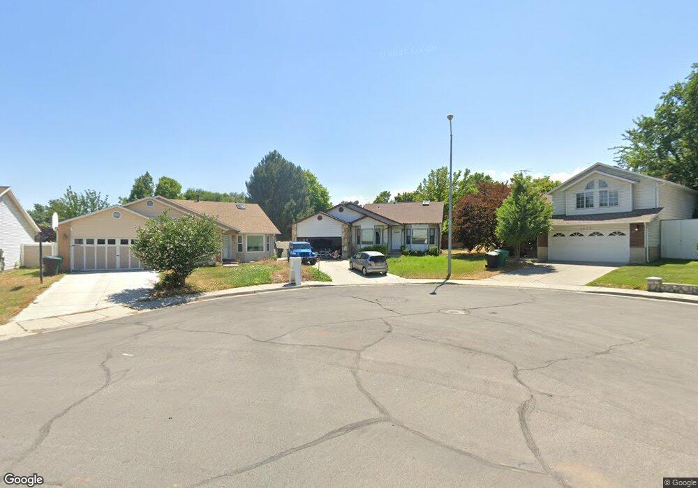
1269 W Brister Dr Salt Lake City, UT 84123
Estimated Value: $490,000 - $530,000
3
Beds
2
Baths
1,637
Sq Ft
$307/Sq Ft
Est. Value
About This Home
This home is located at 1269 W Brister Dr, Salt Lake City, UT 84123 and is currently estimated at $501,867, approximately $306 per square foot. 1269 W Brister Dr is a home located in Salt Lake County with nearby schools including Viewmont Elementary School, Riverview Junior High School, and Murray High School.
Ownership History
Date
Name
Owned For
Owner Type
Purchase Details
Closed on
Oct 31, 2013
Sold by
Rosenlund Rose D
Bought by
Rosenlund Robin and Rosenlund Stacie White
Current Estimated Value
Purchase Details
Closed on
Dec 7, 2010
Sold by
Rosenlund Robin D
Bought by
Rosenlund Robin D and Robin Rosenlund Trust
Home Financials for this Owner
Home Financials are based on the most recent Mortgage that was taken out on this home.
Original Mortgage
$176,000
Outstanding Balance
$116,043
Interest Rate
4.18%
Mortgage Type
New Conventional
Estimated Equity
$385,824
Purchase Details
Closed on
Apr 17, 2008
Sold by
Rosenlund Robin D
Bought by
Rosenlund Robin D and Robin Rosenlund Trust
Home Financials for this Owner
Home Financials are based on the most recent Mortgage that was taken out on this home.
Original Mortgage
$178,300
Interest Rate
5.99%
Mortgage Type
New Conventional
Purchase Details
Closed on
Apr 16, 2008
Sold by
Hostetler Curtis J and Hostetler Carmen L
Bought by
Rosenlund Robin D
Home Financials for this Owner
Home Financials are based on the most recent Mortgage that was taken out on this home.
Original Mortgage
$178,300
Interest Rate
5.99%
Mortgage Type
New Conventional
Purchase Details
Closed on
Jan 31, 2007
Sold by
Stump David H and Stump Maria S
Bought by
Hostetler Curtis J and Hostetler Carmen L
Home Financials for this Owner
Home Financials are based on the most recent Mortgage that was taken out on this home.
Original Mortgage
$209,000
Interest Rate
6.75%
Mortgage Type
Unknown
Purchase Details
Closed on
Aug 1, 2001
Sold by
Stump David H
Bought by
Stump David H and Stump Maria S
Purchase Details
Closed on
Jun 5, 2001
Sold by
Jim Carlson Inc
Bought by
Pehrson Darrell Lee and Pehrson Cindy R
Create a Home Valuation Report for This Property
The Home Valuation Report is an in-depth analysis detailing your home's value as well as a comparison with similar homes in the area
Home Values in the Area
Average Home Value in this Area
Purchase History
| Date | Buyer | Sale Price | Title Company |
|---|---|---|---|
| Rosenlund Robin | -- | None Available | |
| Rosenlund Robin D | -- | Cottonwood Title | |
| Rosenlund Robin D | -- | Cottonwood Title | |
| Rosenlund Robin D | -- | Accommodation | |
| Rosenlund Robin D | -- | Cottonwood Title | |
| Hostetler Curtis J | -- | Reliable Title | |
| Stump David H | -- | -- | |
| Pehrson Darrell Lee | -- | -- |
Source: Public Records
Mortgage History
| Date | Status | Borrower | Loan Amount |
|---|---|---|---|
| Open | Rosenlund Robin D | $176,000 | |
| Closed | Rosenlund Robin D | $178,300 | |
| Previous Owner | Hostetler Curtis J | $209,000 |
Source: Public Records
Tax History Compared to Growth
Tax History
| Year | Tax Paid | Tax Assessment Tax Assessment Total Assessment is a certain percentage of the fair market value that is determined by local assessors to be the total taxable value of land and additions on the property. | Land | Improvement |
|---|---|---|---|---|
| 2025 | $2,073 | $479,200 | $143,000 | $336,200 |
| 2024 | $2,073 | $459,800 | $137,100 | $322,700 |
| 2023 | $2,167 | $460,400 | $134,300 | $326,100 |
| 2022 | $2,329 | $470,300 | $131,700 | $338,600 |
| 2021 | $1,950 | $347,300 | $109,800 | $237,500 |
| 2020 | $1,874 | $315,900 | $74,600 | $241,300 |
| 2019 | $1,865 | $303,700 | $74,600 | $229,100 |
| 2018 | $0 | $271,200 | $68,600 | $202,600 |
| 2017 | $1,521 | $254,800 | $68,600 | $186,200 |
| 2016 | $1,310 | $211,900 | $68,600 | $143,300 |
| 2015 | $1,400 | $205,600 | $69,900 | $135,700 |
| 2014 | $1,267 | $184,600 | $63,400 | $121,200 |
Source: Public Records
Map
Nearby Homes
- 1273 W Brister Dr
- 1334 Portside Way Unit 165
- 1332 W Ocean Ct
- 1380 W Ocean Ct
- 1178 W Brandonwood Dr
- 1370 W Telegraph Hill Dr
- 1381 Beacon Hill Dr
- 1401 Beacon Hill Dr Unit 118
- 5449 S Coastal Ct
- Sargent Plan at The Gallery at Bullion - Single Family Homes
- Dexter Plan at The Gallery at Bullion - Single Family Homes
- Gomez Plan at The Gallery at Bullion - Single Family Homes
- Caro 2 Plan at The Gallery at Bullion - Townhomes
- Hirst 2 Plan at The Gallery at Bullion - Townhomes
- 903 W Bullion St
- 913 W Bullion St Unit 10
- 937 Coalburn Way Unit 102
- 931 Coalburn Way Unit 102
- 923 Coalburn Way Unit 103
- 924 Coalburn Way Unit 8-26
- 1269 Brister Dr
- 1263 Brister Dr
- 1263 W Brister Dr
- 1273 Brandonwood Dr
- 1270 Springshire Ln
- 1270 W Springshire Ln
- 1266 Springshire Ln
- 1266 W Springshire Ln
- 1253 Brister Dr
- 5478 Brandonwood Dr
- 1260 Springshire Ln
- 1274 Springshire Ln
- 5470 S Brandonwood Dr
- 5470 Brandonwood Dr
- 1247 Brister Dr
- 1247 W Brister Dr
- 1258 Springshire Ln
- 1278 Springshire Ln
- 1254 Brister Dr
- 5460 S Brandonwood Dr