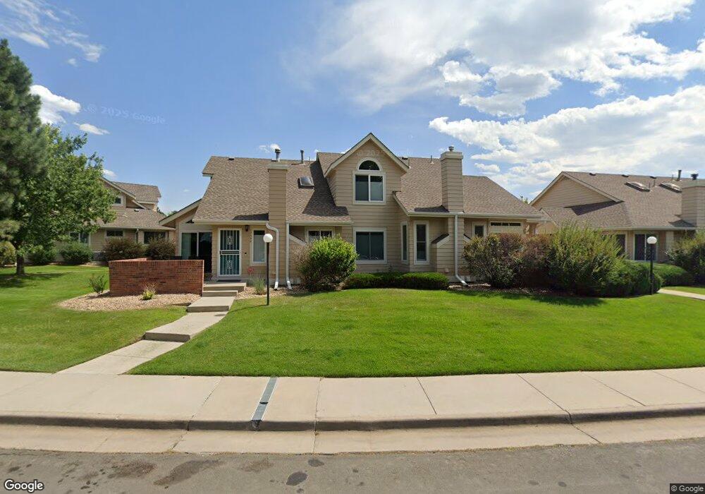
12696 E Pacific Cir Unit 27 Aurora, CO 80014
Heather Ridge NeighborhoodEstimated Value: $373,000 - $408,000
2
Beds
2
Baths
1,546
Sq Ft
$249/Sq Ft
Est. Value
About This Home
This home is located at 12696 E Pacific Cir Unit 27, Aurora, CO 80014 and is currently estimated at $385,082, approximately $249 per square foot. 12696 E Pacific Cir Unit 27 is a home located in Arapahoe County with nearby schools including Ponderosa Elementary School, Prairie Middle School, and Overland High School.
Ownership History
Date
Name
Owned For
Owner Type
Purchase Details
Closed on
Oct 25, 2022
Sold by
Duffala Karen E
Bought by
Douglas Eugene B and Douglas Katherine F
Current Estimated Value
Purchase Details
Closed on
Apr 27, 2007
Sold by
Watts Beverly M and Estate Of Donna M Elwood
Bought by
Duffala Karen E
Home Financials for this Owner
Home Financials are based on the most recent Mortgage that was taken out on this home.
Original Mortgage
$148,500
Interest Rate
6.37%
Mortgage Type
Purchase Money Mortgage
Purchase Details
Closed on
Jul 29, 1993
Sold by
Conversion Arapco
Bought by
Elwood Donna M Watts Beverly M
Create a Home Valuation Report for This Property
The Home Valuation Report is an in-depth analysis detailing your home's value as well as a comparison with similar homes in the area
Home Values in the Area
Average Home Value in this Area
Purchase History
| Date | Buyer | Sale Price | Title Company |
|---|---|---|---|
| Douglas Eugene B | $372,100 | -- | |
| Duffala Karen E | $82,500 | Fahtco | |
| Duffala Karen E | $82,500 | Fahtco | |
| Elwood Donna M Watts Beverly M | -- | -- | |
| Conversion Arapco | -- | -- |
Source: Public Records
Mortgage History
| Date | Status | Borrower | Loan Amount |
|---|---|---|---|
| Previous Owner | Duffala Karen E | $148,500 |
Source: Public Records
Tax History Compared to Growth
Tax History
| Year | Tax Paid | Tax Assessment Tax Assessment Total Assessment is a certain percentage of the fair market value that is determined by local assessors to be the total taxable value of land and additions on the property. | Land | Improvement |
|---|---|---|---|---|
| 2024 | $1,858 | $26,860 | -- | -- |
| 2023 | $1,858 | $26,860 | $0 | $0 |
| 2022 | $1,518 | $20,961 | $0 | $0 |
| 2021 | $1,528 | $20,961 | $0 | $0 |
| 2020 | $1,520 | $21,171 | $0 | $0 |
| 2019 | $1,467 | $21,171 | $0 | $0 |
| 2018 | $1,348 | $18,288 | $0 | $0 |
| 2017 | $1,329 | $18,288 | $0 | $0 |
| 2016 | $1,123 | $14,495 | $0 | $0 |
| 2015 | $1,069 | $14,495 | $0 | $0 |
| 2014 | $1,024 | $12,298 | $0 | $0 |
| 2013 | -- | $13,350 | $0 | $0 |
Source: Public Records
Map
Nearby Homes
- 12685 E Pacific Cir Unit C
- 12685 E Pacific Cir Unit E
- 2110 S Scranton Way
- 12573 E Pacific Cir Unit C
- 12440 E Pacific Cir Unit B
- 12513 E Pacific Cir Unit C
- 2210 S Vaughn Way Unit 103
- 2231 S Vaughn Way Unit 118B
- 2231 S Vaughn Way Unit 114B
- 2101 S Victor St Unit B
- 12622 E Warren Dr Unit E
- 2281 S Vaughn Way Unit 209A
- 2281 S Vaughn Way Unit 214A
- 2312 S Troy St Unit 2312
- 2306 S Troy St Unit A
- 13221 E Asbury Dr Unit 101
- 13241 E Asbury Dr Unit 202
- 13304 E Asbury Dr
- 13290 E Jewell Ave Unit 103
- 12412 E Caspian Dr
- 12698 E Pacific Cir Unit 28
- 12694 E Pacific Cir Unit 26
- 12692 E Pacific Cir Unit 25
- 2111 S Troy Way
- 2113 S Troy Way Unit 20
- 12722 E Pacific Cir
- 2115 S Troy Way Unit 21
- 12688 E Pacific Cir Unit 24
- 12724 E Pacific Cir
- 2123 S Troy Way
- 12686 E Pacific Cir Unit 23
- 12726 E Pacific Cir
- 2125 S Troy Way Unit 10
- 12728 E Pacific Cir
- 12685 E Pacific Cir Unit F
- 12685 E Pacific Cir Unit A
- 2108 S Scranton Way Unit 37
- 12684 E Pacific Cir Unit 31
- 2127 S Troy Way
- 12682 E Pacific Cir Unit 32