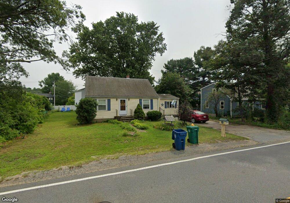
127 Andover Rd Billerica, MA 01821
Estimated Value: $563,000 - $625,000
3
Beds
1
Bath
1,448
Sq Ft
$408/Sq Ft
Est. Value
About This Home
This home is located at 127 Andover Rd, Billerica, MA 01821 and is currently estimated at $590,478, approximately $407 per square foot. 127 Andover Rd is a home located in Middlesex County with nearby schools including Billerica Memorial High School.
Ownership History
Date
Name
Owned For
Owner Type
Purchase Details
Closed on
Jan 10, 2019
Sold by
Leonard Barbara A
Bought by
Leonard Donald F and Leonard David M
Current Estimated Value
Purchase Details
Closed on
Oct 24, 1983
Bought by
Leonard Barbara A
Create a Home Valuation Report for This Property
The Home Valuation Report is an in-depth analysis detailing your home's value as well as a comparison with similar homes in the area
Home Values in the Area
Average Home Value in this Area
Purchase History
| Date | Buyer | Sale Price | Title Company |
|---|---|---|---|
| Leonard Donald F | -- | None Available | |
| Leonard Barbara A | -- | -- |
Source: Public Records
Mortgage History
| Date | Status | Borrower | Loan Amount |
|---|---|---|---|
| Previous Owner | Leonard Barbara A | $12,589 |
Source: Public Records
Tax History Compared to Growth
Tax History
| Year | Tax Paid | Tax Assessment Tax Assessment Total Assessment is a certain percentage of the fair market value that is determined by local assessors to be the total taxable value of land and additions on the property. | Land | Improvement |
|---|---|---|---|---|
| 2025 | $5,314 | $467,400 | $263,100 | $204,300 |
| 2024 | $4,885 | $432,700 | $238,100 | $194,600 |
| 2023 | $4,691 | $395,200 | $201,800 | $193,400 |
| 2022 | $4,313 | $341,200 | $185,700 | $155,500 |
| 2021 | $4,189 | $322,200 | $174,000 | $148,200 |
| 2020 | $4,097 | $315,400 | $167,200 | $148,200 |
| 2019 | $3,782 | $280,600 | $147,000 | $133,600 |
| 2018 | $3,689 | $260,000 | $136,200 | $123,800 |
| 2017 | $3,489 | $247,600 | $130,000 | $117,600 |
| 2016 | $3,480 | $246,100 | $128,500 | $117,600 |
| 2015 | $3,389 | $241,400 | $123,800 | $117,600 |
| 2014 | $3,330 | $233,000 | $116,400 | $116,600 |
Source: Public Records
Map
Nearby Homes
- 91 Pond St
- 133 Salem Rd
- LOT 54B Beverly Rd
- 396 Boston Rd Unit 103
- 81 Salem Rd Unit 102
- 15 Governor Peabody Rd
- 37 Porter St
- 405 Boston Rd Unit 2
- 1 Purcell Dr
- 10 Charnstaff Ln Unit 204
- 22 Kenmar Dr Unit 194Y
- 14 Kenmar Dr Unit 111
- 2 Karen Cir Unit 2
- 5 Karen Cir Unit 16
- 19 Parker St
- 142 Baldwin Rd
- 4 Strand St
- 23 Salem Rd
- 12 Stoney Dr
- 79 Bridle Rd
- 125 Andover Rd
- 129 Andover Rd
- 121 Andover Rd
- 6 Allen Road Extension
- 10 Allen Rd
- 4 Allen Road Extension
- 8 Allen Road Extension
- 131 Andover Rd
- 8 Allen Rd
- 6 Allen Rd
- 7 Agawam Cir
- 4 Allen Rd
- 6 Agawam Cir
- 12 Allen Rd
- 2 Allen Rd
- 2 Allen Road Extension
- 133 Andover Rd
- 0 Allen Road Extension Unit 70952219
- 9 Agawam Cir
- 5 Mohawk Dr