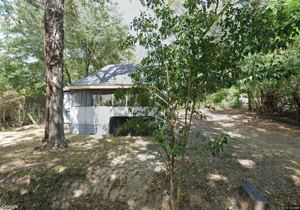
127 Annie M Harris Dr Barnesville, GA 30204
Estimated Value: $57,917 - $134,000
2
Beds
1
Bath
769
Sq Ft
$120/Sq Ft
Est. Value
About This Home
This home is located at 127 Annie M Harris Dr, Barnesville, GA 30204 and is currently estimated at $92,479, approximately $120 per square foot. 127 Annie M Harris Dr is a home with nearby schools including Lamar County Primary School, Lamar County Elementary School, and Lamar County Middle School.
Ownership History
Date
Name
Owned For
Owner Type
Purchase Details
Closed on
Apr 15, 2024
Sold by
Family Trust Of Louis Governo
Bought by
Hummingbird Dreams Llc
Current Estimated Value
Purchase Details
Closed on
Dec 6, 2016
Sold by
Tax Commissioner Of Lamar County Middle East Contr
Bought by
Governo Louis
Purchase Details
Closed on
Dec 1, 2009
Sold by
Anthony Andrea L Tax Commi
Bought by
Middle East Contracting Llc
Purchase Details
Closed on
Feb 1, 2000
Sold by
Bentley Johnny Wesle
Bought by
Shropshire Sammy D I
Create a Home Valuation Report for This Property
The Home Valuation Report is an in-depth analysis detailing your home's value as well as a comparison with similar homes in the area
Home Values in the Area
Average Home Value in this Area
Purchase History
| Date | Buyer | Sale Price | Title Company |
|---|---|---|---|
| Hummingbird Dreams Llc | -- | -- | |
| Governo Louis | $1,427 | -- | |
| Middle East Contracting Llc | $946 | -- | |
| Middle East Contracting Llc | $946 | -- | |
| Shropshire Sammy D I | $11,000 | -- |
Source: Public Records
Tax History Compared to Growth
Tax History
| Year | Tax Paid | Tax Assessment Tax Assessment Total Assessment is a certain percentage of the fair market value that is determined by local assessors to be the total taxable value of land and additions on the property. | Land | Improvement |
|---|---|---|---|---|
| 2025 | $115 | $5,920 | $2,400 | $3,520 |
| 2024 | $115 | $4,000 | $1,200 | $2,800 |
| 2023 | $132 | $4,280 | $1,200 | $3,080 |
| 2022 | $121 | $4,400 | $1,200 | $3,200 |
| 2021 | $132 | $4,400 | $1,200 | $3,200 |
| 2020 | $139 | $4,400 | $1,200 | $3,200 |
| 2019 | $140 | $4,400 | $1,200 | $3,200 |
| 2018 | $163 | $5,344 | $1,200 | $4,144 |
| 2017 | $162 | $5,344 | $1,200 | $4,144 |
| 2016 | $162 | $5,344 | $1,200 | $4,144 |
| 2015 | $162 | $5,344 | $1,200 | $4,144 |
| 2014 | $157 | $5,344 | $1,200 | $4,144 |
| 2013 | -- | $5,464 | $1,320 | $4,144 |
Source: Public Records
Map
Nearby Homes